Santo, Texas
| Santo | |
|---|---|
| Unincorporated community | |
.jpg) | |
 Santo Location within the state of Texas  Santo Santo (the US) | |
| Coordinates: 32°36′11″N 98°12′24″W / 32.60306°N 98.20667°WCoordinates: 32°36′11″N 98°12′24″W / 32.60306°N 98.20667°W | |
| Country | United States |
| State | Texas |
| County | Palo Pinto |
| Population (2008) | |
| • Total | 315 |
| Time zone | UTC-6 (Central (CST)) |
| • Summer (DST) | UTC-5 (CDT) |
| ZIP codes | 76472 |
| Area code(s) | 940 |
Santo is an unincorporated community in Palo Pinto County, Texas, United States. It lies on Farm to Market Road 4, 14 miles south of Palo Pinto, and has an estimated population of 315.
Education
The Santo Independent School District serves area students.
External links
Municipalities and communities of Palo Pinto County, Texas, United States | ||
|---|---|---|
| Cities | 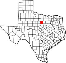 | |
| CDP | ||
| Other unincorporated communities | ||
| Footnotes | ‡This populated place also has portions in an adjacent county or counties | |
This article is issued from
Wikipedia.
The text is licensed under Creative Commons - Attribution - Sharealike.
Additional terms may apply for the media files.