Dell City, Texas
| Dell City, Texas | |
|---|---|
| City | |
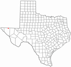 Location of Dell City, Texas | |
 | |
| Coordinates: 31°56′7″N 105°12′1″W / 31.93528°N 105.20028°WCoordinates: 31°56′7″N 105°12′1″W / 31.93528°N 105.20028°W | |
| Country | United States |
| State | Texas |
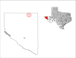
| County | Hudspeth |
| Area | |
| • Total | 1.7 sq mi (4.3 km2) |
| • Land | 1.7 sq mi (4.3 km2) |
| • Water | 0.0 sq mi (0.0 km2) |
| Elevation | 3,701 ft (1,128 m) |
| Population (2010) | |
| • Total | 365 |
| • Density | 219/sq mi (84.6/km2) |
| Time zone | UTC-7 (Mountain (MST)) |
| • Summer (DST) | UTC-6 (MDT) |
| ZIP code | 79837 |
| Area code(s) | 915 |
| FIPS code | 48-19708[1] |
| GNIS feature ID | 1355897[2] |
Dell City is a city in Hudspeth County, Texas, United States. The population was 365 at the 2010 census,[3] down from 413 at the 2000 census. It is the closest city to Paulville, a cooperative and planned community.
It was incorporated in 1948 shortly after the discovery of an underground water supply by oil prospectors, which attracted farmers to the area. Its name is a reference to the nursery rhyme "The Farmer in the Dell."[4][5]
Geography
Dell City is located in northeastern Hudspeth County at 31°56′7″N 105°12′1″W / 31.93528°N 105.20028°W (31.935324, -105.200298),[6] in west Texas. It is 13 miles (21 km) north of U.S. Routes 62 and 180, and 4 miles (6 km) south of the New Mexico border. The Guadalupe Mountains are visible to the east.
According to the United States Census Bureau, the city has a total area of 1.7 square miles (4.3 km2), all of it land.[3]
Education
The area is served by the Dell City Independent School District. The district has about 113 students in grades kindergarten through 12th. The district has just one school.
Demographics
| Historical population | |||
|---|---|---|---|
| Census | Pop. | %± | |
| 1970 | 383 | — | |
| 1980 | 495 | 29.2% | |
| 1990 | 569 | 14.9% | |
| 2000 | 413 | −27.4% | |
| 2010 | 365 | −11.6% | |
| Est. 2016 | 425 | [7] | 16.4% |
| U.S. Decennial Census[8] | |||
As of the census[1] of 2000, there were 413 people, 155 households, and 119 families residing in the city. The population density was 250.1 people per square mile (96.6/km²). There were 226 housing units at an average density of 136.9 per square mile (52.9/km²). The racial makeup of the city was 61.50% White, 1.45% African American, 1.94% Native American, 0.24% Asian, 32.69% from other races, and 2.18% from two or more races. Hispanic or Latino of any race were 69.25% of the population.
There were 155 households out of which 36.8% had children under the age of 18 living with them, 63.9% were married couples living together, 11.6% had a female householder with no husband present, and 22.6% were non-families. 20.6% of all households were made up of individuals and 7.7% had someone living alone who was 65 years of age or older. The average household size was 2.66 and the average family size was 3.11.
In the city, the population was spread out with 30.5% under the age of 18, 6.3% from 18 to 24, 21.8% from 25 to 44, 28.1% from 45 to 64, and 13.3% who were 65 years of age or older. The median age was 37 years. For every 100 females, there were 105.5 males. For every 100 females age 18 and over, there were 95.2 males.
The median income for a household in the city was $19,602, and the median income for a family was $21,667. Males had a median income of $24,135 versus $18,571 for females. The per capita income for the city was $9,580. About 26.4% of families and 29.4% of the population were below the poverty line, including 33.1% of those under age 18 and 38.6% of those age 65 or over.
Climate
| Climate data for Dell City, Texas | |||||||||||||
|---|---|---|---|---|---|---|---|---|---|---|---|---|---|
| Month | Jan | Feb | Mar | Apr | May | Jun | Jul | Aug | Sep | Oct | Nov | Dec | Year |
| Record high °F (°C) | 81 (27) |
87 (31) |
93 (34) |
101 (38) |
108 (42) |
115 (46) |
112 (44) |
108 (42) |
105 (41) |
101 (38) |
90 (32) |
79 (26) |
115 (46) |
| Average high °F (°C) | 60.0 (15.6) |
64.8 (18.2) |
72.7 (22.6) |
80.8 (27.1) |
89.4 (31.9) |
97.6 (36.4) |
97.3 (36.3) |
94.9 (34.9) |
88.8 (31.6) |
80.5 (26.9) |
68.4 (20.2) |
59.3 (15.2) |
79.5 (26.4) |
| Average low °F (°C) | 25.4 (−3.7) |
30.0 (−1.1) |
35.6 (2) |
42.9 (6.1) |
52.6 (11.4) |
60.9 (16.1) |
64.8 (18.2) |
63.5 (17.5) |
56.2 (13.4) |
44.4 (6.9) |
32.2 (0.1) |
25.6 (−3.6) |
44.5 (6.9) |
| Record low °F (°C) | 3 (−16) |
−9 (−23) |
11 (−12) |
20 (−7) |
32 (0) |
44 (7) |
53 (12) |
50 (10) |
34 (1) |
21 (−6) |
9 (−13) |
−5 (−21) |
−9 (−23) |
| Average precipitation inches (mm) | 0.43 (10.9) |
0.59 (15) |
0.28 (7.1) |
0.27 (6.9) |
0.89 (22.6) |
0.94 (23.9) |
1.48 (37.6) |
1.89 (48) |
1.74 (44.2) |
0.99 (25.1) |
0.54 (13.7) |
0.52 (13.2) |
10.55 (268) |
| Source: The Western Regional Climate Center[9] | |||||||||||||
Notable people
- Laura Lynch, founder and member of the original Dixie Chicks
References
- 1 2 "American FactFinder". United States Census Bureau. Archived from the original on 2013-09-11. Retrieved 2008-01-31.
- ↑ "US Board on Geographic Names". United States Geological Survey. 2007-10-25. Retrieved 2008-01-31.
- 1 2 "Geographic Identifiers: 2010 Census Summary File 1 (G001): Dell City city, Texas". American Factfinder. U.S. Census Bureau. Retrieved March 19, 2018.
- ↑ "Dell City Texas". Texas Escapes. Retrieved 2012-09-15.
- ↑ "N". Texas Tech University Southwest Collection/Special Collections Library. Retrieved 2012-09-15.
- ↑ "US Gazetteer files: 2010, 2000, and 1990". United States Census Bureau. 2011-02-12. Retrieved 2011-04-23.
- ↑ "Population and Housing Unit Estimates". Retrieved June 9, 2017.
- ↑ "Census of Population and Housing". Census.gov. Archived from the original on May 12, 2015. Retrieved June 4, 2015.
- ↑ "Seasonal Temperature and Precipitation Information". Western Regional Climate Center. Retrieved April 1, 2013.
External links
- Information about Dell City sponsored by the Dell City Chamber of Commerce.
Municipalities and communities of Hudspeth County, Texas, United States | ||
|---|---|---|
| City | 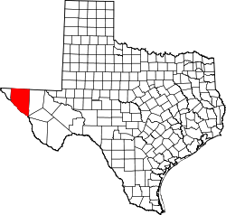 | |
| CDPs | ||
| Unincorporated communities | ||
| Ghost towns | ||