Circumferential Road 5
| |
|---|---|
| Carlos P. Garcia Avenue | |
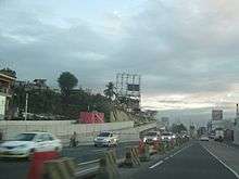
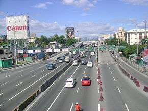 C-5 Road corner Kalayaan Avenue, looking towards Pasig. | |
| Route information | |
| Maintained by Department of Public Works and Highways and Metropolitan Manila Development Authority | |
| Component highways |
|
| Major junctions | |
| Beltway around Metro Manila | |
| C-5 Road (main route) | |
| Length | 32.5 km[1] (20.2 mi) |
| North end |
|
| Major junctions |
|
| South end | East Service Road |
| C-5 Extension | |
| Length | 9.8 km (6.1 mi) |
| East end | West Service Road |
| Major junctions | |
| West end |
|
| Location | |
| Major cities | Valenzuela, Quezon City, Pasig, Makati, Marikina, Taguig, Parañaque, and Las Piñas |
| Highway system | |
|
Roads in the Philippines | |
.svg.png)
.svg.png)
.svg.png)
.svg.png)
Circumferential Road 5, more commonly known as C-5 Road or C-5, is a network of roads and bridges that altogether forms a major route that transverses in Metro Manila, in the National Capital Region of the Philippines.[2] It is also known officially as Carlos P. Garcia Avenue, and as National Route 11 (N11), National Route 128 (N128) and National Route 129 (N129) in the National Route Numbering System implemented in 2014. Expressway portions, part of the North Luzon Expressway Mindanao Avenue and Karuhatan Link, are numbered Expressway Route 5 (E5).
The road serves as a beltway around Metro Manila, spanning some 32.5 kilometres (20.2 mi) as it transverses through the cities of Parañaque, Taguig, Makati, Pasig, Marikina, Quezon City and Valenzuela. It runs parallel to the four other beltways around Metro Manila, and is also known for being the second most important transportation corridor, after Circumferential Road 4, better known as EDSA.[3]
The road is not yet complete to date, because of certain controversies regarding right of way, but portions of the road are already open for public use.[4] The two segments of the road will be connected together with the completion of the CAVITEX - C-5 Link Expressway, through a flyover over the Skyway and SLEX in the Pasay - Taguig boundary, by 2020.
Route description
The C-5 road lies parallel to Epifanio de los Santos Avenue, passing through the cities of Valenzuela, Quezon City, Marikina, Pasig, Makati, Taguig and Parañaque. The road is divided into segments.
NLEX-Karuhatan connector link
Also known as the NLEX Segment 9, the NLEX-MacArthur Highway connector is a 2.42 kilometres (1.50 mi) tollway starting from Smart Connect Interchange, a cloverleaf interchange between NLEX-Mindanao Avenue link, NLEX-Karuhatan link and the North Luzon Expressway. The western end of the road is located at MacArthur Highway in Karuhatan, Valenzuela and also a part of C-5 Road.
NLEX-Mindanao Avenue connector link
Also known as the NLEX Segment 8, the NLEX-Mindanao Avenue connector is a 2.7 kilometres (1.7 mi) tollway starting from the Smart Connect Interchange, a cloverleaf interchange between the NLEX-Mindanao Avenue link, NLEX-Karuhatan link and the North Luzon Expressway (NLEX) and ending in a 3-way signalized junction with the Mindanao Avenue. The entire 2.6 kilometres (1.6 mi) tollway is designated as part of a C-5 Road.
Mindanao Avenue
| |
|---|---|
| Location | Quezon City to Valenzuela |
| Length | 6.7 km (4.2 mi) |
Mindanao Avenue is a 6.7 kilometres (4.2 mi), 10-lane divided carriageway that serves as the main transportation corridor of the Talipapa and Tandang Sora districts of Quezon City. The northern terminus of the road is a dead end 1.1 kilometres (0.68 mi) north of the NLEX-Mindanao Avenue Connector Road and the southern terminus of the road is the Epifanio de los Santos Avenue. The 3.5 kilometres (2.2 mi) portion of the road from the NLEX-Mindanao Avenue Connector Road junction to Congressional Avenue is designated as a portion of the C-5 Road.
Congressional Avenue
| |
|---|---|
| Location | Quezon City |
| Length | 6.0 km (3.7 mi) |
Congressional Avenue is a 6 kilometres (3.7 mi), 6-lane divided carriageway that serves as the main east to west transportation corridor of Muñoz, Culiat and Tandang Sora districts in Quezon City. The western terminus of the road is Epifanio de los Santos Avenue and the eastern terminus of the road is a junction with Luzon Avenue. The 3.9 kilometres (2.4 mi) portion of the road from Mindanao Avenue to Luzon Avenue is designated as a portion of C-5 Road. The whole segment of Congressional Avenue is designated as part of N129.
Luzon Avenue
Luzon Avenue is a 2.5 kilometres (1.6 mi), 4-lane divided/undivided city road that serves as the main thoroughfare of the Holy Spirit district of Quezon City. The northern terminus of the road is a junction with Holy Spirit Drive and the southern terminus is a junction with Commonwealth Avenue. The 850 metres (2,790 ft) portion of the road from Congressional Avenue to Commonwealth Avenue is designated as a portion of C-5 Road. Before crossing ending in Commonwealth Avenue, a 6-lane flyover starts 850 metres (2,790 ft) north of the junction and heads towards Tandang Sora Avenue on the other side of Commonwealth Avenue.
Tandang Sora Avenue
Tandang Sora Avenue is a 9.6 kilometres (6.0 mi), 2-lane undivided municipal road that serves as the main thoroughfare of the Talipapa, Culiat and Tandang Sora districts of Quezon City. The northern terminus of the road is the Tullahan Road, while the southern terminus is the junction with Magsaysay Avenue inside the University of the Philippines campus. The original planned route of C-5 included the entire road, however, due to the incapacity of the road to carry a large amount of vehicular traffic, only the 1 kilometre (0.62 mi) portion of the road from the Luzon Avenue flyover to Magsaysay Avenue was designated as a portion of C-5 Road. Furthermore, Tandang Sora Avenue becomes a 6-lane divided carriageway shortly after crossing Capitol Hills Drive, 350 meters south of the flyover. After crossing Magsaysay Avenue, Tandang Sora Avenue becomes Katipunan Avenue.
Katipunan Avenue
| |
|---|---|
| Location | Quezon City |
| Length | 7.3 km (4.5 mi) |
_-_Ateneo-Miriam_area_(Quezon_City)(2017-09-06).jpg)
Katipunan Avenue is a 7.3 kilometres (4.5 mi), 10-lane divided carriageway that serves as the main transportation corridor of the Balara and Project 4 districts of Quezon City. The northern terminus of the road is Tandang Sora Avenue and the southern terminus is Epifanio de los Santos Avenue. The 4.8 kilometres (3.0 mi) portion of the road from its northern terminus to the intersection with Col. Bonny Serrano Avenue is designated as a portion of C-5 Road. Shortly before crossing Bonny Serrano Avenue, a 4-lane divided underpass descends from Katipunan Avenue and traverses underneath Col. Bonny Serrano Avenue and ascends into a flyover that immediately connects to E. Rodriguez Jr. Avenue.
Bonny Serrano Avenue
Col. Bonny Serrano Avenue is a 2.2 kilometres (1.4 mi), 4-lane undivided avenue that serves as the main thoroughfare between Epifanio de los Santos Avenue and Eastwood City. The 500 metres (1,600 ft) portion of the road from Katipunan Avenue to Eulogio Rodriguez Jr. Avenue is designated as a portion of the C-5 Road. A 4-lane divided underpass descends from Katipunan Avenue and traverses underneath Col. Bonny Serrano Avenue and ascends into a flyover that immediately connects to E. Rodriguez Jr. Avenue.
Eulogio Rodriguez Jr. Avenue
| |
|---|---|
| Location | Pasig to Quezon City |
| Length | 6.7 km (4.2 mi) |

Eulogio Rodriguez Jr. Avenue is a 6.7 kilometres (4.2 mi), 10-lane divided road that serves as the main thoroughfare between Quezon City and Pasig. The entire road, from Katipunan Avenue to Pasig Boulevard is designated as a portion of C-5 Road. The road ends in a junction with Pasig Boulevard and continues onto F. Manalo Bridge that crosses the Pasig River and eventually becomes C.P. Garcia Avenue shortly afterwards.
Carlos P. Garcia Avenue
| |
|---|---|
| Location | Taguig to Makati-Pasig boundary |
| Length | 7.5 km (4.7 mi) |
Carlos P. Garcia Avenue is a 7.5 kilometres (4.7 mi), 14-lane divided road that serves as the main thoroughfare between Pasig and Parañaque, passing a small portion in Makati and continuously passing Taguig. The entire road, from the F. Manalo Bridge to South Luzon Expressway (SLEX) is designated as a portion of C-5 Road. The road ends in a junction with South Luzon Expressway.
Location on the West Valley Fault
Studies by the PHIVOLCS reveal that a large portion of the C-5 road is built on top of the West Valley Fault. A map of the fault line released in May 18, 2015 shows the C-5 road in Taguig beside the fault line.[5] The C-5 road is prone to liquefaction.[6]
History
The proposal for the Metro Manila Arterial Road System was done in the late 1960s.[7] The proposal states of building 10 Radial Roads and 6 Circumferential Roads to support the growing vehicular population of the Metropolitan Manila.
The 5th Circumferential Road began construction in 1986.[2][7] Under the power of Republic Act 8224, which was passed in November 6, 1996, the C-5 road was legally known as President Carlos P. Garcia Avenue, honoring the eighth president of the Republic of the Philippines, Carlos P. Garcia.[8]
Extensions
On July 23, 2007, President Gloria Macapagal-Arroyo announced on her State of the Nation Address that C-5 Road will be extended to the north of Metro Manila, from North Luzon Expressway in Quezon City to Navotas and will be extended in the south from South Luzon Expressway in Taguig-Parañaque boundary to Coastal Road in Las Piñas in the southern part of Ninoy Aquino International Airport.[9]
As of June 2010, the NLEx-Mindanao Avenue Link or NLEx Segment 8.1 which is located in Valenzuela City and Congressional Avenue Extension from Tandang Sora to Luzon Avenue which is located in Quezon City has been opened to all motorists in the North Extension and also the SLEx-Sucat Link or Carlos Garcia Avenue Extension in the South Extension located in Parañaque was also opened.
As of March 2015, the NLEX-Karuhatan Link (Segment 9) has been opened to all motorists. The opening of the Segment 9 from NLEx to MacArthur Highway in Karuhatan, Valenzuela serves as a preparation for the Holy Week season.
At present, the New Commonwealth Avenue Flyover connecting Katipunan and Luzon Avenue is opened to all motorists. Before the opening of the flyover, the Congressional Avenue Extension from Visayas to Luzon Avenue opened in 2010 to decongest heavy traffic in Visayas-Tandang Sora Avenue Intersection.
Future
C-5 Link South Expressway
| C-5 South Link Expressway | |
|---|---|
| CAVITEX - C-5 Link Expressway | |
| Route information | |
| Length | 7.737 km[10] (4.808 mi) |
| Major junctions | |
| East end |
|
| West end |
|
| Highway system | |
|
Roads in the Philippines | |
The C-5 South Link Expressway, or the CAVITEX - C-5 Link Expressway, is a 7.737-kilometer (4.808 mi) toll expressway that will connect Manila-Cavite Expressway (CAVITEX) with the main route of C-5 in Taguig. The project costs at ₱12 billion (US$253 million), and is a joint project of the Philippine Reclamation Authority, Toll Regulatory Board, and CAVITEX Infrastructure, Inc. The expressway is built in two phases, with the first phase that will fill the gap between the C-5 main route and the C-5 Extension in Merville by constructing a flyover over the SLEX and Skyway, and the second phase involving construction of the Merville-CAVITEX segment. Construction of the new expressway started in May 8, 2016.[11] Completion is expected at 2019, and start of operation is due on the first quarter of 2020. [10]
C-5 Expressway
NLEX Corporation (formerly Manila North Tollways Corporation) and CAVITEX Infrastructure Inc., submitted a proposal for C-5 Expressway, a 19 kilometres (12 mi) fully elevated expressway that will further decongest the existing C-5 and provide a fully controlled-access route between CAVITEX-C5 South Link and NLEX Segment 8.2. [12]. The proposed expressway will utilize portions of the existing C-5 right of way between SLEX and Pasig Boulevard, and run above Marikina River from Pasig Boulevard to Luzon Avenue.
Controversy
The Senate of the Philippines is investigating the South Extension since it passes many of Sen. Manny Villar's properties such as Camella. The original C5 South Extension was called MCTEP, and was already approved by the Senate. MCTEP was a road that would be made as a toll expressway and resurrected as CAVITEX-C5 Link.[4][13]
Landmarks
Commercial Areas
- Bonifacio Global City (Taguig)
- Eastwood City (Quezon City)
- Nuvo City (Quezon City)
- Robinsons Bridgetowne (Quezon City)
- Frontera Verde (Pasig)
- Market! Market! (Taguig)
- Silver City Mall (Pasig)
- SM Aura Premier (Taguig)
- SM City Sucat (Parañaque)
- SM Center Pasig (Pasig)
- Arcovia City (Pasig)
- Tiendesitas (Pasig)
- UP Town Center (Quezon City)
- Arca South (Taguig)
- McKinley Hill (Taguig)
Educational Institutions
These schools are located in Quezon City.
- Ateneo de Manila University
- Colegio de San Lorenzo - Main Campus
- Miriam College
- St. James College of Quezon City
- University of the Philippines Diliman
- Reedley International School
- These schools are located in Bonifacio Global City, Taguig City
- International School Manila
- British School Manila
- Manila Japanese School
- Everest Academy
- Treston International College
- Summit School
Cemeteries/Memorial Parks
- Golden Haven Memorial Park (Las Piñas)
- Heritage Memorial Park (Taguig)
- Libingan ng mga Bayani or Cemetery of Heroes (Taguig)
- Manila American Cemetery and Memorial (Taguig)
- Himlayang Pilipino Memorial Park (via Himlayan Road) (Quezon City)
Ecclesiastical Landmarks
- El Shaddai House of Prayer (San Dionisio, Parañaque)
- Iglesia ni Cristo Pembo Locale (via Xyris St., Pembo, Makati)
- Iglesia ni Cristo Luzon Avenue Locale (Matandang Balara, Quezon City)
- Iglesia ni Cristo Bagong Ilog Locale (via Lakeshore Drive) (Bagong Ilog, Pasig)
- Iglesia ni Cristo Ugong Locale (Ugong, Pasig)
- Saint John Paul II Parish (Eastwood Chapel) (Eastwood City, Quezon City)
- Monasterio de Santa Clara (Loyola Heights, Quezon City)
- Church of the Gesu (Loyola Heights, Quezon City)
- Santa Maria dela Strada Parish (Pansol, Quezon City)
- Iglesia ni Cristo Central Temple (via Commonwealth Ave., Quezon City)
- Christ's Commission Fellowship (CCF Center) (Frontera Verde, C5, cor. Ortigas Avenue, Pasig)
- Santuario De San Ezekiel Moreno (Pulanglupa Uno, Las Piñas)
Others
Exits and Intersections
| Province | City/Municipality[14][15][16] | km[17][18][19] | mi | Destinations | Notes |
|---|---|---|---|---|---|
| Taguig | 14.1266 | 8.7779 | East Service Road | Southern end. | |
| Half-Y interchange. C-5 Exit of SLEX. South end. | |||||
| 15.1851– 15.2237 | 9.4356– 9.4596 | Bayani Road, Marichu R. Tinga Avenue | Half-diamond and half-partial cloverleaf interchange. Access to Libingan ng mga Bayani | ||
| Diego Silang Street | At-grade intersection. No southbound access. | ||||
| 17.000 | 10.563 | Scorpio Street | No northbound entrance. Northbound access via Diego Silang Street | ||
| Makati | Alligator Street | No Southbound access. Access to Brgy. Rizal, Makati | |||
| Blue Voz Street | No southbound access. Access to Brgy. Rizal and Brgy. Pembo, Makati | ||||
| Taguig | Upper McKinley Road | Traffic light intersection. Former half-diamond interchange with no northbound access. Access to McKinley Hill | |||
| 26th Street, Sampaguita Street, Target Street (Makati) | Diamond interchange. Access to Market! Market! and Bonifacio Global City | ||||
| 32nd Street | Directional T interchange. No northbound exit. Access to Bonifacio Global City | ||||
| Makati | C-5-Kalayaan Interchange. Former traffic light intersection. Access to Kalayaan Avenue westbound from C-5 northbound via elevated U-turn slot. Access to Kalayaan Avenue eastbound from C-5 southbound via elevated U-turn slot. | ||||
| Pasig River | 20.418 | 12.687 | Bagong Ilog Bridge | ||
| Pasig | South end of Bagong Ilog Flyover. South end of E. Rodriguez, Jr. Avenue segment | ||||
Maximo Flores Street | Intersection with traffic light for southbound only. No left turn and U-turn from C-5 southbound | ||||
| Pasig Boulevard | Traffic light intersection. | ||||
| Canley Road | Southbound at-grade intersection. No northbound access | ||||
| 14.1285 | 8.7790 | North end of Bagong Ilog Flyover. | |||
| R. Lanuza Avenue | Traffic light intersection. Access to Philsports Arena | ||||
| Kaginhawaan Bridge | Northbound only. Access to Dr. Sixto Antonio Avenue via P. Conducto Street. | ||||
| Julia Vargas Avenue | Traffic light intersection. Access to SM Center Pasig, Tiendesitas, and Ortigas Center | ||||
| Eagle Drive | Northbound entry only | ||||
| South end of Ortigas Flyover. | |||||
| C-5-Ortigas Interchange. Traffic light intersection at grade. No left turns from northbound. Access to C-5 southbound either through flyover ramp or traffic light intersection. | |||||
| Quezon City | 16.986– 12.612 | 10.555– 7.837 | North end of Ortigas Flyover. | ||
| Greenmeadows Avenue | Traffic light intersection. | ||||
| Calle Industria | Traffic light intersection. | ||||
| Eastwood Drive | Traffic light intersection. Access to Eastwood City | ||||
| South end of Bonny Serrano Flyover | |||||
| 14.234 | 8.845 | C-5 Access Road | Exit only for C-5 northbound. Entrance to C-5 southbound and northbound. North end of E. Rodriguez, Jr. Avenue segment. East end of Bonny Serrano Avenue segment | ||
| West end of Bonny Serrano Flyover | |||||
| East end of Libis Tunnel | |||||
| 11.975 | 7.441 | Katipunan Avenue | Traffic light intersection. West end of Bonny Serrano Avenue segment. South end of Katipunan Avenue segment. | ||
| North end of Libis Tunnel | |||||
| P. Tuazon Boulevard, Major S. Dizon Street | No left turns. Right-in/right-out for northbound intersection. | ||||
| South end of Katipunan Flyover | |||||
| Left turn and right turn from southbound service road. Right turn only from northbound service road. | |||||
| Xavierville Avenue | Accessible from Katipunan Flyover southbound service road only. | ||||
| North end of Katipunan Flyover | |||||
| 13.944– 15.1060 | 8.664– 9.3864 | Carlos P. Garcia Avenue | Traffic light intersection. Route number change from N11 to N129. | ||
| Magsaysay Avenue | Gated access to University of the Philippines. No left turns to Katipunan Avenue northbound. | ||||
| Mactan Street | Roundabout | ||||
| Capitol Drive | |||||
| 15.743 | 9.782 | Tandang Sora Avenue | Southbound access only. North end of Katipunan Avenue segment. | ||
| South end of Luzon Avenue Flyover | |||||
| Ramps with U-turns. | |||||
| North end of Luzon Avenue Flyover | |||||
| Luzon Avenue | North end of Luzon Avenue segment. West end of Congressional Avenue segment. | ||||
| Tandang Sora Avenue | Access via U-turn slots from opposite directions | ||||
| Visayas Avenue | Traffic light intersection | ||||
| Traffic light intersection. West end of Congressional Avenue segment. South end of Mindanao Avenue segment. Route number change from N129 to N128 | |||||
| Road 20, Road 20 Extension | Accessible via U-turn slot from opposite directions. | ||||
| Tandang Sora Avenue | Accessible via U-turn slot from opposite directions. Access to St. James College of Quezon City | ||||
| South end of Mindanao Avenue Underpass | |||||
| Traffic light intersection. | |||||
| North end of Mindanao Avenue Underpass | |||||
| Mindanao Avenue | North end of Mindanao Avenue section. Route number change from N128 to E5. | ||||
1.000 mi = 1.609 km; 1.000 km = 0.621 mi
| |||||
NLEX Mindanao Avenue Link/Karuhatan Link
| Province | City/Municipality | km | mi | Exit | Name | Destinations | Notes |
|---|---|---|---|---|---|---|---|
| Quezon City | East end of expressway. Link with the future NLEX Segment 8.2. Route number change from N128 to E5. | ||||||
| Mindanao Avenue toll plaza (Easytrip, cash payments. Westbound only) | |||||||
| Valenzuela | Smart Connect Interchange | Cloverleaf interchange with collector lanes | |||||
| Karuhatan toll plaza (Easytrip, cash payments. Eastbound only) | |||||||
| West end of expressway. Link with the future NLEX Segment 10. | |||||||
1.000 mi = 1.609 km; 1.000 km = 0.621 mi
| |||||||
C-5 Extension
| Province | City/Municipality | km | mi | Destinations | Notes |
|---|---|---|---|---|---|
| Las Piñas | Right-in/right-out interchange. Entry to CAVITEx only. Western end. | ||||
| At-grade intersection | |||||
| Fruto Santos Avenue | At-grade intersection | ||||
| Sipag Center | |||||
| Naga Road | At-grade intersection | ||||
| Parañaque | Eastbound exit and westbound entrance. Access to SM City Sucat | ||||
| Flyover over Sucat Road | |||||
| Old Sucat Road | Westbound exit and eastbound entrance. Access to Amvel City | ||||
| At-grade intersection | |||||
| Amvel City, Ninoy Aquino Avenue. | Partial cloverleaf interchange. | ||||
| Multinational Avenue | Traffic light intersection. Serves Multinational Village. | ||||
| E. Rodriguez Avenue | At-grade intersection. Future interchange with CAVITEX-C5 South Link Expressway | ||||
| Moonwalk Access Road | At-grade intersection, and right-in/right out interchange. | ||||
| Pasay | West Service Road | At-grade intersection. Future interchange upon completion of flyover for the ongoing CAVITEX- C-5 Link Expressway over South Luzon Expressway and Skyway. | |||
| 1.000 mi = 1.609 km; 1.000 km = 0.621 mi | |||||
See also
References
- ↑ Google (January 5, 2013). "Circumferential Road 5" (Map). Google Maps. Google. Retrieved January 5, 2013.
- 1 2 "The Circumferential Road 5". scribd.com. Retrieved January 5, 2013.
- ↑ Flores, Asti (February 7, 2013). "MMDA, DPWH name C5 Road as alternate route for EDSA overhaul". GMA News. Retrieved March 30, 2013.
- 1 2 "Controversies regarding the C-5 Road". slideshare.net. Retrieved January 5, 2013.
- ↑ Ranada, Pia (May 18, 2015). "High resolution West Valley Fault maps launched". Retrieved February 19, 2016.
- ↑ See, Aie (March 25, 2011). "C-5 Road, 3 Taguig barangays prone to liquefaction". Philstar. Retrieved February 19, 2016.
- 1 2 "Overview of the Metro Manila Arterial Road System". Department of Public Works and Highways (Philippines). Retrieved January 5, 2013.
- ↑ Chan Robles Virtual Law Library. "REPUBLIC ACT NO. 8224-THE ACT OF CHANGING THE NAME OF THE C-5 ROAD TO CARLOS P. GARCIA AVENUE, TO HONOR CARLOS P. GARCIA, THE 8TH PRESIDENT OF THE REPUBLIC OF THE PHILIPPINES". Retrieved January 5, 2013.
- ↑ Official Gazette of the Republic of the Philippines. "State of the Nation Address, July 23, 2007". Retrieved March 30, 2013.
- 1 2 "C-5 South Link Project". Department of Public Works and Highways. Retrieved October 28, 2017.
- ↑ Camus, Miguel R. (May 9, 2016). "Cavitex-C5 South Link Road project starts". Inquirer.net/Business. Philippine Daily Inquirer. Retrieved May 20, 2017.
- ↑ "C-5 Expressway". DPWH PPP Portal. Department of Public Works and Highways. Retrieved July 30, 2018.
- ↑ Legaspi, Amita (January 25, 2012). "'Villar intervened in C-5 project for his own benefit'". GMA News. Retrieved March 17, 2013.
- ↑ Department of Public Works and Highways (2016). "Atlas 2016 Road Surface Type and Condition: Metro Manila 1st" (Map). 2016 Road Data. 1:70000. Retrieved May 19, 2017.
- ↑ Department of Public Works and Highways (2016). "Atlas 2016 Road Surface Type and Condition: Metro Manila 2nd" (Map). 2016 Road Data. 1:45000. Retrieved May 19, 2017.
- ↑ Department of Public Works and Highways (2016). "Atlas 2016 Road Surface Type and Condition: Quezon City 2nd" (Map). 2016 Road Data. 1:45000. Retrieved May 19, 2017.
- ↑ "Metro Manila 1st". 2016 Road Data. Department of Public Works and Highways. Retrieved May 19, 2017.
- ↑ "Metro Manila 2nd". 2016 Road Data. Department of Public Works and Highways. Retrieved May 19, 2017.
- ↑ "Quezon City 2nd". 2016 Road Data. Department of Public Works and Highways. Retrieved May 19, 2017.
External links
- Map of Proposed C-5 Road North and South Extension-DPWH
- The C5 Extension controversy: An interactive map-GMANews.TV