South Avenue
| South Avenue | |
|---|---|
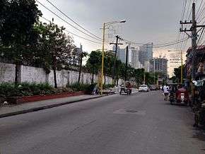 The Manila South Cemetery on South Avenue | |
| Route information | |
| Length | 0.9 km (0.6 mi) |
| Component highways |
|
| Major junctions | |
| North end | Hipodromo Street |
|
J.P. Rizal Avenue Kalayaan Avenue Pablo Ocampo Street Extension | |
| South end | Metropolitan Avenue |
South Avenue is a short extension of Ayala Avenue north of Metropolitan Avenue in Makati, Metro Manila, Philippines. It forms the border between the Manila South Cemetery to the east and Barangay Santa Cruz to the west, running several hundred meters in a southwest-northeast direction from its southern terminus in Barangay San Antonio until Barangay Olympia at the intersection with Hipodromo Street fronting the old Santa Ana Race Track (now being redeveloped by Ayala Land as Circuit Makati district).[1][2] The origin of the name of the avenue is unclear, but it may be derived from the cemetery through which it passes. South Avenue is also the location of the Ecoville Townhouses and F. Benitez Elementary School.
See also
References
- ↑ News - Makati Archived 2014-03-03 at the Wayback Machine. published by MakeItMakati.com; accessed 2013-10-29.
- ↑ Ayala transforms race track into Broadway, football hub published by Rappler; accessed 2013-10-29.
This article is issued from
Wikipedia.
The text is licensed under Creative Commons - Attribution - Sharealike.
Additional terms may apply for the media files.