Cheyenne, Wyoming
| Cheyenne, Wyoming | ||
|---|---|---|
| State capital of Wyoming | ||
| City of Cheyenne | ||
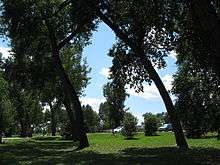
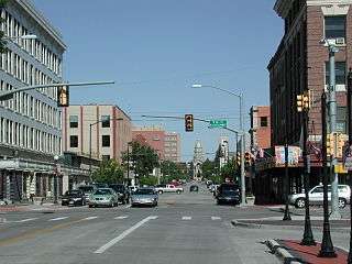 Capitol Avenue in Downtown | ||
| ||
| Nickname(s): Magic City of the Plains; Capital City (of Wyoming); The Frontier City | ||
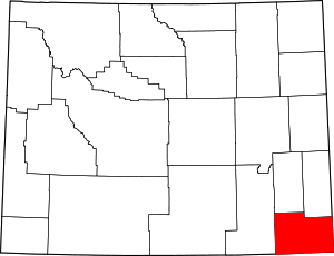
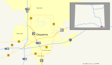
 Location within Laramie County | ||
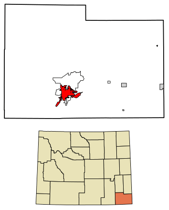
 Cheyenne Location within Wyoming  Cheyenne Location within the United States  Cheyenne Location within North America | ||
| Coordinates: 41°8′44″N 104°48′7″W / 41.14556°N 104.80194°WCoordinates: 41°8′44″N 104°48′7″W / 41.14556°N 104.80194°W | ||
| Country |
| |
| State |
| |
| County |
| |
| Founded | 1867 | |
| Named for | Cheyenne people | |
| Government | ||
| • Mayor | Marian Orr[1] | |
| Area[2] | ||
| • City | 24.63 sq mi (63.79 km2) | |
| • Land | 24.52 sq mi (63.51 km2) | |
| • Water | 0.11 sq mi (0.28 km2) 0.45% | |
| Elevation | 6,062 ft (1,848 m) | |
| Population (2010)[3] | ||
| • City | 59,466 | |
| • Estimate (2016)[4] | 64,019 | |
| • Rank | US: 564th | |
| • Density | 2,425.2/sq mi (936.4/km2) | |
| • Urban | 73,588 (US: 377th) | |
| • Metro | 96,389 (US: 359th) | |
| Time zone | UTC−7 (Mountain) | |
| • Summer (DST) | UTC−6 (Mountain) | |
| Zip Code | 82001, 82002, 82003, 82006, 82007, 82008, 82009, 82010 | |
| Area code(s) | 307 | |
| FIPS code | 56-13900[5] | |
| GNIS feature ID | 1609077[6] | |
| Website |
www | |
|
| ||

Cheyenne (/ʃaɪˈæn/ shy-AN or /ʃaɪˈɛn/) is the capital and most populous city of the U.S. state of Wyoming and the county seat of Laramie County.[7] It is the principal city of the Cheyenne, Wyoming, Metropolitan Statistical Area which encompasses all of Laramie County. The population was 59,466 at the 2010 census.[8] Cheyenne is the northern terminus of the extensive and fast-growing Front Range Urban Corridor that stretches from Cheyenne to Pueblo, Colorado, and has a population of 4,333,742 according to the 2010 United States Census.[3][9] Cheyenne is situated on Crow Creek and Dry Creek. The Cheyenne, Wyoming Metropolitan Area had a 2010 population of 91,738, making it the 354th-most populous metropolitan area in the United States.
History

On July 5, 1867, General Grenville M. Dodge and his survey crew plotted the site now known as Cheyenne in Dakota Territory (later Wyoming Territory). This site was chosen as the point at which the Union Pacific Railroad crossed Crow Creek, a tributary of the South Platte River. The city was not named by Dodge, as his memoirs state, but rather by friends who accompanied him to the area Dodge called "Crow Creek Crossing".[10] It was named for the American Indian Cheyenne tribe, one of the most famous and prominent Great Plains tribes closely allied with the Arapaho.
The construction of the Union Pacific Railroad brought hopes of prosperity to the region when it reached Cheyenne on November 13, 1867. The population at the time numbered over 4,000, and grew rapidly.[10] This rapid growth earned the city the nickname "Magic City of the Plains".[10]
In 1867, Fort D. A. Russell was established, three miles (5 km) west of the city. The fort was later renamed Francis E. Warren Air Force Base.
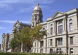
The Wyoming State Capitol was constructed between 1886 and 1890, with further improvements being completed in 1917.
The Wyoming Stock Growers Association met at The Cheyenne Club, which allegedly acted as an interim government for the territory. Many of the WSGA's rules and regulations became state laws.
The Cheyenne Regional Airport was opened in 1920, initially serving as a stop for airmail. It soon developed into a civil-military airport, serving DC-3s and various military craft. During World War II, hundreds of B-17s, B-24s, and PBYs were outfitted and upgraded at the airfield. Today, it serves a number of military functions, as well as a high-altitude testbed for civilian craft.[11]
Geography and climate
Geography
Lying near the southeast corner of the state, Cheyenne is one of the least centrally located state capitals in the nation (together with cities such as Carson City, Nevada; Juneau, Alaska; and Topeka, Kansas).
According to the United States Census Bureau, the city has a total area of 24.63 square miles (63.79 km2), of which 24.52 square miles (63.51 km2) is land and 0.11 square miles (0.28 km2) is water.[2]
Climate
Cheyenne, like most of the rest of Wyoming, has a cool semi-arid climate (Köppen BSk), and is part of USDA Hardiness zone 5b, with the suburbs falling in zone 5a.[12] Winters are cold and moderately long, but relatively dry, with a December average of 28.8 °F (−1.8 °C), highs that fail to breach freezing occur 35 days per year, and lows dip to the 0 °F (−17.8 °C) mark on 9.2 mornings.[13] However, the cold is often interrupted, with chinook winds blowing downslope from the Rockies that can bring warm conditions, bringing the high above 50 °F (10 °C) on twenty days from December to February.[13]
Snowfall is greatest in March and April, seasonally averaging 60 inches (1,500 mm), historically ranging from 13.1 inches (330 mm) between July 1965 and June 1966 up to 121.5 inches (3,090 mm) between July 1979 and June 1980, yet thick snow cover rarely stays.[13] Summers are warm, with a high diurnal temperature range; July averages 69.4 °F (20.8 °C), and highs reach 90 °F (32.2 °C) on an average twelve afternoons annually. Spring and autumn are quick transitions, with the average window for freezing temperatures being September 29 thru May 14, allowing a growing season of 106 days.[13] Official record temperatures range from −38 °F (−38.9 °C) on January 9, 1875, up to 100 °F (37.8 °C) on June 23, 1954, the last of four occurrences; the record cold daily maximum is −21 °F (−29.4 °C) on January 11, 1963, while, conversely, the record warm daily minimum is 68 °F (20 °C) on July 31, 1960.[13] The annual precipitation of 15.9 inches (400 mm) tends to be concentrated from May to August and is low during fall and winter; it has historically ranged from 5.04 inches (128.0 mm) in 1876 to 23.69 inches (602 mm) in 1942.[13]
The city averages below 60% daily relative humidity in each month and receives an average 2,980 hours (~67% of the possible total) of sunshine annually. On July 16, 1979 an F3 tornado struck Cheyenne causing one death and 40 injuries.[14] It was the most destructive tornado in Wyoming history.[15]
| Climate data for Cheyenne Regional Airport, Wyoming (1981–2010 normals, extremes 1872−present)[lower-alpha 1] | |||||||||||||
|---|---|---|---|---|---|---|---|---|---|---|---|---|---|
| Month | Jan | Feb | Mar | Apr | May | Jun | Jul | Aug | Sep | Oct | Nov | Dec | Year |
| Record high °F (°C) | 66 (19) |
71 (22) |
77 (25) |
83 (28) |
91 (33) |
100 (38) |
100 (38) |
98 (37) |
95 (35) |
85 (29) |
75 (24) |
69 (21) |
100 (38) |
| Average high °F (°C) | 39.5 (4.2) |
40.5 (4.7) |
47.5 (8.6) |
54.9 (12.7) |
64.7 (18.2) |
75.3 (24.1) |
83.4 (28.6) |
81.2 (27.3) |
71.8 (22.1) |
58.8 (14.9) |
46.5 (8.1) |
38.2 (3.4) |
58.5 (14.7) |
| Average low °F (°C) | 18.0 (−7.8) |
18.6 (−7.4) |
24.4 (−4.2) |
30.8 (−0.7) |
40.2 (4.6) |
48.9 (9.4) |
55.5 (13.1) |
54.1 (12.3) |
44.7 (7.1) |
33.9 (1.1) |
24.2 (−4.3) |
17.3 (−8.2) |
34.2 (1.2) |
| Record low °F (°C) | −38 (−39) |
−34 (−37) |
−21 (−29) |
−8 (−22) |
8 (−13) |
25 (−4) |
33 (1) |
25 (−4) |
8 (−13) |
−5 (−21) |
−21 (−29) |
−28 (−33) |
−38 (−39) |
| Average precipitation inches (mm) | 0.33 (8.4) |
0.47 (11.9) |
1.05 (26.7) |
1.78 (45.2) |
2.34 (59.4) |
2.34 (59.4) |
2.19 (55.6) |
1.95 (49.5) |
1.48 (37.6) |
0.93 (23.6) |
0.59 (15) |
0.49 (12.4) |
15.94 (404.9) |
| Average snowfall inches (cm) | 5.9 (15) |
7.9 (20.1) |
11.3 (28.7) |
10.2 (25.9) |
2.3 (5.8) |
trace | 0 (0) |
0 (0) |
1.3 (3.3) |
5.0 (12.7) |
8.0 (20.3) |
8.4 (21.3) |
60.3 (153.2) |
| Average precipitation days (≥ 0.01 in) | 4.9 | 6.2 | 8.6 | 10.3 | 12.4 | 11.4 | 10.7 | 11.0 | 8.3 | 7.4 | 6.4 | 6.2 | 103.8 |
| Average snowy days (≥ 0.1 in) | 5.7 | 6.5 | 7.8 | 6.1 | 1.8 | 0.1 | 0 | 0 | 0.7 | 3.4 | 6.1 | 6.8 | 45.0 |
| Average relative humidity (%) | 52.5 | 54.6 | 56.1 | 54.3 | 55.8 | 53.5 | 51.3 | 51.4 | 51.5 | 50.0 | 53.6 | 54.0 | 53.2 |
| Mean monthly sunshine hours | 190.7 | 202.6 | 253.1 | 271.9 | 291.9 | 303.2 | 317.5 | 297.4 | 262.3 | 237.0 | 178.8 | 175.4 | 2,981.8 |
| Percent possible sunshine | 64 | 68 | 68 | 68 | 65 | 67 | 69 | 70 | 70 | 69 | 60 | 61 | 67 |
| Source: NOAA (relative humidity and sun 1961−1990)[13][17][18] | |||||||||||||
Demographics
| Historical population | |||
|---|---|---|---|
| Census | Pop. | %± | |
| 1870 | 1,450 | — | |
| 1880 | 3,456 | 138.3% | |
| 1890 | 11,690 | 238.3% | |
| 1900 | 14,087 | 20.5% | |
| 1910 | 11,320 | −19.6% | |
| 1920 | 13,829 | 22.2% | |
| 1930 | 17,361 | 25.5% | |
| 1940 | 22,474 | 29.5% | |
| 1950 | 31,935 | 42.1% | |
| 1960 | 43,505 | 36.2% | |
| 1970 | 41,254 | −5.2% | |
| 1980 | 47,283 | 14.6% | |
| 1990 | 50,008 | 5.8% | |
| 2000 | 53,011 | 6.0% | |
| 2010 | 59,466 | 12.2% | |
| Est. 2016 | 64,019 | [4] | 7.7% |
| U.S. Decennial Census[19] 1870–2000 census[20] 2014 estimate[21][22] | |||
At the 2005–2007 American Community Survey 3-Year Estimates, the city's population was 87.2% White or European American (79.3% non-Hispanic White alone), 12.7% Hispanic or Latino (of any race), 4.5% Black or African American, 2.5% American Indian and Alaska Native, 2.1% Asian and 6.4% from some other race.[23] 22.5% of the total population had a Bachelor's degree or higher.
2010 census
As of the census[3] of 2010, there were 59,467 people, 25,558 households, and 15,270 families residing in the city. The population density was 2,425.2 inhabitants per square mile (936.4/km2). There were 27,284 housing units at an average density of 1,112.7 per square mile (429.6/km2). The racial makeup of the city was 77.44% European American, 2.88% African American, 0.96% Native American, 1.24% Asian, 0.20% Pacific Islander, 4.0% from other races, and 3.28% from two or more races. Hispanic or Latino of any race were 14.45% of the population.
There were 25,558 households of which 30.2% had children under the age of 18 living with them, 43.1% were married couples living together, 12.0% had a female householder with no husband present, 4.7% had a male householder with no wife present, and 40.3% were non-families. 33.5% of all households were made up of individuals and 10.6% had someone living alone who was 65 years of age or older. The average household size was 2.29 and the average family size was 2.92.
The median age in the city was 36.5 years. Twenty-four percent of residents were under the age of 18; 9.5% were between the ages of 18 and 24; 26.9% were from 25 to 44; 26.2% were from 45 to 64; and 13.5% were 65 years of age or older. The gender makeup of the city was 49.3% male and 50.7% female.
2000 census
As of the census[5] of 2000, there were 53,011 people, 22,324 households, 14,175 families residing in the city, and 81,607 people residing in the Metropolitan Statistical Area making it the largest city and metropolitan area in the state of Wyoming. The population density was 2,511.4 inhabitants per square mile (969.6/km²). There were 23,782 housing units at an average density of 1,126.7 per square mile (435.0/km²). The racial makeup of the city was 78.1% White or European American, 2.8% Black or African American, 0.8% Native American, 1.1% Asian, 0.1% Pacific Islander, 4.4% from other races, and 2.7% from two or more races. 12.5% of the population were Hispanic or Latino of any race.
There were 22,324 households out of which 30.4% had children under the age of 18 living with them, 49.2% were married couples living together, 10.6% had a female householder with no husband present, and 36.5% were non-families. 31.3% of all households were made up of individuals and 10.6% had someone living alone who was 65 years of age or older. The average household size was 2.33 and the average family size was 2.93.
The city has a wide range of age groups, with 24.9% under the age of 18, 8.8% from 18 to 24, 29.7% from 25 to 44, 22.8% from 45 to 64, and 13.8% 65 years of age or older. The median age was 37 years. For every 100 females, there were 95.3 males. For every 100 females age 18 and over, there were 92.7 males.
The median income for a household in the city was $38,856, and the median income for a family was $46,771. Males had a median income of $32,286 versus $24,529 for females. The per capita income for the city was $19,809. About 6.3% of families and 8.8% of the population were below the poverty line, including 11.1% of those under age 18 and 5.8% of those age 65 or over.
Government
Cheyenne's government consists of a mayor and a city council. The mayor is elected in a citywide vote. The city council has nine members each of whom are elected from one of three wards. Each ward elects three members. The mayor's office is responsible for managing the various city departments which consist of Street/Alley, Police, Fire, Parks, Fleet Maintenance, Traffic, Sanitation, Downtown Historic District, Weed and Pest, Facilities Maintenance, and Cemetery. The Cheyenne Board of Public Utilities is owned by the city but is semi-autonomous.[24]
Education
Public education in the city of Cheyenne is provided by Laramie County School District #1. The district is served by four high schools, Central High on the northwest side, East High on the east side, South High on the south side, and Triumph High, also on the south side.
Cheyenne is home to the Laramie County Community College (LCCC), one of seven constituent campuses managed by the Wyoming Community College Commission.
Government is the largest sector of Cheyenne's economy. The state of Wyoming operates a multitude of offices in downtown Cheyenne. Many area residents are employed by or are dependent on the U.S. Air Force, through F.E. Warren Air Force Base to the west of the city, or by the Wyoming National Guard.
Railroads also remain a major economic force for the city, with both the Burlington Northern Santa Fe and Union Pacific employing many residents.[25]
Due much in part to work done by Cheyenne's economic development agency "Cheyenne Leads", successful steps have been taken in recent years to diversify the city's economy. Lowe's and Wal-Mart both operate distribution centers on the city's outskirts. Sierra Trading Post is headquartered in the city and also operates its distribution and fulfillment centers in the city.[26] In addition, because of the towns cooler summers and abundant electricity supplies (both renewable and non-renewable), Cheyenne has been able to attract a number of data centers including the NCAR supercomputing center, along with a Microsoft data center, powered by bio gas and powered by wind energy.
On January 2, 2014 Magpul Industries announced that it was moving its production, distribution, and shipping operations to Cheyenne from Erie, Colorado.[27]
Cheyenne's high elevation, coupled with its position on the continent, make it one of the windiest cities in the United States. The abundance of wind makes Cheyenne an opportune place to develop wind energy. Wind turbines are currently being placed around Laramie County. Laramie County Community College is home to a leading wind energy technician program, where students learn to maintain these turbines. The opening of a Vestas wind turbine blade assembly in nearby Weld County, Colorado, as well as other alternative energy manufacturing facilities around Colorado, are transforming the region into a center for alternative energy.
Great Lakes Airlines, Taco John's, and Green House Data are headquartered in Cheyenne.[28][29]
Cheyenne has one of only three enclosed shopping malls in Wyoming, the Frontier Mall. The other two are the Eastridge Mall in Casper, and the White Mountain Mall in Rock Springs.
Parks and recreation
The Cheyenne Parks and Recreation Department operates an Ice and Events center, swimming pool, spray park, skateboard park, two golf courses, Cheyenne Botanic Gardens (including the Paul Smith Children's Village at the Gardens), paddle boat rentals in Lions Park (summers only), cemeteries, forestry operations, community house, Youth Activity Center and a miniature golf park. The Cheyenne Parks and Recreation Department also operates a 37 miles (60 kilometers)) Greater Cheyenne Greenway system. The greenway connects parks and neighborhoods of greater Cheyenne. It includes many bridges and underpasses where travelers can avoid high traffic roads and travel above waterways and drainages. In 1996, as a result of the greenway, Cheyenne was named a "Trail Town USA" by the National Park service and the American Hiking Society.[30]
Professional sports
The Cheyenne Warriors were founded as an American Professional Football League team in 2012. After playing a season in the APFL, they announced a move to the Indoor Football League. Shortly after the owner of the team died in December 2012, the Warriors announced that they were forming the new Developmental Football League. After playing several games in this new league, the team folded in May 2013.
Landmarks
- Wyoming State Capitol
- F.E. Warren Air Force Base, one of the nation's oldest, continuously active installations (originally U.S. Army Fort D.A. Russell).
- Nagle Warren Mansion
National Register of Historic Places
Over fifty different locations in Cheyenne are listed on the National Register of Historic Places, including:
- The Historic Plains Hotel (added 1978)
- Atlas Theatre (added 1973)
- Union Pacific Depot (Cheyenne Depot Museum) (1973)
- the Governor's Mansion (1969)
- Nagle-Warren Mansion (1976)
- First Presbyterian Church (1869)
- First United Methodist Church (1975)
- St. Mark's Episcopal Church (1970)
- St. Mary's Catholic Cathedral (1974)
- Cheyenne High School (2005)
- High Plains Horticulture Research Station a.k.a. High Plains Arboretum (1930–1974)
- Storey Gymnasium (2005)
- Park Addition School (1970)
- Big Boy Steam Engine (1956)
- Botanic Gardens Rotary Century Plaza & Steam Locomotive (1921)
Several districts in the city are also listed, including:
- Downtown Cheyenne Historic District (1978, with boundary increase in 1980, 1988, 1996. Encompasses 205 acres (0.83 km2) and 67 buildings)
- Lakeview Historic District (1996, 350 acres and 109 buildings)
- Rainsford Historic District (1984, 1980 acres and 288 buildings)
- Capitol North Historic District (1980, 204 acres and 112 buildings)
- Fort David A. Russell (1969, 6,300 acres and 19 buildings)
- Union Pacific Roundhouse, Turntable and Machine Shop (1992, 113 acres and 2 buildings)
- South Side Historic District (2006)
Transportation
Highways


Local bus service
Cheyenne provides local hourly bus service from 6 a.m.–7 p.m. Monday to Friday and 10 a.m.–5 p.m. on Saturday. There is no Sunday service.[31]
Airports
Cheyenne Regional Airport previously featured daily service from Great Lakes Airlines to Denver.
Railroads
The Union Pacific and BNSF railroads intersect in Cheyenne. The city is home to a BNSF railyard, as well as the Union Pacific's steam program. UP's 844, 3985 and 4014 reside in the steam shop.[32]
Cheyenne Frontier Days
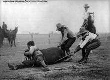
Cheyenne Frontier Days, which is held over ten days centered around the last full week in July, is the largest outdoor rodeo in the US. The events include professional bull riding, calf roping, barrel racing, steer wrestling, team roping, bronc riding, steer roping, bareback riding, and many others. During this week there are many parades and other events. Additionally there is a carnival with numerous rides, games, and shops.[33]
Media
- Wyoming Tribune Eagle newspaper
- The Cheyenne Herald ( OCLC 51310460) was written and published by Dave Featherly from 2002–2012.[34]
- KGWN
Notable people
- Vernon Baker, Medal of Honor recipient[35]
- Jillian Balow, Wyoming superintendent of public instruction since 2015[36]
- James Emmett Barrett, U.S. federal judge[37]
- Larry Birleffi, voice of the Wyoming Cowboys, 1947–1986[38]
- Bryant B. Brooks (1861-1944) - Governor of Wyoming 1905-1911[39]
- Harriet Elizabeth Byrd, first African-American to serve in Wyoming Legislature[40]
- Rich Crandall, member of Arizona State Senate, moved to Cheyenne in 2013 to assume new position of "director" of Wyoming Department of Education[41]
- Neil Diamond, singer, lived in Cheyenne during his father's military service in World War II era[42]
- David R. Edwards, late state representative from Converse County was born in Cheyenne in 1938.[43]
- Floyd Esquibel, member of Wyoming Senate and former member of Wyoming House of Representatives[44]
- James M. Flinchum, editor-in-chief of Wyoming State Tribune from 1961 to 1985[45]
- Stephanie Flowers, African-American Democratic member of the Arkansas State Senate, former Cheyenne resident[46]
- Shirley E. Flynn, Cheyenne historian and author[47]
- John Frullo, former Cheyenne resident and member of Texas House of Representatives from Lubbock[48]
- Bill Garnaas, NFL player for Pittsburgh Steelers, 1946-48[49]
- John Godina, shot putter, silver medalist at 1996 Atlanta Olympics and a bronze medal at the 2000 Sydney games[50]
- Mark Gordon, state treasurer since 2012[51]
- Curt Gowdy, sportscaster, member of American Sportscasters Association Hall of Fame, recipient of Spink Award from baseball's Hall of Fame[52]
- Robert Mills Grant, rancher, expert in branding law, state representative, was born and died in Cheyenne but spent his life in Platte County[53]
- Charles G. Hall, photojournalist[54]
- Mildred Harris, actress and first wife of actor Charlie Chaplin[55]
- Cecilia Hart, actress and second wife of actor James Earl Jones[56]
- Wild Bill Hickok, iconic gunfighter and lawman[57]
- Robert Holding, founder of Grand America Hotels & Resorts[58]
- Tom Horn, American Old West lawman, scout, soldier, hired gunman, detective, outlaw and assassin[59]
- Jeremy Horst, MLB pitcher with Cincinnati Reds (2011) and Philadelphia Phillies (2012–2013)[60]
- George Clayton Johnson, fiction writer[61]
- James Johnson, professional basketball player with the NBA's Chicago Bulls, Toronto Raptors, Sacramento Kings, Memphis Grizzlies, and Miami Heat[62]
- Raymond A. Johnson, aviation pioneer[63]
- Wayne Harold Johnson, Republican member of both houses, respectively, of the Wyoming State Legislature from 1993 to 2016; resident of Cheyenne[64]
- Daniel Junge, documentary filmmaker, Academy Award winner for Saving Face[65]
- William T. Kane, physicist in field of fiber optics[66]
- Chris LeDoux, rodeo champion and country music legend; graduate of Cheyenne Central High[67]
- Phil Ligrani, Professor of Mechanical and Aerospace Engineering at the University of Alabama in Huntsville[68]
- Cynthia Lummis, former state treasurer and member of United States House of Representatives[69]
- Edgar Warner Mann, Wyoming territorial legislator and lawyer[70]
- Marlin McKeever, defensive end for USC and NFL's Los Angeles Rams, Minnesota Vikings, Washington Redskins and Philadelphia Eagles[71]
- Mike McKeever, All-American football player for USC, twin of Marlin McKeever[72]
- Joseph B. Meyer, Wyoming attorney general and state treasurer[73]
- Jennifer Nichols, archer who competed in 2004, 2008 and 2012 Summer Olympics[74]
- Brandon Nimmo, baseball player for the New York Mets[75]
- Leslie Osterman, member of Kansas House of Representatives from Wichita; Cheyenne native[76]
- Charles E. Richardson, former newspaper publisher, Rock Springs Daily Rocket-Miner; retired to Cheyenne until his death in 2009[77]
- Tracy Ringolsby, sportswriter and sportscaster[78]
- Robert Schliske, member of Wyoming House of Representatives, 1971–1975[79]
- Edwin H. Whitehead, former member of the Wyoming House of Representatives and leader of the John F. Kennedy forces in Wyoming in 1960[80]
- Alvin Wiederspahn (1949–2014), Cheyenne lawyer, historical preservationist, rancher, and member of both houses of the Wyoming State Legislature; husband of U.S. Representative Cynthia Lummis[81]
Sister cities
Cheyenne's sister cities are:
- Bismarck, North Dakota, United States
- Hammam Sousse, Tunisia
- Lourdes, France
- Taichung, Taiwan
- Voghera, Italy
- Waimea, Hawaii County, Hawaii, United States
Suburbs
1. North Cheyenne 2. South Greeley 3. Warren A.F.B 4. Ranchettes 5. Orchard Valley 6. Fox Farm-College
See also
Notes
References
- ↑ Mayor's Office, Cheyenne. Accessed January 18, 2009.
- 1 2 "US Gazetteer files 2010". United States Census Bureau. Archived from the original on January 24, 2012. Retrieved 2012-12-14.
- 1 2 3 "American FactFinder". United States Census Bureau. Retrieved 2012-12-14.
- 1 2 "Population and Housing Unit Estimates". Retrieved June 9, 2017.
- 1 2 "American FactFinder". United States Census Bureau. Archived from the original on September 11, 2013. Retrieved 2008-01-31.
- ↑ "US Board on Geographic Names". United States Geological Survey. 2007-10-25. Retrieved 2008-01-31.
- ↑ "Find a County". National Association of Counties. Archived from the original on May 10, 2015. Retrieved 2011-06-07.
- ↑ "Profile of General Population and Housing Characteristics: 2010 Demographic Profile Data (DP-1): Cheyenne city, Wyoming". U.S. Census Bureau, American Factfinder. Archived from the original on September 11, 2013. Retrieved April 2, 2012.
- ↑ "Front Range - America 2050". America2050.org. Retrieved January 9, 2018.
- 1 2 3 "History of Cheyenne". City of Cheyenne. Retrieved June 29, 2015.
- ↑ "Cheyenne Regional Airport History". Cheyenne Regional Airport. Retrieved September 27, 2013.
- ↑ "USDA Plant Hardiness Zone Map". United States Department of Agriculture. Retrieved 2014-06-01.
- 1 2 3 4 5 6 7 "NowData – NOAA Online Weather Data". National Oceanic and Atmospheric Administration. Retrieved January 19, 2012.
- ↑ "Tornado History Project: Maps and Statistics". Tornadohistoryproject.com. Retrieved January 9, 2018.
- ↑
- ↑ ThreadEx
- ↑ "Station Name: WY CHEYENNE". National Oceanic and Atmospheric Administration. Retrieved 2014-03-21.
- ↑ "WMO Climate Normals for CHEYENNE WSFO, WY 1961–1990". National Oceanic and Atmospheric Administration. Retrieved 2014-03-21.
- ↑ "Decennials - Census of Population and Housing". Census.gov. February 8, 2006. Retrieved January 9, 2018.
- ↑ "HISTORICAL DECENNIAL CENSUS POPULATION FOR WYOMING COUNTIES, CITIES, AND TOWNS". Eadiv.state.wy.us. Retrieved January 9, 2018.
- ↑ "Population Estimates". United States Census Bureau. Archived from the original on May 22, 2015. Retrieved June 7, 2015.
- ↑ "2014 estimate" (PDF). Eadiv.state.wy.us. Retrieved January 9, 2018.
- ↑ American FactFinder. Factfinder.census.gov. Retrieved on April 11, 2012.
- ↑ Cheyenne, WY – Official Website – City Council. Wy-cheyenne.civicplus.com. Retrieved on April 11, 2012.
- ↑ The Cheyenne-Laramie County Corporation for Economic Development Archived July 25, 2011, at the Wayback Machine.. Cheyenne LEADS. Retrieved on April 11, 2012.
- ↑ Bowman, Robert J. (May 1, 2007). "A Random Walk Through Sierra Trading Post's Warehouse". Global Logistics & Supply Chain Strategies.
- ↑ "US gun magazine producer to leave Colo. over gun laws". Fox News. 2 January 2014. Retrieved 7 January 2014.
- ↑ "Contact Us". Great Lakes Airlines. Retrieved May 25, 2009.
- ↑ "Contact Us". Taco John's. Archived from the original on February 10, 2010. Retrieved February 25, 2010.
- ↑ "American Hiking Society – Protecting the places you love to hike". Americanhiking.org. Retrieved January 9, 2018.
- ↑ "Fixed Route Service - Cheyenne, WY - Official Website". Cheyennecity.org. Retrieved January 9, 2018.
- ↑ "UP: Steam". Retrieved May 28, 2014.
- ↑ Cheyenne Frontier Days. Cfdrodeo.com (April 3, 2012). Retrieved on April 11, 2012.
- ↑ "cheyenneherald.com". Cheyenneherald.com. Retrieved January 9, 2018.
- ↑ "Vernon Baker". nationalww2museum.org. Retrieved 18 September 2013.
- ↑ Aaron Schrank (November 5, 2014). "Republican Jillian Balow Elected Wyoming Schools Chief". Wyoming Public Radio. Retrieved December 11, 2014.
- ↑ "Barrett, James Emmett | Federal Judicial Center". Fjc.gov. Retrieved 2017-10-18.
- ↑ "Lawrence V. Birleffi - University of Wyoming Athletics Hall of Fame". University of Wyoming Athletics Hall of Fame. Retrieved 2017-10-18.
- ↑ https://www.wyohistory.org/encyclopedia/bryant-brooks
- ↑ "Harriet Elizabeth Byrd". University of Wyoming. Retrieved 18 September 2013.
- ↑ "Wyoming Gov. Mead appoints Arizona senator to run education department, June 27, 2013". Casper Star-Tribune. Retrieved July 21, 2013.
- ↑ "Neil Diamond". jewishvirtuallibrary.org. Retrieved 18 September 2013.
- ↑ "David Richard Edwards". wyomingnews.com. Retrieved January 9, 2013.
- ↑ "Senator Floyd A. Esquibel". State of Wyoming Legislature. Retrieved November 6, 2012.
- ↑ "James M. Flinchum". Wyoming Tribune-Eagle. Retrieved 18 September 2013.
- ↑ "Stephanie Anne Flowers". intelius.com. Retrieved April 17, 2015.
- ↑ "Shirley E. Flynn". Wyoming Tribune-Eagle. Retrieved 18 September 2013.
- ↑ "John Frullo". vote-tx.org/. Retrieved 18 September 2013.
- ↑ "Bill Garnaas Stats | Pro-Football-Reference.com". Pro-Football-Reference.com. Retrieved 2017-10-18.
- ↑ "John Godina". USA Track & Field, Inc. Retrieved 18 September 2013.
- ↑ "Mark Gordon". The Billings Gazette. Retrieved 18 September 2013.
- ↑ "Curt Gowdy". baseballhall.org/. Archived from the original on September 14, 2013. Retrieved 18 September 2013.
- ↑ "For the Record: Robert Mills Grant, May 2, 2012". Platte County Record Times. Archived from the original on February 1, 2015. Retrieved August 10, 2013.
- ↑ "Charles G. Hall". Wyoming Tribune-Eagle. Retrieved 18 September 2013.
- ↑ "St. Petersburg Times - Google News Archive Search". News.google.com. Retrieved 2017-10-18.
- ↑ "Cecilia Hart, Actress and Wife of James Earl Jones, Dies at 68". The Hollywood Reporter. Retrieved 2017-10-18.
- ↑ "Wild Bill Hickok". Nebraska State Government Homepage. Retrieved 18 September 2013.
- ↑ "Robert Holding". by the U.S. National Ski Hall of Fame. Retrieved 18 September 2013.
- ↑ "Tom Horn". Wyoming Tribune-Eagle. Retrieved 19 September 2013.
- ↑ "Jeremy Horst Stats | Baseball-Reference.com". Baseball-Reference.com. Retrieved 2017-10-18.
- ↑ Slotnik, Daniel E. (2015-12-27). "George Clayton Johnson, Science Fiction Writer, Dies at 86". The New York Times. ISSN 0362-4331. Retrieved 2017-10-18.
- ↑ "James Patrick Johnson". Basketball-Reference.Com. Retrieved November 15, 2012.
- ↑ "James Chilton, Hall of Fame inductee grew alongside aviation industry, September 26, 2013". Wyoming Tribune-Eagle. Retrieved September 26, 2013.
- ↑ "Senator Wayne H. Johson". Legisweb.state.wy.us. Retrieved 2017-10-18.
- ↑ "Daniel Junge". Casper Star Tribune. Retrieved 7 March 2014.
- ↑ "William T. Kane". Wyoming Tribune-Eagle. Retrieved 19 September 2013.
- ↑ "Chris LeDoux". Wyoming Tribune-Eagle. Retrieved 19 September 2013.
- ↑ LaChance, Diana (17 February 2015). "Professor's illustrious career leads to research innovations and broadened horizons for students". University of Alabama in Huntsville
- ↑ "Cynthia Lummis". Biographical Directory of the United States Congress. Retrieved 19 September 2013.
- ↑ 'Proceedings of the State Bar Association of Wisconsin 1907,' Wisconsin Bar Association: 1907, Biographical Sketch of Edgar Warner Mann, pg. 306
- ↑ "Marlin McKeever Stats | Pro-Football-Reference.com". Pro-Football-Reference.com. Retrieved 2017-10-18.
- ↑ Bolch, Ben (2006-10-28). "Marlin McKeever, 66; former USC All-American, L.A. Rams linebacker". Los Angeles Times. ISSN 0458-3035. Retrieved 2017-10-18.
- ↑ "Joseph Meyer". Wyoming Tribune-Eagle. Retrieved 19 September 2013.
- ↑ "Jennifer Nichols". United States Olympic Committee. Retrieved 19 September 2013.
- ↑ "Brandon Nimmo". BASEBALL REFERENCE. COM. Retrieved 19 September 2013.
- ↑ "Leslie Osterman". MProject Vote Smart. Retrieved 19 September 2013.
- ↑ "Charles E. Richardson". Wyoming Tribune-Eagle. Retrieved 19 September 2013.
- ↑ "Tracy Ringolsby". MLB Advanced Media, L.P. Retrieved 19 September 2013.
- ↑ "Robert Schliske". Wyoming Tribune-Eagle. June 23, 2007. Retrieved May 24, 2015.
- ↑ "Edwin H. Whitehead". Wyoming Tribune-Eagle. Retrieved 19 September 2013.
- ↑ "Alvin Wiederspahn". Wyoming Tribune Eagle. Retrieved October 29, 2014.
Bibliography
External links
| Wikimedia Commons has media related to Cheyenne, Wyoming. |
| Wikivoyage has a travel guide for Cheyenne. |
- Official website

Articles relating to Cheyenne, Wyoming | ||||||||||||||||
|---|---|---|---|---|---|---|---|---|---|---|---|---|---|---|---|---|
| ||||||||||||||||