Horse Creek, Wyoming
| Horse Creek, Wyoming | |
|---|---|
| Unincorporated community | |
 Horse Creek, Wyoming Location within the state of Wyoming  Horse Creek, Wyoming Horse Creek, Wyoming (the US) | |
| Coordinates: 41°24′54″N 105°10′56″W / 41.41500°N 105.18222°WCoordinates: 41°24′54″N 105°10′56″W / 41.41500°N 105.18222°W | |
| Country | United States |
| State | Wyoming |
| County | Laramie |
| Elevation | 6,506 ft (1,983 m) |
| Time zone | UTC-7 (Mountain (MST)) |
| • Summer (DST) | UTC-6 (MDT) |
| ZIP codes | 82061 |
| GNIS feature ID | 1589684[1] |
Horse Creek is an unincorporated community in western Laramie County, Wyoming, United States. It lies between Horse Creek to the north, and the South Fork of Horse Creek to the south, along WYO 211 northwest of the city of Cheyenne, the county seat of Laramie County.[2] Its elevation is 6,506 feet (1,983 m).[1] Although Horse Creek is unincorporated, it has a post office, with the ZIP code of 82061.[3] As of the 2010 census, Horse Creek had an estimated population of 39.[4]
Public education in the community of Horse Creek is provided by Laramie County School District #1.
Highways

- County Road #228 (Fisher Canyon Rd.), which becomes County Road #17 (Roger Canyon Rd.), runs west from Horse Creek to Laramie.
References
- 1 2 "Horse Creek, Wyoming". Geographic Names Information System. United States Geological Survey.
- ↑ Rand McNally. The Road Atlas '08. Chicago: Rand McNally, 2008, p. 116.
- ↑ Zip Code Lookup Archived 2011-06-15 at the Wayback Machine.
- ↑ Community Facts - 2010 Demographic Profile Retrieved 2015-07-06
Municipalities and communities of Laramie County, Wyoming, United States | ||
|---|---|---|
| City | 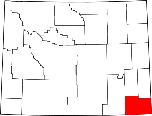 | |
| Towns | ||
| CDPs | ||
| Unincorporated communities | ||
This article is issued from
Wikipedia.
The text is licensed under Creative Commons - Attribution - Sharealike.
Additional terms may apply for the media files.