Natrona County, Wyoming
| Natrona County, Wyoming | ||
|---|---|---|
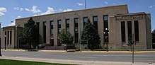 Natrona County Courthouse in Casper | ||
| ||
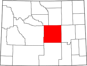 Location in the U.S. state of Wyoming | ||
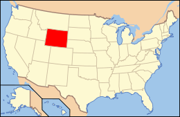 Wyoming's location in the U.S. | ||
| Founded | 1890 | |
| Named for | Natron deposits | |
| Seat | Casper | |
| Largest city | Casper | |
| Area | ||
| • Total | 5,376 sq mi (13,924 km2) | |
| • Land | 5,340 sq mi (13,831 km2) | |
| • Water | 35 sq mi (91 km2), 0.7% | |
| Population (est.) | ||
| • (2016) | 81,039 | |
| • Density | 15/sq mi (6/km2) | |
| Congressional district | At-large | |
| Time zone | Mountain: UTC−7/−6 | |
| Website |
www | |
Natrona County is a county in the U.S. state of Wyoming. As of the 2010 census, the population was 75,450,[1] making it the second-most populous county in Wyoming. Its county seat is Casper.[2]
Natrona County comprises the Casper, WY Metropolitan Statistical Area.
In 2010, the center of population of Wyoming was in Natrona County, near Alcova.[3]
History
The first Euro-American settlement occurred in the Casper area in the late 19th century.[4] Natrona County was created by the legislature of the Wyoming Territory on March 9, 1888, and it was organized in 1890.[5] The land for Natrona County was ceded from Carbon County.
Natrona County was named for the deposits of natron found in the area.[6] In 1909, Natrona County gained land from Fremont County. The boundaries were adjusted slightly in 1911 and 1931, and at that point the county gained its present outline.
Geography
According to the U.S. Census Bureau, the county has an area of 5,376 square miles (13,920 km2), of which 5,340 square miles (13,800 km2) is land and 35 square miles (91 km2) (0.7%) is water.[7]
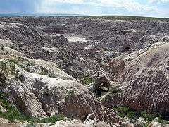
Geographic features
Adjacent counties
- Johnson County (north)
- Converse County (east)
- Carbon County (south)
- Fremont County (west)
- Washakie County (northwest)
National protected areas
Major highways
Demographics
| Historical population | |||
|---|---|---|---|
| Census | Pop. | %± | |
| 1890 | 1,094 | — | |
| 1900 | 1,785 | 63.2% | |
| 1910 | 4,766 | 167.0% | |
| 1920 | 14,635 | 207.1% | |
| 1930 | 24,272 | 65.8% | |
| 1940 | 23,858 | −1.7% | |
| 1950 | 31,437 | 31.8% | |
| 1960 | 49,623 | 57.8% | |
| 1970 | 51,264 | 3.3% | |
| 1980 | 71,856 | 40.2% | |
| 1990 | 61,226 | −14.8% | |
| 2000 | 66,533 | 8.7% | |
| 2010 | 75,450 | 13.4% | |
| Est. 2016 | 81,039 | [8] | 7.4% |
| U.S. Decennial Census[9] 1870–2000[10] 2010–2016[1] | |||
2000 census
As of the census[11] of 2000, there were 66,533 persons, 26,819 households, and 17,754 families residing in the county. The population density was 12 people per square mile (5/km²). There were 29,882 housing units at an average density of 6 per square mile (2/km²). The racial makeup of the county was 94.15% White, 0.76% Black or African American, 1.03% Native American, 0.42% Asian, 0.04% Pacific Islander, 1.92% from other races, and 1.68% from two or more races. 4.90% of the population were Hispanic or Latino of any race. 24.6% were of German, 11.6% English, 11.3% American and 11.2% Irish ancestry.
There were 26,819 households out of which 32.20% had children under the age of 18 living with them, 51.40% were married couples living together, 10.60% had a female householder with no husband present, and 33.80% were non-families. 27.50% of all households were made up of individuals and 9.40% had someone living alone who was 65 years of age or older. The average household size was 2.42 and the average family size was 2.95.
In the county, the population was distributed as follows: 26.00% under the age of 18, 10.10% from 18 to 24, 27.90% from 25 to 44, 23.30% from 45 to 64, and 12.70% who were 65 years of age or older. The median age was 36 years. For every 100 females there were 97.70 males. For every 100 females age 18 and over, there were 95.00 males.
The median income for a household in the county was $36,619, and the median income for a family was $45,575. Males had a median income of $33,524 versus $21,374 for females. The per capita income for the county was $18,913. About 8.70% of families and 11.80% of the population were below the poverty line, including 16.20% of those under age 18 and 7.20% of those age 65 or over.
2010 census
As of the 2010 United States Census, there were 75,450 people, 30,616 households, and 19,714 families residing in the county.[12] The population density was 14.1 inhabitants per square mile (5.4/km2). There were 33,807 housing units at an average density of 6.3 per square mile (2.4/km2).[13] The racial makeup of the county was 92.8% white, 1.0% American Indian, 0.9% black or African American, 0.7% Asian, 0.1% Pacific islander, 2.2% from other races, and 2.4% from two or more races. Those of Hispanic or Latino origin made up 6.9% of the population.[12] In terms of ancestry, 27.2% were German, 15.2% were Irish, 13.2% were English, and 10.7% were American.[14]
Of the 30,616 households, 31.9% had children under the age of 18 living with them, 48.1% were married couples living together, 10.9% had a female householder with no husband present, 35.6% were non-families, and 28.5% of all households were made up of individuals. The average household size was 2.41 and the average family size was 2.94. The median age was 36.8 years.[12]
The median income for a household in the county was $50,936 and the median income for a family was $62,859. Males had a median income of $47,610 versus $30,664 for females. The per capita income for the county was $28,235. About 5.4% of families and 8.4% of the population were below the poverty line, including 9.9% of those under age 18 and 8.8% of those age 65 or over.[15]
Communities
Cities
- Casper (county seat)
Towns
Census-designated places
Unincorporated communities
Government
Like almost all of Wyoming, Natrona is a powerfully Republican county. Bill Clinton did win a 100-vote plurality in the 1992 election due to a strong vote for Ross Perot, but no Democratic Presidential candidate has won forty percent of the county’s vote since Lyndon Johnson garnered 52 percent in his 1964 landslide against Barry Goldwater. In 2016 Donald J. Trump received 70.6% of the vote, the highest county vote percentage for any presidential candidate since Wyoming statehood in 1890.
| Year | Republican | Democratic | Third parties |
|---|---|---|---|
| 2016 | 70.6% 23,552 | 19.7% 6,577 | 9.7% 3,219 |
| 2012 | 68.4% 22,132 | 27.7% 8,961 | 4.0% 1,280 |
| 2008 | 65.9% 21,906 | 31.5% 10,475 | 2.7% 886 |
| 2004 | 67.1% 21,512 | 30.8% 9,863 | 2.2% 693 |
| 2000 | 65.0% 18,439 | 30.5% 8,646 | 4.6% 1,303 |
| 1996 | 46.7% 13,182 | 39.8% 11,240 | 13.4% 3,793 |
| 1992 | 35.5% 9,717 | 35.8% 9,817 | 28.7% 7,866 |
| 1988 | 59.6% 14,005 | 39.0% 9,148 | 1.4% 334 |
| 1984 | 69.9% 18,488 | 28.7% 7,598 | 1.4% 378 |
| 1980 | 63.0% 16,801 | 26.7% 7,111 | 10.4% 2,760 |
| 1976 | 60.8% 13,761 | 38.2% 8,640 | 1.0% 220 |
| 1972 | 70.5% 15,649 | 29.3% 6,514 | 0.2% 37 |
| 1968 | 57.2% 10,679 | 31.6% 5,900 | 11.2% 2,095 |
| 1964 | 47.6% 10,135 | 52.4% 11,167 | |
| 1960 | 56.7% 11,809 | 43.3% 9,002 | |
| 1956 | 62.6% 10,796 | 37.4% 6,462 | |
| 1952 | 63.9% 10,663 | 36.1% 6,021 | 0.1% 11 |
| 1948 | 46.0% 5,341 | 53.3% 6,183 | 0.7% 84 |
| 1944 | 51.5% 5,196 | 48.5% 4,890 | |
| 1940 | 46.5% 5,555 | 53.3% 6,373 | 0.2% 21 |
| 1936 | 32.0% 3,810 | 65.7% 7,819 | 2.3% 278 |
| 1932 | 37.9% 4,368 | 58.8% 6,777 | 3.4% 388 |
| 1928 | 64.8% 7,141 | 34.6% 3,818 | 0.6% 64 |
| 1924 | 60.1% 8,267 | 11.9% 1,631 | 28.0% 3,857 |
| 1920 | 66.2% 2,957 | 25.8% 1,153 | 8.0% 357 |
| 1916 | 39.2% 912 | 59.2% 1,377 | 1.6% 38 |
| 1912 | 45.5% 640 | 31.8% 447 | 22.7% 319 |
| 1908 | 63.7% 835 | 35.2% 461 | 1.1% 14 |
| 1904 | 69.3% 738 | 30.1% 320 | 0.7% 7 |
| 1900 | 66.1% 520 | 33.9% 267 | |
| 1896 | 54.3% 392 | 45.3% 327 | 0.4% 3 |
| 1892 | 55.9% 194 | 44.1% 153 |
Natrona County is governed by the Board of County Commissioners who meet in the county seat of Casper. The board consists of five members who are each is elected to a four-year term, which is staggered so not more than three commissioners are elected at the same time. Elections for the County Commissioners occur at the General Election every two years.
Current commissioners are:
- Forrest Chadwick (Chairman) – Republican
- John Lawson (Vice-Chairman) – Republican
- Matt Keating – Republican
- Rob Hendry – Republican
- Steve Schlager – Republican
See also
References
- 1 2 "State & County QuickFacts". United States Census Bureau. Archived from the original on July 15, 2011. Retrieved January 25, 2014.
- ↑ "Find a County". National Association of Counties. Retrieved 2011-06-07.
- ↑ "Centers of Population by State: 2010". United States Census Bureau. Retrieved May 14, 2014.
- ↑ "Email Validation". Newedc.net. Retrieved 9 January 2018.
- ↑ Long, John H., ed. (2004). "Wyoming: Individual County Chronologies". Wyoming Atlas of Historical County Boundaries. The Newberry Library. Retrieved August 19, 2015.
- ↑ Urbanek, Mae (1988). Wyoming Place Names. Missoula, MT: Mountain Press Publishing Company. ISBN 0-87842-204-8.
- ↑ "2010 Census Gazetteer Files". United States Census Bureau. August 22, 2012. Retrieved August 18, 2015.
- ↑ "Population and Housing Unit Estimates". Census.gov. Retrieved June 9, 2017.
- ↑ "U.S. Decennial Census". United States Census Bureau. Retrieved August 18, 2015.
- ↑ "Historical Decennial Census Population for Wyoming Counties, Cities, and Towns". Wyoming Department of Administration & Information, Division of Economic Analysis. Retrieved January 25, 2014.
- ↑ "American FactFinder". United States Census Bureau. Retrieved 2011-05-14.
- 1 2 3 "DP-1 Profile of General Population and Housing Characteristics: 2010 Demographic Profile Data". United States Census Bureau. Retrieved 2016-01-12.
- ↑ "Population, Housing Units, Area, and Density: 2010 - County". United States Census Bureau. Retrieved 2016-01-12.
- ↑ "DP02 SELECTED SOCIAL CHARACTERISTICS IN THE UNITED STATES – 2006-2010 American Community Survey 5-Year Estimates". United States Census Bureau. Retrieved 2016-01-12.
- ↑ "DP03 SELECTED ECONOMIC CHARACTERISTICS – 2006-2010 American Community Survey 5-Year Estimates". United States Census Bureau. Retrieved 2016-01-12.
- ↑ Leip, David. "Dave Leip's Atlas of U.S. Presidential Elections". Uselectionatlas.org. Retrieved 9 January 2018.
| Wikimedia Commons has media related to Natrona County, Wyoming. |
Places adjacent to Natrona County, Wyoming | ||||||||||
|---|---|---|---|---|---|---|---|---|---|---|
| ||||||||||
Municipalities and communities of Natrona County, Wyoming, United States | ||
|---|---|---|
| City | | |
| Towns | ||
| CDPs | ||
| Unincorporated communities | ||