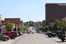
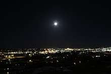
Gillette, Wyoming
| Gillette, Wyoming | |
|---|---|
| City | |
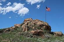
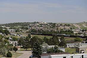 Gillette seen from Overlook Park | |
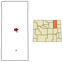 Location of Gillette in Campbell County, Wyoming. | |
| Coordinates: 44°16′58″N 105°30′19″W / 44.28278°N 105.50528°WCoordinates: 44°16′58″N 105°30′19″W / 44.28278°N 105.50528°W | |
| Country |
|
| State |
|
| County |
|
| Government[1] | |
| • Type | Mayor–Council |
| • Body | Gillette City Council |
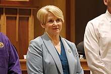
| • Mayor | Louise Carter-King [2] |
| Area[3] | |
| • Total | 19.00 sq mi (49.21 km2) |
| • Land | 18.97 sq mi (49.13 km2) |
| • Water | 0.03 sq mi (0.08 km2) |
| Elevation | 4,554 ft (1,388 m) |
| Population (2010)[4] | |
| • Total | 29,087 |
| • Estimate (2016)[5] | 32,398 |
| • Density | 1,533.3/sq mi (592.0/km2) |
| Time zone | UTC−7 (Mountain (MST)) |
| • Summer (DST) | UTC−6 (MDT) |
| ZIP code | 82716-82718 |
| Area code(s) | 307, exchanges 670, 682, 685-688 |
| FIPS code | 56-31855[6] |
| GNIS feature ID | 1609094[7] |
| Website | gillettewy.gov |
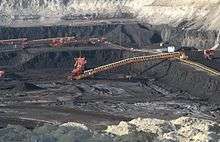
Gillette is a city in and the county seat of Campbell County, Wyoming, United States.[8] The population was estimated at 32,398 as of July 1, 2016.[9] Gillette is centrally located in an area involved with the development of vast quantities of American coal, oil, and coalbed methane gas. The city calls itself the "Energy Capital of the Nation," noting that the state of Wyoming provides nearly 35% of the nation's coal.[10] Over the last decade Gillette saw a population increase of 48% from the 2000 census of 19,646 residents.[11] [12]
History
Gillette started as Donkey Town named after Donkey Creek and then was moved and called Rocky Pile after rocky draw.[13] Gillette was founded in 1891 with the coming of the Chicago, Burlington & Quincy Railroad and incorporated on January 6, 1892, less than two years after Wyoming became a state. Chicago, Burlington & Quincy Railroad changed the name to Gillette for Edward Gillette, who worked as a surveyor for the company.[14]
The first airplane to be flown in Wyoming happened in Gillette for the July 4th celebration in 1911. Pilot George W. Thompson made a few flights in a Mathewson biplane and performed tricks. Thousands of people from cities in a 100 mile (160 km) radius came to see the event.[15][16]
In 1974, U.S. psychologist ElDean Kohrs used the town as the basic example of what he called the 'Gillette Syndrome': the social disruption that can occur in a community due to rapid population growth. During the 1960s, Gillette doubled its population from 3,580 to 7,194 residents.[17] Kohrs proposed that this fast increase of population caused the phenomenon known as Gillette Syndrome, resulting in increased crime, high costs of living and weakened social and community bonds. Some of Kohrs' claims about the energy industry's influence have later been disputed, since similar increases in divorce rates, welfare usage, and crime were also seen in other rapidly growing areas of the country.[18]
The census-designated place Antelope Valley-Crestview was annexed by the city on January 1, 2018. [19] The population of Antelope Valley-Crestview was 1,658 at the 2010 census and it has a total area of 4.9 square miles (12.7 km²).
Geography
Gillette is located at 44°16′58″N 105°30′19″W / 44.28278°N 105.50528°W (44.282660, −105.505256).[21] It is situated between the Bighorn Mountains to the west and the Black Hills to the east, in the Powder River Basin.
According to the United States Census Bureau, the city has a total area of 19.00 square miles (49.21 km2), of which, 18.97 square miles (49.13 km2) is land and 0.03 square miles (0.08 km2) is water.[3]
Climate
Gillette has a semi-arid climate (Köppen climate classification BSk).
| Climate data for Gillette, Wyoming | |||||||||||||
|---|---|---|---|---|---|---|---|---|---|---|---|---|---|
| Month | Jan | Feb | Mar | Apr | May | Jun | Jul | Aug | Sep | Oct | Nov | Dec | Year |
| Record high °F (°C) | 67 (19) |
70 (21) |
80 (27) |
88 (31) |
95 (35) |
104 (40) |
107 (42) |
106 (41) |
102 (39) |
89 (32) |
75 (24) |
69 (21) |
107 (42) |
| Average high °F (°C) | 30.9 (−0.6) |
36.6 (2.6) |
45.2 (7.3) |
54.7 (12.6) |
64.5 (18.1) |
76.0 (24.4) |
84.5 (29.2) |
83.5 (28.6) |
71.8 (22.1) |
58.7 (14.8) |
42.1 (5.6) |
32.9 (0.5) |
56.8 (13.8) |
| Daily mean °F (°C) | 20.5 (−6.4) |
25.7 (−3.5) |
33.4 (0.8) |
41.9 (5.5) |
51.5 (10.8) |
61.9 (16.6) |
69.3 (20.7) |
68.4 (20.2) |
57.5 (14.2) |
45.6 (7.6) |
31.2 (−0.4) |
22.5 (−5.3) |
44.1 (6.7) |
| Average low °F (°C) | 10.0 (−12.2) |
14.8 (−9.6) |
21.5 (−5.8) |
29.1 (−1.6) |
38.4 (3.6) |
47.7 (8.7) |
54.1 (12.3) |
53.3 (11.8) |
43.2 (6.2) |
32.4 (0.2) |
20.3 (−6.5) |
12.1 (−11.1) |
31.4 (−0.3) |
| Record low °F (°C) | −36 (−38) |
−40 (−40) |
−23 (−31) |
−12 (−24) |
11 (−12) |
28 (−2) |
35 (2) |
32 (0) |
10 (−12) |
−12 (−24) |
−26 (−32) |
−37 (−38) |
−40 (−40) |
| Average precipitation inches (mm) | 0.56 (14.2) |
0.54 (13.7) |
1.00 (25.4) |
1.97 (50) |
2.95 (74.9) |
2.64 (67.1) |
1.78 (45.2) |
1.33 (33.8) |
1.43 (36.3) |
1.57 (39.9) |
0.70 (17.8) |
0.67 (17) |
17.14 (435.3) |
| Source #1: NOAA (normals, 1971–2000)[22] | |||||||||||||
| Source #2: The Weather Channel (Records)[23] | |||||||||||||
Demographics
| Historical population | |||
|---|---|---|---|
| Census | Pop. | %± | |
| 1900 | 151 | — | |
| 1910 | 448 | 196.7% | |
| 1920 | 1,157 | 158.3% | |
| 1930 | 1,340 | 15.8% | |
| 1940 | 2,177 | 62.5% | |
| 1950 | 2,191 | 0.6% | |
| 1960 | 3,580 | 63.4% | |
| 1970 | 7,194 | 100.9% | |
| 1980 | 12,134 | 68.7% | |
| 1990 | 17,635 | 45.3% | |
| 2000 | 19,646 | 11.4% | |
| 2010 | 29,087 | 48.1% | |
| Est. 2016 | 32,398 | [5] | 11.4% |
| [17] | |||
As of 2000 the median income for a household in the city was $69,581, and the median income for a family was $78,377. Males had a median income of $41,131 versus $22,717 for females. The per capita income for the city was $19,749. About 5.7% of families and 7.9% of the population were below the poverty line, including 6.2% of those under age 18 and 14.1% of those age 65 or over.
| Racial makeup | 2016 Est.[24] | 2010 [25] | 2000 [26] |
|---|---|---|---|
| White | 94.4% | 92.2% | 95.5% |
| Black or African American | 1.1% | 0.4% | 0.2% |
| American Indian and Alaska Native | 0.8% | 1.2% | 1.0% |
| Asian | 0.9% | 0.7% | 0.4% |
| Native Hawaiian and Other Pacific Islander | 0.0% | 0.0% | 0.1% |
| Other race | 0.9% | 3.2% | 1.3% |
| Two or more races | 2.0% | 2.2% | 1.5% |
| Hispanic or Latino of any race | 9.7% | 9.5% | 3.9% |
2010 census
As of the census[4] of 2010, there were 29,087 people, 10,975 households, and 7,299 families residing in the city. The population density was 1,533.3 inhabitants per square mile (592.0/km2). There were 12,153 housing units at an average density of 640.6 per square mile (247.3/km2). The racial makeup of the city was 92.2% White, 0.4% African American, 1.2% Native American, 0.7% Asian, 3.2% from other races, and 2.2% from two or more races. Hispanic or Latino of any race were 9.5% of the population.
There were 10,975 households of which 38.9% had children under the age of 18 living with them, 49.2% were married couples living together, 10.3% had a female householder with no husband present, 7.0% had a male householder with no wife present, and 33.5% were non-families. 24.3% of all households were made up of individuals and 4.7% had someone living alone who was 65 years of age or older. The average household size was 2.61 and the average family size was 3.09.
The median age in the city was 30.6 years. 28% of residents were under the age of 18; 10.9% were between the ages of 18 and 24; 30.6% were from 25 to 44; 24.8% were from 45 to 64; and 5.8% were 65 years of age or older. The gender makeup of the city was 52.3% male and 47.7% female.
Economy
Coal

Culture
The Wyoming Center, a 9,000 seat arena located at the CAM-PLEX just east of the city, was completed in 2008. The CAM-PLEX hosts events ranging from concerts and balls to the National High School Finals Rodeo.
Parks
Sports
The Campbell County Recreation Center is a 190,000 square foot facility that was established April 2010. This facility includes a 42-foot climbing wall resembling the Devils Tower National Monument. There is also an 81,000 square foot field house that contains a six-lane track and 5 indoor tennis courts.[27]
The Energy Capital Sports Complex site has four fast-pitch softball fields that can be converted for Little League baseball. The fields use Slitfilm synthetic turf with sand-rubber infill. There is a 28,000 square foot protected spectator viewing area with a grass play area. There is also a 2.4 mile recreation trail around the complex. Since the grand opening in 2015, the Energy Capital Sports Complex has hosted many tournaments including the Razor City Softball Tournament and the 2016 Wyoming ASA State Softball Tournament.[28]
Education
Public education in the city of Gillette is provided by Campbell County School District #1. Gillette is home to Campbell County High School and Thunder Basin High School. Gillette College, a two-year college, is part of the Northern Wyoming Community College District.
Government
Gillette is governed by an elected mayor and a city council with six members. Gillette is split into three wards each represented by two council members. Both the mayor and council members serve four-year terms.[1]
Under the mayor and city council the city government consists of the city attorney, municipal court, and city administration. The city administration consists of several departments and their divisions. Those departments are Human Resources Department, Finance Department, Police Department, Development Services Department, Public Works Department, and Utilities Department.[29]
City Council
The City Council holds regular sessions on first and third Tuesday of every month in the Council Chambers at City Hall. In addition the council also holds agenda review meetings and pre-meetings before regular sessions. All meetings are open to the public except executive sessions.[30]
 Ward 1 Dan Barks
 Ward 1 Shawn Neary
 Ward 2 Billy Montgomery
 Ward 2 Tim Carsrud
 Ward 3 Robin Kuntz
 Ward 3 Shay Lundvall[31]
Media
Newspapers
Gillette has one newspaper, the Gillette News-Record, published by Ann Kennedy Turner, The News-Record was originally two newspapers, the Gillette News and the Campbell County Record. The News-Record became a daily July 14, 1975.
Magazines
Gillette has many local magazines, including The Gillette Wy Adventure Guide, published online by Tyson Waggener. Print magazines include: Anybody's Autos, The House Hunter, and W Magazine.
Radio
Television
Gillette Public Access Television is the only television station located in Gillette. It is a traditional PEG cable access station operated by the City of Gillette. It can be viewed on Charter Communications Cable channels 189 (Education), 190 (Public Access) and 192 (Government). Programming on GPA-TV can be viewed live and archived online at .[37]
Transportation

Airport
Gillette–Campbell County Airport (GCC) is served by United Airlines operated by SkyWest Airlines. SkyWest currently operates 6 flights daily in and out of Gillette to Denver.[38]
Highways
Infrastructure
At Gillette, Wyoming there is a LORAN-C transmitter at 44°00'11" N and 105°37'24" W. Its antenna, a 700 ft (213.36 meter) high guyed radio mast, is the tallest structure in Wyoming.
Tallest buildings
| Name | Height | Floors | Built [39] | Address | Image |
|---|---|---|---|---|---|
| Farmers Coop Association Feed and Grain Elevator | 1928 [40] | 207 East 1st Street | 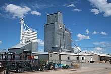 | ||
| First Interstate Bank | 1983 | 220 South Gillette Avenue | 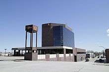 | ||
| Campbell County Memorial Hospital | 1982 | 501 South Burma Avenue |  |
Notable features around Gillette
.jpg)
Devils Tower National Monument is an hour drive from Gillette. This flat-top volcanic formation rises more than 1,200 feet above the ground and is a popular site to visit. Many people walk the 1.3 mile path around the entire monument while others climb the formation.
Keyhole State Park is also a 49 minute drive from Gillette that is a popular place to visit in both the summer and winter. Many residents enjoy the reservoir during the summer by camping, hiking, and engaging in water sports. During the winter many people ice fish at keyhole which is excellent fishing for walleye, catfish, small mouth bass, and northern pike. Another winter sport you can find people doing around keyhole is snowmobiling.[41]
Gillette is a midway point between the Bighorn Mountains and the Black Hills, and has a somewhat close proximity to both.
Notable people
Born in Gillette
 Bob Harris, professional baseball player, 1938–42
 Ryun Williams, women's basketball head coach, Colorado State
- John Chick, professional football player, 2006–17
- Alicia Craig, distance runner
- Burke Jackson, Wyoming rancher and member of the Wyoming House of Representatives, 2004–06
- John C. Ostlund, Wyoming State Senator, 1973–78
- Sue Wallis, poet and member of the Wyoming House of Representatives, 2007–14
From Gillette
 Joe Clifford Faust, author
- Jacob M. Appel, author[43]
- Jillian Balow, Wyoming Superintendent of Public Instruction, 2015–, and a former teacher in Gillette[44]
- Wade Brorby, United States federal appellate judge, 1988–
- Tom Lubnau, Gillette attorney, member of the Wyoming House of Representatives, 2005–2015, and Speaker of the Wyoming House of Representatives, 2013–2015
- Clint Oldenburg, professional football player, 2007–12
In popular culture
In David Breskin's bildungsroman The Real Life Diary of a Boomtown Girl [45], Randi Bruce Harper is raised by parents in the Wyoming "oil-field service business;" as an adult she drives a Wabco haul truck "down in the pit" while living with her husband in Gillette. Randi is a member of the first all-female blasting team, the "Boom-Boom Girls."
The Manticore facility is set in Gillette in the cyberpunk TV show Dark Angel [46] and the books based on the show.[47] Several fan fiction stories were written with Gillette central to the story because of the reference.[48][49]
Marcus Sakey, in his Brilliance trilogy, lists Gillette as one of the three entrances (along with Rawlins and Shoshoni) to the New Canaan Holdfast, a large portion of Wyoming land owned by "abnorms."[50]
In an interview with HorrorHound magazine, actor and musician Bill Moseley of the band Cornbugs said he was the great-grandson of Edward Gillette and named their studio album Donkey Town in honor of Chicago, Burlington & Quincy Railroad's decision to change the name of Donkey Town to Gillette as a reward for Edward Gillette's surveying work.[51]
On December 5, 1998 Cheryl Trover a math teacher at Campbell County High School kidnapped and tied up her children, shot her husband John Trover with a .22-caliber pistol, and stabbed him to death with a hunting knife. She had stolen the gun from her lover of 4 years John Riley the principal at the same school. She then set fire to her pickup truck and lied to police about who committed her planned crimes. Once police suspected her she killed herself with a .270 rifle at a friend's house.[52] The events were dramatized in the crime story TV shows Redrum and Murderous Affairs.[53][54]
Sister cities
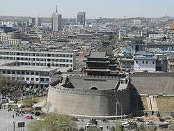
After the Mayor of Gillette visited a coal conference in China a delegation from Yulin, Shaanxi, China came to Gillette. These meetings eventually lead both becoming sister cities in 2012.[55][56]
References
- 1 2 "City Council Gillette Wyoming". Gillette Wyoming. City of Gillette. 2018. Retrieved 2018-05-12.
- ↑ City of Gillette (2018). "City of Gillette Organizational Chart". Gillette, Wyoming. City of Gillette. Archived from the original on 2018-01-25. Retrieved 2018-05-29.
- 1 2 "US Gazetteer files 2010". United States Census Bureau. Archived from the original on 2012-03-12. Retrieved 2012-12-14.
- 1 2 "American FactFinder". United States Census Bureau. Retrieved 2012-12-14.
- 1 2 "Population and Housing Unit Estimates". Retrieved June 9, 2017.
- ↑ "American FactFinder". United States Census Bureau. Archived from the original on 2013-09-11. Retrieved 2008-01-31.
- ↑ "US Board on Geographic Names". United States Geological Survey. 2007-10-25. Retrieved 2008-01-31.
- ↑ "Find a County". National Association of Counties. Archived from the original on 2011-05-31. Retrieved 2011-06-07.
- ↑ "U.S. Census QuickFacts: Gillette city, Wyoming; Campbell County, Wyoming". Archived from the original on 2018-05-14. Retrieved 2018-05-14.
- ↑ "Coal Mine Tours - Campbell County Chamber of Commerce Gillette, WY". Gillettechamber.com. Archived from the original on 14 November 2014. Retrieved 30 October 2014.
- ↑ "Gillette, WY Population - Census 2010 and 2000 Interactive Map, Demographics, Statistics, Quick Facts". Censusviewer.com. Retrieved 30 October 2014.
- ↑ About the County, Campbell County, Wyoming, archived from the original on September 10, 2012, retrieved August 20, 2012
- ↑ Urbanek, Mae (1988). Wyoming Place Names. Mountain Press Publishing Company. p. 81.
- ↑ Edward Gillette (1925). Locating the iron trail. The Christopher Publishing House. p. 75. Retrieved 28 August 2012.
- ↑ Hall-Scott; Mathewson, E. L. (September 1911). "Hall-Scott: Aviation Power Plants Mean Professional Success". Aeronautics. 9 (3): 3. Retrieved 2017-12-23.
- ↑ "Thousands Celebrate". Gillette News. Gillette, Wyoming. 1911-07-07. Retrieved 2017-12-23.
- 1 2 "Historical Decennial Census Population for Wyoming Counties, Cities, and Towns". Wyoming Department of State / U.S. Census Bureau. Retrieved 2008-06-30.
- ↑ Thompson, James G. (Spring 1979). "Gillette Syndrome A myth revisited?". Wyoming Issues. 2 (2): 30–35. Retrieved 2017-12-19.
- 1 2 Filbin, Patrick (2018-03-08). "City Accepts Deeds to Annexed Parks". Gillette News Record. Gillette, Wyoming. Retrieved 2018-08-16.
- ↑ Kelley, Mary (2010). Images of America: Gillette. Arcadia Publishing. p. 15. ISBN 978-0-7385-8026-5.
- ↑ "US Gazetteer files: 2010, 2000, and 1990". United States Census Bureau. 2011-02-12. Retrieved 2011-04-23.
- ↑ "Climatography of the United States NO.81" (PDF). National Oceanic and Atmospheric Administration. Retrieved January 13, 2011.
- ↑ "Monthly Averages for Gillette, WY". The Weather Channel. Retrieved January 13, 2011.
- ↑ United States Census Bureau. "2012-2016 American Community Survey 5-Year Estimates". American Fact Finder. United States Census Bureau. Retrieved 2018-05-29.
- ↑ United States Census Bureau. "Profile of General Population and Housing Characteristics: 2010". American Fact Finder. United States Census Bureau. Retrieved 2018-05-29.
- ↑ United States Census Bureau. "Profile of General Demographic Characteristics: 2000". American Fact Finder. United States Census Bureau. Retrieved 2018-05-29.
- ↑
- ↑
- ↑ City of Gillette (2017-07-01). "City of Gillette Organizational Chart". Gillette, Wyoming. City of Gillette. Archived from the original on 2017-10-29. Retrieved 2018-05-23.
- ↑ City of Gillette (2018). "About City Council Meetings". Gillette, Wyoming. City of Gillette. Archived from the original on 2017-11-04. Retrieved 2018-10-08.
- ↑ City of Gillette (2018). "City Council". Gillette, Wyoming. City of Gillette. Archived from the original on 2018-08-22. Retrieved 2018-10-08.
- ↑ United States Federal Communications Commission (2018-05-12). "FM Query Results -- Audio Division (FCC) USA". Federal Communications Commission. United States Federal Communications Commission. Retrieved 2018-05-12.
- ↑ United States Federal Communications Commission (2018-05-12). "FM Query Results -- Audio Division (FCC) USA". Federal Communications Commission. United States Federal Communications Commission. Retrieved 2018-05-12.
- ↑ United States Federal Communications Commission. "FM Query Broadcast Station Search". Federal Communications Commission. United States Federal Communications Commission. Retrieved 2018-08-16.
- ↑ United States Federal Communications Commission. "AM Query Broadcast Station Search". Federal Communications Commission. United States Federal Communications Commission. Retrieved 2018-08-16.
- ↑ Theodric Technologies (2018). "Radio Stations in Gillette, Wyoming". radio-locator. Archived from the original on 2018-08-16. Retrieved 2018-08-16.
- ↑ "City of Gillette: Gillette Public Access". Gillettewy.gov. Retrieved 9 January 2018.
- ↑ "The Gillette-Campbell County Airport". Iflygillette.com. Retrieved 2012-06-05.
- ↑ City of Gillette (2018). "Discover Gillette". ArcGIS. Retrieved 2018-05-29.
- ↑ Kelley, Mary (2010). Images of America: Gillette. Arcadia Publishing. p. 60. ISBN 978-0-7385-8026-5.
- 1 2 "Keyhole State Park". Wyomingtourism.org. Retrieved 9 January 2018.
- ↑ City of Gillette (2018). "Gillette Mayors". Gillette Wyoming. City of Gillette. Archived from the original on 2017-02-11. Retrieved 2018-08-28.
- ↑ Appel, JM. Phoning Home. University of South Carolina Press, 2014
- ↑ "Biographical Profile for Jillian Balow". Vote-wy.org. Retrieved December 11, 2014.
- ↑ Breskin, David (October 17, 1989). "The Real Life Diary of a Boomtown Girl". Viking. Retrieved August 29, 2018.
- ↑ Cameron, James (executive director). Dark Angel (Television production). United States: Fox.
- ↑ Collins, Max Allen (October 2002). Dark Angel: Before the Dawn. Random House Publishing Group. p. 3. ISBN 9780345463210.
- ↑ Diivine (2007-03-24). "Two of a kind". FanFiction. Retrieved 2018-01-23.
- ↑ Doc Dracula (2006-02-27). "L'ennemi Caché". FanFiction. Retrieved 2018-01-23.
- ↑ Marcus,, Sakey,. Brilliance. Daniels, Luke,. Grand Haven, Michigan. ISBN 9781480504509. OCLC 853166671.
- ↑ HorrorHound (2006), "Catching Up With Chop Top...", HorrorHound, Nathan Hanneman, p. 29, retrieved 2018-04-19
- ↑ The News-Record staff (1998-12-10). "Police tell of Trover affair with her boss". The News-Record. Gillette, Wyoming. pp. 1, 12.
- ↑ "School House Rocked". Redrum. Season 3. Episode 13. 2015-05-19.
- ↑ "Turmoil". Murderous Affairs. Season 1. Episode 32. 2016.
- ↑ Collins, Abby (2012-10-31). "Sister Cities". Gillette News Record. Gillette, Wyoming. Retrieved 2017-12-21.
- ↑ Collins, Abby (2012-06-12). "Gillette and Yulin, China, are on a path to be sister cities". Gillette News Record. Gillette, Wyoming. Retrieved 2017-12-21.
External links
| Wikimedia Commons has media related to Gillette, Wyoming. |
- Campbell County Chamber of Commerce
- Campbell County Convention & Visitors Bureau
- City of Gillette
- Energy Capital Economic Development (ECED)
- Gillette News-Record
Municipalities and communities of Campbell County, Wyoming, United States | ||
|---|---|---|
| City | 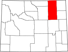 | |
| Town | ||
| CDPs | ||
| Unincorporated communities | ||