Interstate 180 (Wyoming)
| ||||
|---|---|---|---|---|
| North Greeley Highway | ||||
|
I-180 highlighted in red | ||||
| Route information | ||||
| Auxiliary route of I-80 | ||||
| Maintained by WYDOT | ||||
| Length | 1.09 mi[1] (1.75 km) | |||
| Existed | 1984 – present | |||
| Major junctions | ||||
| South end |
| |||
| North end |
| |||
| Highway system | ||||
| ||||
.svg.png)
Interstate 180 (I-180) is a one-mile (1.75 km)-long connector in the U.S. state of Wyoming off Interstate 80 into downtown Cheyenne, Wyoming.

It is unusual for being one of few Interstate Highway that does not conform to Interstate Highway standards, and it is not even a freeway, anywhere along its route [1]. Other routes in Alaska and Hawaii are similar in nature by being funded by interstate dollars but not conforming to interstate highway standards [3]. The only grade separations are a diamond interchange at its southern end at I-80, as well as bridges over 1st Street and the Union Pacific railroad tracks. However, even the interchange with I-80 is a standard diamond with signalized intersections. It is a divided at-grade expressway with a 40 mph (64 km/h) speed limit due to the frequency of signals. There are five traffic signals along I-180.[4] This is nowhere near Interstate standards, but it received federal funding under the Interstate Highway program.
I-180 is cosigned with Business Loop Interstate 25, U.S. Highway 85 and U.S. Highway 87 Business, making it the only concurrency of an Interstate, a Business Loop Interstate, a U.S. route and a Business U.S. route.[4] It is also the only 3-digit interstate in Wyoming.
Route description
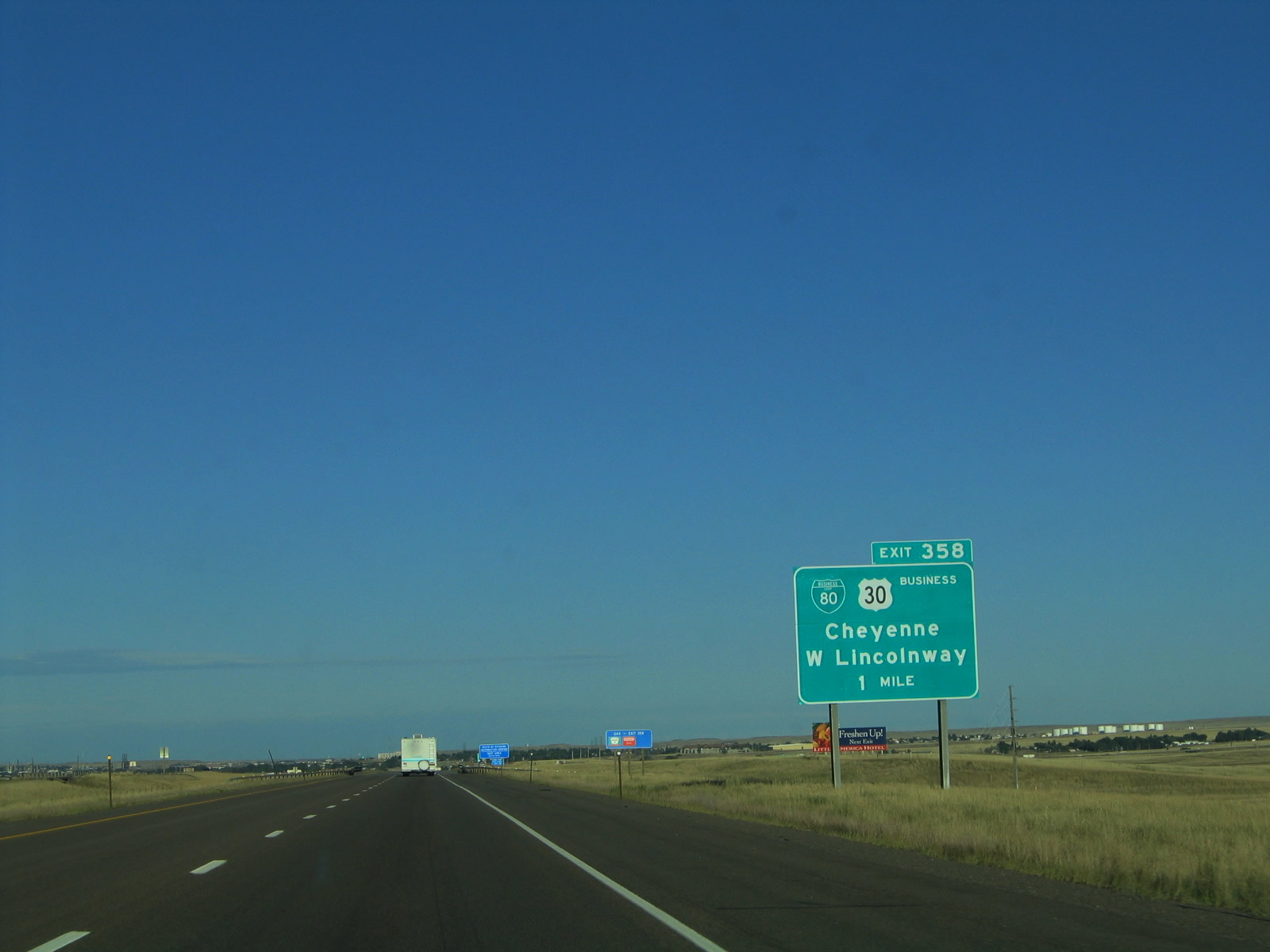
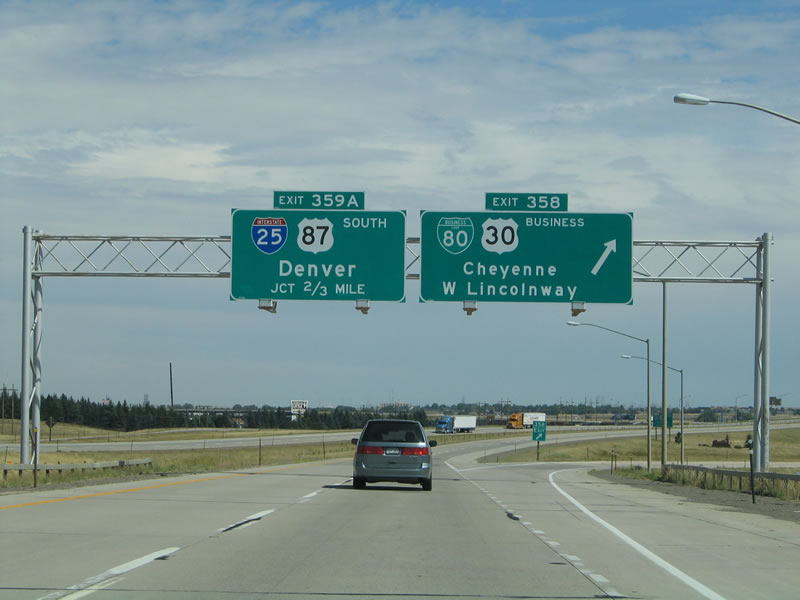
I-180 begins at a diamond interchange with I-80 in Cheyenne, heading north concurrent with I-25 Bus./US 85/US 87 Bus. on four-lane divided North Greeley Highway. South of this interchange, I-25 Bus./US 85/US 87 Bus. continue along North Greeley Highway. From the southern terminus, I-180 passes over Deming Drive and heads near homes and businesses. The road curves northwest and intersects 5th Street at a traffic light. The highway continues along and passes under a pedestrian bridge at 7th Street before crossing 9th Street at a signalized intersection. Past 9th Street, the directions of I-180 split and pass over a large Union Pacific Railroad yard. After this bridge, I-180 reaches its northern terminus at an at-grade signalized intersection with I-80 Bus./US 30. Past this intersection, I-25 Bus./US 85/US 87 Bus. continue north on the one-way pair of Warren Avenue northbound and Central Avenue southbound.[5]
Major intersections
The entire route is in Cheyenne, Laramie County.
| mi[6] | km | Destinations | Notes | ||
|---|---|---|---|---|---|
| 0.00 | 0.00 | Continuation past I-80 | |||
| Southern terminus; exit 362 on I-80 | |||||
| 0.34 | 0.55 | 5th Street | At-grade intersection; signalized intersection | ||
| 0.61 | 0.98 | 9th Street | At-grade intersection; signalized intersection | ||
| 1.09 | 1.75 | At-grade intersections; signalized intersections; northern terminus | |||
| Continuation past US 30 | |||||
1.000 mi = 1.609 km; 1.000 km = 0.621 mi
| |||||
References
- 1 2 [https://www.fhwa.dot.gov/planning/national_highway_system/interstate_highway_system/routefinder/table02.cfm FHWA Route Log and Finder List Table 2 - Auxiliary Routes
- ↑ It isn't clear whether Lincolnway, the road at the northern terminus of I-180 is US 30 or BUS US 30. There are Business US 30 shields where W Lincolnway splits off from I-80 (Photos: , from ) and on E Lincolnway (Photos: , from ) but there are East US 30/West US 30 shields at other places, including the I-180 junction.
- ↑ FHWA Route Log and Finder List Table 1 - Main Routes
- 1 2 Photos showing road signs and traffic lights on I-180: from , and from .
- ↑ Google (December 19, 2013). "overview of Interstate 180" (Map). Google Maps. Google. Retrieved December 19, 2013.
- ↑ "Reference Marker Book". Wyoming Department of Transportation. November 2004. Archived from the original (PDF) on 2007-03-11. Retrieved 2007-03-10.
External links
Route map:
| Wikimedia Commons has media related to Interstate 180 (Wyoming). |
| ||