Burke County, North Dakota
| Burke County, North Dakota | |
|---|---|
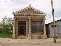 Union Bank of Portal | |
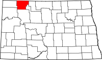 Location in the U.S. state of North Dakota | |
 North Dakota's location in the U.S. | |
| Founded | 15 July, 1910 |
| Named for | John Burke |
| Seat | Bowbells |
| Largest city | Powers Lake |
| Area | |
| • Total | 1,129 sq mi (2,924 km2) |
| • Land | 1,104 sq mi (2,859 km2) |
| • Water | 25 sq mi (65 km2), 2.2% |
| Population (est.) | |
| • (2016) | 2,198 |
| • Density | 1.8/sq mi (0.7/km2) |
| Congressional district | At-large |
| Time zone | Central: UTC−6/−5 |
| Website |
www |
Burke County is a county located on the north edge of the U.S. state of North Dakota, adjacent to the south line of Canada. As of the 2010 census, the population was 1,968.[1] Its county seat is Bowbells.[2] The county was created in 1910.[3][4]
History
Burke County was partitioned in 1910 from 'Imperial Ward' County (which covered present-day Burke, Mountrail, Renville, and Ward counties). It is named after John Burke (1859–1937), a politician who served as governor of North Dakota and Treasurer of the United States. The county government was first organized on July 15, 1910; the county seat has always been Bowbells.[5] The county is managed by a three-member Board of Commissioners. As of 2018 the Board Chair is Debbie Kuryn.[6]
Geography
According to the U.S. Census Bureau, the county has a total area of 1,129 square miles (2,920 km2), of which 1,104 square miles (2,860 km2) is land and 25 square miles (65 km2) (2.2%) is water.[7]
Major highways


Adjacent counties and rural municipalities
- Estevan No. 5, Saskatchewan (north)
- Coalfields No. 4, Saskatchewan (north)
- Village of North Portal, Saskatchewan (north)
- Enniskillen No. 3, Saskatchewan (north)
- Renville County (east)
- Ward County (southeast)
- Mountrail County (south)
- Williams County (southwest)
- Divide County (west)
National protected areas
Demographics
| Historical population | |||
|---|---|---|---|
| Census | Pop. | %± | |
| 1910 | 9,064 | — | |
| 1920 | 9,511 | 4.9% | |
| 1930 | 9,998 | 5.1% | |
| 1940 | 7,653 | −23.5% | |
| 1950 | 6,621 | −13.5% | |
| 1960 | 5,886 | −11.1% | |
| 1970 | 4,739 | −19.5% | |
| 1980 | 3,822 | −19.4% | |
| 1990 | 3,002 | −21.5% | |
| 2000 | 2,242 | −25.3% | |
| 2010 | 1,968 | −12.2% | |
| Est. 2016 | 2,198 | [8] | 11.7% |
| U.S. Decennial Census[9] 1790-1960[10] 1900-1990[11] 1990-2000[12] 2010-2016[1] | |||
2000 census
As of the 2000 census, there were 2,242 people, 1,013 households, and 680 families residing in the county. The population density was 2.0 people per square mile (0.8/km²). There were 1,412 housing units at an average density of 1.3 per square mile (0.5/km²). The racial makeup of the county was 99.24% White, 0.13% Black or African American, 0.22% Native American, 0.13% Asian, 0.04% from other races, and 0.22% from two or more races. 0.36% of the population were Hispanic or Latino of any race. 52.4% were of Norwegian, 18.4% German and 7.4% Swedish ancestry.
There were 1,013 households out of which 23.00% had children under the age of 18 living with them, 58.20% were married couples living together, 5.30% had a female householder with no husband present, and 32.80% were non-families. 31.60% of all households were made up of individuals and 17.60% had someone living alone who was 65 years of age or older. The average household size was 2.21 and the average family size was 2.77.
The county's population was spread out with 20.80% under the age of 18, 3.50% from 18 to 24, 22.30% from 25 to 44, 28.30% from 45 to 64, and 25.10% who were 65 years of age or older. The median age was 48 years. For every 100 females there were 101.60 males. For every 100 females age 18 and over, there were 103.80 males.
The median income for a household in the county was $25,330, and the median income for a family was $31,384. Males had a median income of $28,164 versus $16,382 for females. The per capita income for the county was $14,026. About 11.70% of families and 15.40% of the population were below the poverty line, including 17.20% of those under age 18 and 16.50% of those age 65 or over.
2010 census
As of the 2010 United States Census, there were 1,968 people, 913 households, and 567 families residing in the county.[13] The population density was 1.8 inhabitants per square mile (0.69/km2). There were 1,340 housing units at an average density of 1.2 per square mile (0.46/km2).[14] The racial makeup of the county was 97.8% white, 0.8% American Indian, 0.7% Asian, 0.2% black or African American, 0.0% from other races, and 0.6% from two or more races. Those of Hispanic or Latino origin made up 1.9% of the population.[13] In terms of ancestry, 45.2% were of Norwegian, 34.9% German, 13% Swedish, and 10% Danish ancestry.[15]
Of the 913 households, 22.6% had children under the age of 18 living with them, 52.4% were married couples living together, 5.4% had a female householder with no husband present, 37.9% were non-families, and 33.6% of all households were made up of individuals. The average household size was 2.15 and the average family size was 2.74. The median age was 48.1 years.[13]
The median income for a household in the county was $50,800 and the median income for a family was $62,283. Males had a median income of $49,958 versus $27,206 for females. The per capita income for the county was $32,347. About 3.3% of families and 5.8% of the population were below the poverty line, including 9.4% of those under age 18 and 6.1% of those age 65 or over.[16]
Economy
The main industries are farming and oil. Burke County is one of several western North Dakota counties with significant exposure to the Bakken Formation in the Williston Basin.
Communities
Cities
Townships
- Battleview
- Bowbells
- Carter
- Clayton
- Cleary
- Colville
- Dale
- Dimond
- Fay
- Foothills
- Forthun
- Garness
- Harmonious
- Kandiyohi
- Keller
- Lakeview
- Leaf Mountain
- Lucy
- Minnesota
- North Star
- Portal
- Richland
- Roseland
- Short Creek
- Soo
- Thorson
- Vale
- Vanville
- Ward
Census-designated place
Unincorporated communities
- Atcoal
- Battleview
- Coteau
- Kincaid
- Northgate
- Perella
- Rival
- Stampede
- Woburn
Politics
| Year | Republican | Democratic | Third parties |
|---|---|---|---|
| 2016 | 85.1% 895 | 11.3% 119 | 3.6% 38 |
| 2012 | 75.2% 769 | 22.5% 230 | 2.4% 24 |
| 2008 | 67.9% 640 | 30.3% 286 | 1.8% 17 |
| 2004 | 69.4% 808 | 28.8% 336 | 1.8% 21 |
| 2000 | 67.2% 698 | 28.5% 296 | 4.3% 45 |
| 1996 | 44.4% 483 | 38.2% 416 | 17.5% 190 |
| 1992 | 36.2% 551 | 30.1% 458 | 33.8% 515 |
| 1988 | 57.5% 971 | 41.0% 693 | 1.5% 26 |
| 1984 | 69.5% 1,298 | 29.1% 543 | 1.5% 28 |
| 1980 | 73.3% 1,442 | 21.2% 418 | 5.5% 108 |
| 1976 | 52.0% 1,087 | 43.0% 899 | 4.9% 103 |
| 1972 | 66.4% 1,446 | 29.9% 651 | 3.8% 82 |
| 1968 | 56.8% 1,239 | 37.1% 808 | 6.1% 133 |
| 1964 | 40.0% 974 | 59.7% 1,454 | 0.3% 6 |
| 1960 | 59.9% 1,609 | 40.0% 1,076 | 0.1% 2 |
| 1956 | 60.0% 1,415 | 39.7% 936 | 0.3% 8 |
| 1952 | 69.9% 1,986 | 28.6% 811 | 1.6% 44 |
| 1948 | 51.0% 1,212 | 40.9% 972 | 8.2% 195 |
| 1944 | 54.5% 1,540 | 43.4% 1,226 | 2.2% 61 |
| 1940 | 57.5% 1,951 | 39.6% 1,342 | 2.9% 98 |
| 1936 | 18.3% 684 | 48.8% 1,821 | 32.9% 1,226 |
| 1932 | 25.2% 906 | 68.8% 2,473 | 6.0% 215 |
| 1928 | 58.4% 2,002 | 39.0% 1,336 | 2.7% 91 |
| 1924 | 39.6% 996 | 5.4% 135 | 55.0% 1,383 |
| 1920 | 70.9% 1,911 | 16.9% 456 | 12.1% 327 |
| 1916 | 31.4% 518 | 55.8% 922 | 12.8% 211 |
| 1912 | 23.6% 264 | 27.5% 308 | 48.9% 548 |
See also
References
- 1 2 "State & County QuickFacts". United States Census Bureau. Retrieved 31 October 2013.
- ↑ "Find a County". National Association of Counties. Archived from the original on 31 May 2011. Retrieved 7 June 2011.
- ↑ "Dakota Territory, South Dakota, and North Dakota: Individual County Chronologies". Dakota Territory Atlas of Historical County Boundaries. The Newberry Library. 2006. Retrieved 1 February 2015.
- ↑ "County History". North Dakota.gov. The State of North Dakota. Retrieved 1 February 2015.
- ↑ "County History". Official Portal for North Dakota State Government. Retrieved 4 May 2011.
- ↑ Burke County Commissioners (county website)
- ↑ "2010 Census Gazetteer Files". United States Census Bureau. 22 August 2012. Archived from the original on 29 January 2015. Retrieved 27 January 2015.
- ↑ "Population and Housing Unit Estimates". Retrieved 9 June 2017.
- ↑ "U.S. Decennial Census". United States Census Bureau. Archived from the original on 12 May 2015. Retrieved 27 January 2015.
- ↑ "Historical Census Browser". University of Virginia Library. Retrieved 27 January 2015.
- ↑ Forstall, Richard L., ed. (27 March 1995). "Population of Counties by Decennial Census: 1900 to 1990". United States Census Bureau. Retrieved 27 January 2015.
- ↑ "Census 2000 PHC-T-4. Ranking Tables for Counties: 1990 and 2000" (PDF). United States Census Bureau. 2 April 2001. Retrieved 27 January 2015.
- 1 2 3 "DP-1 Profile of General Population and Housing Characteristics: 2010 Demographic Profile Data". United States Census Bureau. Retrieved 14 March 2016.
- ↑ "Population, Housing Units, Area, and Density: 2010 - County". United States Census Bureau. Retrieved 14 March 2016.
- ↑ "DP02 SELECTED SOCIAL CHARACTERISTICS IN THE UNITED STATES – 2006-2010 American Community Survey 5-Year Estimates". United States Census Bureau. Retrieved 14 March 2016.
- ↑ "DP03 SELECTED ECONOMIC CHARACTERISTICS – 2006-2010 American Community Survey 5-Year Estimates". United States Census Bureau. Retrieved 14 March 2016.
- ↑ Leip, David. "Dave Leip's Atlas of U.S. Presidential Elections". uselectionatlas.org. Retrieved 12 April 2018.
Places adjacent to Burke County, North Dakota | |
|---|---|
Municipalities and communities of Burke County, North Dakota, United States | ||
|---|---|---|
| Cities | | |
| Townships |
| |
| CDP | ||
| Unorganized territory |
| |
| Unincorporated communities |
| |
| Indian reservation | ||
| Footnotes | ‡This populated place also has portions in an adjacent county or counties | |
