Mercer County, North Dakota
| Mercer County, North Dakota | |
|---|---|
 Cities of Mercer, left-to-right, up-to-down; Beulah, Golden Valley, Hazen, Pick City, Stanton, and Zap | |
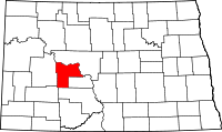 Location in the U.S. state of North Dakota | |
 North Dakota's location in the U.S. | |
| Founded | August 4, 1884 |
| Seat | Stanton |
| Largest city | Beulah |
| Area | |
| • Total | 1,112 sq mi (2,880 km2) |
| • Land | 1,043 sq mi (2,701 km2) |
| • Water | 70 sq mi (181 km2), 6.3% |
| Population (est.) | |
| • (2016) | 8,694 |
| • Density | 8.1/sq mi (3.1/km2) |
| Congressional district | At-large |
| Time zone | Central: UTC−6/−5 |
| Website |
www |
Mercer County is a county located in the U.S. state of North Dakota. As of the 2010 census, the population was 8,424.[1] Its county seat is Stanton.[2] The county was created by the 1874-1875 territorial legislature and was named for William Henry Harrison Mercer[3] (1844–1901), an early rancher who settled north of Bismarck in 1869. The county government was first organized on August 4, 1884.[4]
Geography
According to the U.S. Census Bureau, the county has a total area of 1,112 square miles (2,880 km2), of which 1,043 square miles (2,700 km2) is land and 70 square miles (180 km2) (6.3%) is water.[5]
Adjacent counties
- McLean County (north)
- Oliver County (east)
- Morton County (south)
- Stark County (southwest/MST Border)
- Dunn County (west/MST Border)
Major highways


National protected area
Demographics
| Historical population | |||
|---|---|---|---|
| Census | Pop. | %± | |
| 1890 | 428 | — | |
| 1900 | 1,778 | 315.4% | |
| 1910 | 4,747 | 167.0% | |
| 1920 | 8,224 | 73.2% | |
| 1930 | 9,516 | 15.7% | |
| 1940 | 9,611 | 1.0% | |
| 1950 | 8,686 | −9.6% | |
| 1960 | 6,805 | −21.7% | |
| 1970 | 6,175 | −9.3% | |
| 1980 | 9,404 | 52.3% | |
| 1990 | 9,808 | 4.3% | |
| 2000 | 8,644 | −11.9% | |
| 2010 | 8,424 | −2.5% | |
| Est. 2016 | 8,694 | [6] | 3.2% |
| U.S. Decennial Census[7] 1790-1960[8] 1900-1990[9] 1990-2000[10] 2010-2016[1] | |||
2000 census
As of the census of 2000, there were 8,644 people, 3,346 households, and 2,445 families residing in the county. The population density was 8 people per square mile (3/km²). There were 4,402 housing units at an average density of 4 per square mile (2/km²). The racial makeup of the county was 96.04% White, 0.05% Black or African American, 2.00% Native American, 0.25% Asian, 0.38% Pacific Islander, 0.12% from other races, and 1.16% from two or more races. 0.37% of the population were Hispanic or Latino of any race. 68.8% were of German and 8.2% Norwegian ancestry.
There were 3,346 households out of which 37.10% had children under the age of 18 living with them, 65.20% were married couples living together, 5.10% had a female householder with no husband present, and 26.90% were non-families. 24.80% of all households were made up of individuals and 11.10% had someone living alone who was 65 years of age or older. The average household size was 2.55 and the average family size was 3.05.
In the county, the population was spread out with 29.10% under the age of 18, 4.20% from 18 to 24, 27.50% from 25 to 44, 24.90% from 45 to 64, and 14.30% who were 65 years of age or older. The median age was 40 years. For every 100 females there were 101.20 males. For every 100 females age 18 and over, there were 99.90 males.
The median income for a household in the county was $42,269, and the median income for a family was $51,983. Males had a median income of $47,969 versus $21,667 for females. The per capita income for the county was $18,256. About 5.50% of families and 7.50% of the population were below the poverty line, including 5.20% of those under age 18 and 20.90% of those age 65 or over.
2010 census
As of the 2010 United States Census, there were 8,424 people, 3,625 households, and 2,500 families residing in the county.[11] The population density was 8.1 inhabitants per square mile (3.1/km2). There were 4,450 housing units at an average density of 4.3 per square mile (1.7/km2).[12] The racial makeup of the county was 95.6% white, 2.3% American Indian, 0.3% Asian, 0.2% black or African American, 0.1% Pacific islander, 0.4% from other races, and 1.1% from two or more races. Those of Hispanic or Latino origin made up 1.4% of the population.[11] In terms of ancestry, 64.7% were German, 21.5% were Norwegian, 6.6% were Russian, 6.2% were Irish, and 2.2% were American.[13]
Of the 3,625 households, 26.5% had children under the age of 18 living with them, 60.1% were married couples living together, 5.0% had a female householder with no husband present, 31.0% were non-families, and 27.3% of all households were made up of individuals. The average household size was 2.29 and the average family size was 2.76. The median age was 46.3 years.[11]
The median income for a household in the county was $60,191 and the median income for a family was $71,075. Males had a median income of $63,321 versus $32,294 for females. The per capita income for the county was $30,616. About 4.1% of families and 6.2% of the population were below the poverty line, including 7.2% of those under age 18 and 11.2% of those age 65 or over.[14]
Communities
Politics
| Year | Republican | Democratic | Third parties |
|---|---|---|---|
| 2016 | 80.3% 3,759 | 13.3% 621 | 6.5% 302 |
| 2012 | 70.8% 3,152 | 26.2% 1,166 | 3.1% 137 |
| 2008 | 63.4% 2,789 | 33.6% 1,476 | 3.0% 132 |
| 2004 | 71.2% 3,285 | 27.0% 1,245 | 1.9% 87 |
| 2000 | 68.6% 2,984 | 23.2% 1,011 | 8.2% 358 |
| 1996 | 48.3% 1,953 | 32.2% 1,300 | 19.5% 789 |
| 1992 | 45.3% 2,274 | 26.4% 1,323 | 28.3% 1,420 |
| 1988 | 61.5% 3,013 | 37.6% 1,843 | 0.9% 46 |
| 1984 | 67.2% 3,705 | 31.4% 1,729 | 1.4% 76 |
| 1980 | 68.0% 3,224 | 25.5% 1,209 | 6.5% 308 |
| 1976 | 59.8% 1,982 | 39.1% 1,298 | 1.1% 36 |
| 1972 | 74.3% 2,567 | 22.7% 784 | 3.0% 105 |
| 1968 | 69.4% 2,039 | 24.8% 730 | 5.8% 170 |
| 1964 | 54.0% 1,540 | 46.0% 1,310 | |
| 1960 | 73.9% 2,395 | 26.1% 844 | |
| 1956 | 79.2% 2,555 | 20.6% 666 | 0.2% 6 |
| 1952 | 85.0% 2,994 | 14.5% 512 | 0.5% 18 |
| 1948 | 75.3% 2,219 | 21.8% 643 | 2.9% 86 |
| 1944 | 84.7% 2,504 | 15.1% 445 | 0.2% 7 |
| 1940 | 85.4% 3,341 | 14.5% 567 | 0.2% 6 |
| 1936 | 31.6% 1,142 | 53.2% 1,924 | 15.3% 553 |
| 1932 | 16.0% 480 | 83.2% 2,491 | 0.7% 22 |
| 1928 | 37.5% 971 | 62.4% 1,619 | 0.1% 3 |
| 1924 | 25.0% 522 | 3.4% 70 | 71.6% 1,494 |
| 1920 | 87.3% 1,786 | 8.4% 172 | 4.4% 89 |
| 1916 | 64.2% 730 | 31.0% 353 | 4.8% 55 |
| 1912 | 20.0% 147 | 19.3% 142 | 60.8% 448 |
| 1908 | 81.1% 430 | 18.1% 96 | 0.8% 4 |
| 1904 | 93.3% 252 | 6.3% 17 | 0.4% 1 |
| 1900 | 86.8% 269 | 13.2% 41 |
See also
References
- 1 2 "State & County QuickFacts". United States Census Bureau. Archived from the original on July 14, 2011. Retrieved November 1, 2013.
- ↑ "Find a County". National Association of Counties. Retrieved 2011-06-07.
- ↑ Gannett, Henry (1905). The Origin of Certain Place Names in the United States. U.S. Government Printing Office. p. 205.
- ↑ "County History". Official Portal for North Dakota State Government. Retrieved 4 May 2011.
- ↑ "2010 Census Gazetteer Files". United States Census Bureau. August 22, 2012. Archived from the original on January 29, 2015. Retrieved February 1, 2015.
- ↑ "Population and Housing Unit Estimates". Retrieved June 9, 2017.
- ↑ "U.S. Decennial Census". United States Census Bureau. Retrieved February 1, 2015.
- ↑ "Historical Census Browser". University of Virginia Library. Retrieved February 1, 2015.
- ↑ Forstall, Richard L., ed. (April 20, 1995). "Population of Counties by Decennial Census: 1900 to 1990". United States Census Bureau. Retrieved February 1, 2015.
- ↑ "Census 2000 PHC-T-4. Ranking Tables for Counties: 1990 and 2000" (PDF). United States Census Bureau. April 2, 2001. Retrieved February 1, 2015.
- 1 2 3 "DP-1 Profile of General Population and Housing Characteristics: 2010 Demographic Profile Data". United States Census Bureau. Retrieved 2016-03-14.
- ↑ "Population, Housing Units, Area, and Density: 2010 - County". United States Census Bureau. Retrieved 2016-03-14.
- ↑ "DP02 SELECTED SOCIAL CHARACTERISTICS IN THE UNITED STATES – 2006-2010 American Community Survey 5-Year Estimates". United States Census Bureau. Retrieved 2016-03-14.
- ↑ "DP03 SELECTED ECONOMIC CHARACTERISTICS – 2006-2010 American Community Survey 5-Year Estimates". United States Census Bureau. Retrieved 2016-03-14.
- ↑ Leip, David. "Dave Leip's Atlas of U.S. Presidential Elections". uselectionatlas.org. Retrieved 2018-04-12.
Places adjacent to Mercer County, North Dakota | ||||||||||
|---|---|---|---|---|---|---|---|---|---|---|
| ||||||||||
Municipalities and communities of Mercer County, North Dakota, United States | ||
|---|---|---|
| Cities | | |
| Unorganized territories |
| |
| Unincorporated community |
| |
