Kenmare, North Dakota
| Kenmare, North Dakota | |
|---|---|
| City | |
| Nickname(s): Kenmare Honkers | |
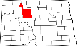
 Location of Kenmare, North Dakota | |
| Coordinates: 48°40′30″N 102°4′43″W / 48.67500°N 102.07861°WCoordinates: 48°40′30″N 102°4′43″W / 48.67500°N 102.07861°W | |
| Country | United States |
| State | North Dakota |
| County | Ward |
| Area[1] | |
| • Total | 1.24 sq mi (3.21 km2) |
| • Land | 1.24 sq mi (3.21 km2) |
| • Water | 0 sq mi (0 km2) |
| Elevation | 1,890 ft (576 m) |
| Population (2010)[2] | |
| • Total | 1,096 |
| • Estimate (2016)[3] | 1,059 |
| • Density | 880/sq mi (340/km2) |
| Time zone | UTC−6 (Central (CST)) |
| • Summer (DST) | UTC−5 (CDT) |
| ZIP code | 58746 |
| Area code(s) | 701 |
| FIPS code | 38-42020 |
| GNIS feature ID | 1029729[4] |
| Highways | US 52, ND 28 |
| Website | http://www.kenmarend.com/ |
Kenmare is a city in Ward County, North Dakota, United States. The population was 1,096 at the 2010 census.[5] Kenmare is part of the Minot Micropolitan Statistical Area.
History
Kenmare was platted in 1897.[6] The city most likely was named after Kenmare, in Ireland.[7] A post office has been in operation at Kenmare since 1897.[8] When proposals were drawn up to partition the old 'Imperial' Ward County (then the state's largest county) in 1908, the groups involved with Burke and Renville Counties declined to include Kenmare as it was larger than Bowbells or Mohall (the cities chosen as the proposed county seats) and would likely have prevailed in a county seat battle. Another proposal would have created Lake County out of this portion of Imperial Ward County, with Kenmare as its seat.
Geography
Kenmare is located at 48°40′30″N 102°4′43″W / 48.67500°N 102.07861°W (48.675015, −102.078709).[9] According to the United States Census Bureau, the city has a total area of 1.24 square miles (3.21 km2), all of it land.[1]
Demographics
| Historical population | |||
|---|---|---|---|
| Census | Pop. | %± | |
| 1910 | 1,437 | — | |
| 1920 | 1,446 | 0.6% | |
| 1930 | 1,494 | 3.3% | |
| 1940 | 1,528 | 2.3% | |
| 1950 | 1,712 | 12.0% | |
| 1960 | 1,696 | −0.9% | |
| 1970 | 1,515 | −10.7% | |
| 1980 | 1,456 | −3.9% | |
| 1990 | 1,214 | −16.6% | |
| 2000 | 1,081 | −11.0% | |
| 2010 | 1,096 | 1.4% | |
| Est. 2016 | 1,059 | [3] | −3.4% |
| U.S. Decennial Census[10] 2015 Estimate[11] | |||
2010 census
As of the census[2] of 2010, there were 1,096 people, 480 households, and 281 families residing in the city. The population density was 883.9 inhabitants per square mile (341.3/km2). There were 558 housing units at an average density of 450.0 per square mile (173.7/km2). The racial makeup of the city was 95.9% White, 0.2% African American, 0.6% Native American, 0.7% Asian, 1.2% from other races, and 1.4% from two or more races. Hispanic or Latino of any race were 2.6% of the population.
There were 480 households of which 25.0% had children under the age of 18 living with them, 48.8% were married couples living together, 6.5% had a female householder with no husband present, 3.3% had a male householder with no wife present, and 41.5% were non-families. 36.7% of all households were made up of individuals and 18.7% had someone living alone who was 65 years of age or older. The average household size was 2.18 and the average family size was 2.85.
The median age in the city was 46.7 years. 21.4% of residents were under the age of 18; 6.2% were between the ages of 18 and 24; 19.5% were from 25 to 44; 29.2% were from 45 to 64; and 23.6% were 65 years of age or older. The gender makeup of the city was 50.5% male and 49.5% female.
2000 census
As of the census of 2000, there were 1,081 people, 468 households, and 278 families residing in the city. The population density was 872.8 people per square mile (336.6/km²). There were 553 housing units at an average density of 446.5 per square mile (172.2/km²). The racial makeup of the city was 98.33% White, 0.56% Native American, 0.28% Asian, 0.09% from other races, and 0.74% from two or more races. Hispanic or Latino of any race were 0.19% of the population.
There were 468 households out of which 23.3% had children under the age of 18 living with them, 50.6% were married couples living together, 6.0% had a female householder with no husband present, and 40.4% were non-families. 38.9% of all households were made up of individuals and 22.4% had someone living alone who was 65 years of age or older. The average household size was 2.15 and the average family size was 2.85.
In the city, the population was spread out with 19.9% under the age of 18, 5.2% from 18 to 24, 22.2% from 25 to 44, 22.0% from 45 to 64, and 30.7% who were 65 years of age or older. The median age was 47 years. For every 100 females, there were 93.0 males. For every 100 females age 18 and over, there were 85.0 males.
The median income for a household in the city was $30,057, and the median income for a family was $40,125. Males had a median income of $27,031 versus $17,826 for females. The per capita income for the city was $15,428. About 10.0% of families and 10.7% of the population were below the poverty line, including 11.1% of those under age 18 and 11.1% of those age 65 or over.
Climate
This climatic region is typified by large seasonal temperature differences, with warm to hot (and often humid) summers and cold (sometimes severely cold) winters. According to the Köppen Climate Classification system, Kenmare has a humid continental climate, abbreviated "Dfb" on climate maps.[12]
Attractions
In the center of Kenmare sits the Old Danish Mill, which was built in 1902 by Danish immigrant Christian C. Jensen on his land 11 miles north of the city. It was used by area farmers to grind grain. Mill capacity was 200 sacks per day. The grinding stones weigh 1,800 pounds each, and the gears were hand-hewn from maple. It was moved to the Kenmare city center in 1959, restored by 1961, and given a face-lift in 1996. Visitors who go inside will marvel at the craftsmanship of this functional work of art which was built well before power tools were available. It is a must-see for visitors to this lovely community.[13]
References
- 1 2 "US Gazetteer files 2010". United States Census Bureau. Archived from the original on 2012-07-14. Retrieved 2012-06-14.
- 1 2 "American FactFinder". United States Census Bureau. Retrieved 2012-06-14.
- 1 2 "Population and Housing Unit Estimates". Retrieved June 9, 2017.
- ↑ "US Board on Geographic Names". United States Geological Survey. 2007-10-25. Retrieved 2008-01-31.
- ↑ "2010 Census Redistricting Data (Public Law 94-171) Summary File". American FactFinder. United States Census Bureau. Archived from the original on 21 July 2011. Retrieved 2 May 2011.
- ↑ Reports of Cases Decided in the Supreme Court of the State of North Dakota. Lawyers Co-operative Publishing Company. 1909. p. 413.
- ↑ Federal Writers' Project (1938). North Dakota, a Guide to the Northern Prairie State,. WPA. p. 276. ISBN 978-1-62376-033-5.
- ↑ "Ward County". Jim Forte Postal History. Retrieved 22 October 2015.
- ↑ "US Gazetteer files: 2010, 2000, and 1990". United States Census Bureau. 2011-02-12. Retrieved 2011-04-23.
- ↑ United States Census Bureau. "Census of Population and Housing". Archived from the original on May 12, 2015. Retrieved October 23, 2013.
- ↑ "Population Estimates". United States Census Bureau. Archived from the original on October 19, 2016. Retrieved June 13, 2016.
- ↑ Climate Summary for Kenmare, North Dakota
- ↑ "City of Kenmare". Kenmare ND. Retrieved 2018-10-03.

