Aspres-lès-Corps
| Aspres-lès-Corps | ||
|---|---|---|
| Commune | ||
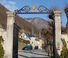 The entrance gates of the castle of Aspres-lès-Corps | ||
| ||
 Aspres-lès-Corps Location within Provence-A.-C.d'A. region  Aspres-lès-Corps | ||
| Coordinates: 44°48′10″N 5°58′57″E / 44.8028°N 5.9825°ECoordinates: 44°48′10″N 5°58′57″E / 44.8028°N 5.9825°E | ||
| Country | France | |
| Region | Provence-Alpes-Côte d'Azur | |
| Department | Hautes-Alpes | |
| Arrondissement | Gap | |
| Canton | Saint-Bonnet-en-Champsaur | |
| Intercommunality | CC Champsaur-Valgaudemar | |
| Government | ||
| • Mayor (2014–2020) | Françoise Mary[1] | |
| Area1 | 16.73 km2 (6.46 sq mi) | |
| Population (2015)2 | 109 | |
| • Density | 6.5/km2 (17/sq mi) | |
| Time zone | UTC+1 (CET) | |
| • Summer (DST) | UTC+2 (CEST) | |
| INSEE/Postal code | 05009 /05800 | |
| Elevation |
743–2,776 m (2,438–9,108 ft) (avg. 900 m or 3,000 ft) | |
|
1 French Land Register data, which excludes lakes, ponds, glaciers > 1 km2 (0.386 sq mi or 247 acres) and river estuaries. 2 Population without double counting: residents of multiple communes (e.g., students and military personnel) only counted once. | ||

Aspres-lès-Corps is a commune of the Hautes-Alpes department in southeastern France.
Population
| Historical population | ||
|---|---|---|
| Year | Pop. | ±% |
| 1962 | 165 | — |
| 1968 | 181 | +9.7% |
| 1975 | 147 | −18.8% |
| 1982 | 147 | +0.0% |
| 1990 | 119 | −19.0% |
| 1999 | 121 | +1.7% |
| 2008 | 134 | +10.7% |
| 2012 | 129 | −3.7% |
| 2015 | 109 | −15.5% |
See also
References
- ↑ "List of mayors of the Hautes-Alpes department". Prefecture of Hautes-Alpes (in French). 3 June 2014. Archived from the original on 10 January 2015. Retrieved 20 March 2015.
| Wikimedia Commons has media related to Aspres-lès-Corps. |
This article is issued from
Wikipedia.
The text is licensed under Creative Commons - Attribution - Sharealike.
Additional terms may apply for the media files.