Molines-en-Queyras
| Molines-en-Queyras | ||
|---|---|---|
| Commune | ||
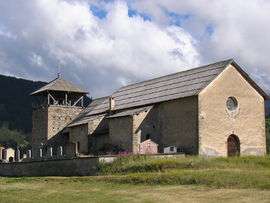 The church of Molines-en-Queyras | ||
| ||
 Molines-en-Queyras Location within Provence-A.-C.d'A. region  Molines-en-Queyras | ||
| Coordinates: 44°43′54″N 6°50′38″E / 44.7317°N 6.8439°ECoordinates: 44°43′54″N 6°50′38″E / 44.7317°N 6.8439°E | ||
| Country | France | |
| Region | Provence-Alpes-Côte d'Azur | |
| Department | Hautes-Alpes | |
| Arrondissement | Briançon | |
| Canton | Guillestre | |
| Intercommunality | Queyras | |
| Government | ||
| • Mayor (2001–2008) | Francis Martin | |
| Area1 | 53.62 km2 (20.70 sq mi) | |
| Population (2008)2 | 334 | |
| • Density | 6.2/km2 (16/sq mi) | |
| Time zone | UTC+1 (CET) | |
| • Summer (DST) | UTC+2 (CEST) | |
| INSEE/Postal code | 05077 /05350 | |
| Elevation |
1,625–3,160 m (5,331–10,367 ft) (avg. 1,762 m or 5,781 ft) | |
|
1 French Land Register data, which excludes lakes, ponds, glaciers > 1 km2 (0.386 sq mi or 247 acres) and river estuaries. 2 Population without double counting: residents of multiple communes (e.g., students and military personnel) only counted once. | ||

Molines-en-Queyras is a commune in the Hautes-Alpes department in southeastern France.
Population
| Historical population | ||
|---|---|---|
| Year | Pop. | ±% |
| 1962 | 219 | — |
| 1968 | 244 | +11.4% |
| 1975 | 288 | +18.0% |
| 1982 | 375 | +30.2% |
| 1990 | 336 | −10.4% |
| 1999 | 322 | −4.2% |
| 2008 | 334 | +3.7% |
See also
References
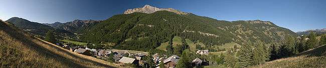
Panorama
| Wikimedia Commons has media related to Molines-en-Queyras. |
This article is issued from
Wikipedia.
The text is licensed under Creative Commons - Attribution - Sharealike.
Additional terms may apply for the media files.