Le Sauze-du-Lac
| Le Sauze-du-Lac | |
|---|---|
| Commune | |
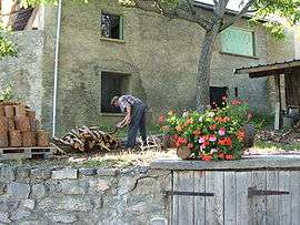 A view within Le Sauze-du-Lac | |
 Le Sauze-du-Lac Location within Provence-A.-C.d'A. region  Le Sauze-du-Lac | |
| Coordinates: 44°28′45″N 6°18′53″E / 44.4792°N 6.3147°ECoordinates: 44°28′45″N 6°18′53″E / 44.4792°N 6.3147°E | |
| Country | France |
| Region | Provence-Alpes-Côte d'Azur |
| Department | Hautes-Alpes |
| Arrondissement | Gap |
| Canton | Chorges |
| Intercommunality | Savinois–Serre Ponçon |
| Government | |
| • Mayor (2008–2014) | Valérie Grenard |
| Area1 | 8.49 km2 (3.28 sq mi) |
| Population (2008)2 | 124 |
| • Density | 15/km2 (38/sq mi) |
| Time zone | UTC+1 (CET) |
| • Summer (DST) | UTC+2 (CEST) |
| INSEE/Postal code | 05163 /05160 |
| Elevation |
770–1,300 m (2,530–4,270 ft) (avg. 1,052 m or 3,451 ft) |
|
1 French Land Register data, which excludes lakes, ponds, glaciers > 1 km2 (0.386 sq mi or 247 acres) and river estuaries. 2 Population without double counting: residents of multiple communes (e.g., students and military personnel) only counted once. | |
Le Sauze-du-Lac is a commune in the Hautes-Alpes department in southeastern France.
Population
| Historical population | ||
|---|---|---|
| Year | Pop. | ±% |
| 1962 | 70 | — |
| 1968 | 72 | +2.9% |
| 1975 | 68 | −5.6% |
| 1982 | 55 | −19.1% |
| 1990 | 72 | +30.9% |
| 1999 | 87 | +20.8% |
| 2008 | 124 | +42.5% |
See also
References
External links
| Wikimedia Commons has media related to Le Sauze-du-Lac. |
This article is issued from
Wikipedia.
The text is licensed under Creative Commons - Attribution - Sharealike.
Additional terms may apply for the media files.