Crots
| Crots | ||
|---|---|---|
| Commune | ||
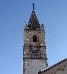 The bell tower of the church in Crots | ||
| ||
 Crots Location within Provence-A.-C.d'A. region  Crots | ||
| Coordinates: 44°32′04″N 6°28′19″E / 44.5344°N 6.4719°ECoordinates: 44°32′04″N 6°28′19″E / 44.5344°N 6.4719°E | ||
| Country | France | |
| Region | Provence-Alpes-Côte d'Azur | |
| Department | Hautes-Alpes | |
| Arrondissement | Gap | |
| Canton | Embrun | |
| Intercommunality | Embrun | |
| Government | ||
| • Mayor (2008–2014) | Jean-Pierre Gandois | |
| Area1 | 53.84 km2 (20.79 sq mi) | |
| Population (2008)2 | 928 | |
| • Density | 17/km2 (45/sq mi) | |
| Time zone | UTC+1 (CET) | |
| • Summer (DST) | UTC+2 (CEST) | |
| INSEE/Postal code | 05045 /05200 | |
| Elevation |
778–2,896 m (2,552–9,501 ft) (avg. 790 m or 2,590 ft) | |
|
1 French Land Register data, which excludes lakes, ponds, glaciers > 1 km2 (0.386 sq mi or 247 acres) and river estuaries. 2 Population without double counting: residents of multiple communes (e.g., students and military personnel) only counted once. | ||

Crots is a commune in the Hautes-Alpes department in southeastern France. The territory of the commune belongs to the Écrins National Park.
Population
| Historical population | ||
|---|---|---|
| Year | Pop. | ±% |
| 1793 | 1,264 | — |
| 1800 | 1,183 | −6.4% |
| 1821 | 1,357 | +14.7% |
| 1831 | 1,496 | +10.2% |
| 1841 | 1,459 | −2.5% |
| 1851 | 1,441 | −1.2% |
| 1861 | 1,360 | −5.6% |
| 1872 | 1,323 | −2.7% |
| 1881 | 1,313 | −0.8% |
| 1891 | 1,088 | −17.1% |
| 1901 | 1,050 | −3.5% |
| 1911 | 939 | −10.6% |
| 1921 | 790 | −15.9% |
| 1936 | 673 | −14.8% |
| 1946 | 584 | −13.2% |
| 1954 | 470 | −19.5% |
| 1962 | 478 | +1.7% |
| 1968 | 463 | −3.1% |
| 1975 | 469 | +1.3% |
| 1982 | 563 | +20.0% |
| 1990 | 670 | +19.0% |
| 1999 | 723 | +7.9% |
| 2006 | 883 | +22.1% |
| 2008 | 928 | +5.1% |
See also
References
| Wikimedia Commons has media related to Crots. |
| Authority control |
|---|
This article is issued from
Wikipedia.
The text is licensed under Creative Commons - Attribution - Sharealike.
Additional terms may apply for the media files.