Aspremont, Hautes-Alpes
| Aspremont | |
|---|---|
| Commune | |
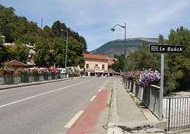 The bridge of the highway (formerly N75) over the River Buëch in Aspremont | |
 Aspremont Location within Provence-A.-C.d'A. region  Aspremont | |
| Coordinates: 44°29′36″N 5°43′42″E / 44.4933°N 5.7283°ECoordinates: 44°29′36″N 5°43′42″E / 44.4933°N 5.7283°E | |
| Country | France |
| Region | Provence-Alpes-Côte d'Azur |
| Department | Hautes-Alpes |
| Arrondissement | Gap |
| Canton | Serres |
| Intercommunality | CC Buëch Dévoluy |
| Government | |
| • Mayor (2014-2020) | Jacques Francou[1] |
| Area1 | 18.52 km2 (7.15 sq mi) |
| Population (2015)2 | 341 |
| • Density | 18/km2 (48/sq mi) |
| Time zone | UTC+1 (CET) |
| • Summer (DST) | UTC+2 (CEST) |
| INSEE/Postal code | 05008 /05140 |
| Elevation |
696–1,378 m (2,283–4,521 ft) (avg. 715 m or 2,346 ft) |
|
1 French Land Register data, which excludes lakes, ponds, glaciers > 1 km2 (0.386 sq mi or 247 acres) and river estuaries. 2 Population without double counting: residents of multiple communes (e.g., students and military personnel) only counted once. | |
Aspremont is a commune in the Hautes-Alpes department in southeastern France.
Population
| Historical population | ||
|---|---|---|
| Year | Pop. | ±% |
| 1962 | 171 | — |
| 1968 | 191 | +11.7% |
| 1975 | 182 | −4.7% |
| 1982 | 196 | +7.7% |
| 1990 | 216 | +10.2% |
| 1999 | 238 | +10.2% |
| 2008 | 306 | +28.6% |
| 2012 | 327 | +6.9% |
| 2015 | 341 | +4.3% |
See also
References
- ↑ "List of mayors of the Hautes-Alpes department". Prefecture of Hautes-Alpes (in French). 3 June 2014. Archived from the original on 10 January 2015. Retrieved 20 March 2015.
| Wikimedia Commons has media related to Aspremont (Hautes-Alpes). |
This article is issued from
Wikipedia.
The text is licensed under Creative Commons - Attribution - Sharealike.
Additional terms may apply for the media files.