Les Orres
| Les Orres | ||
|---|---|---|
| Commune | ||
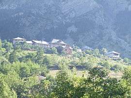 A view of a hamlet in Les Orres | ||
| ||
 Les Orres Location within Provence-A.-C.d'A. region  Les Orres | ||
| Coordinates: 44°30′53″N 6°33′05″E / 44.5147°N 6.5514°ECoordinates: 44°30′53″N 6°33′05″E / 44.5147°N 6.5514°E | ||
| Country | France | |
| Region | Provence-Alpes-Côte d'Azur | |
| Department | Hautes-Alpes | |
| Arrondissement | Gap | |
| Canton | Embrun | |
| Intercommunality | Embrun | |
| Government | ||
| • Mayor (2008–2014) | Paul Dijoud | |
| Area1 | 74.79 km2 (28.88 sq mi) | |
| Population (2008)2 | 516 | |
| • Density | 6.9/km2 (18/sq mi) | |
| Time zone | UTC+1 (CET) | |
| • Summer (DST) | UTC+2 (CEST) | |
| INSEE/Postal code | 05098 /05200 | |
| Elevation |
1,198–2,914 m (3,930–9,560 ft) (avg. 1,460 m or 4,790 ft) | |
|
1 French Land Register data, which excludes lakes, ponds, glaciers > 1 km2 (0.386 sq mi or 247 acres) and river estuaries. 2 Population without double counting: residents of multiple communes (e.g., students and military personnel) only counted once. | ||

Les Orres is a commune in the Hautes-Alpes department in southeastern France.
It is chiefly known for its ski resort: 38 alpine skiing runs, 100 km (62 mi) of runs.
Population
| Historical population | ||
|---|---|---|
| Year | Pop. | ±% |
| 1962 | 170 | — |
| 1968 | 235 | +38.2% |
| 1975 | 307 | +30.6% |
| 1982 | 429 | +39.7% |
| 1990 | 455 | +6.1% |
| 1999 | 446 | −2.0% |
| 2008 | 516 | +15.7% |
See also
References
| Wikimedia Commons has media related to Les Orres. |
This article is issued from
Wikipedia.
The text is licensed under Creative Commons - Attribution - Sharealike.
Additional terms may apply for the media files.