Tabaco
Tabaco, officially the City of Tabaco (Central Bicolano: Ciudad kan Tabaco; Tagalog: Lungsod ng Tabaco), is a 4th class city in the province of Albay, Philippines. According to the 2015 census, it has a population of 133,868 people.[3]
Tabaco Tabako | |
|---|---|
| City of Tabaco | |
 Tabaco Church | |
 Seal | |
| Nickname(s): Tobacco Capital of the Philippines | |
 Map of Albay with Tabaco highlighted | |

| |
.svg.png) Tabaco Location within the Philippines | |
| Coordinates: 13°21′N 123°44′E | |
| Country | |
| Region | Bicol Region (Region V) |
| Province | Albay |
| District | 1st district |
| Founded | 1731 |
| Cityhood | March 24, 2001 |
| Barangays | 47 |
| Government | |
| • Type | Sangguniang Panlungsod |
| • Mayor | Cielo Krisel B. Lagman-Luistro |
| • Vice Mayor | Nestor T. San Pablo |
| • Congressman | Edcel C. Lagman |
| • Electorate | 24,897 voters (2019) |
| Area | |
| • Total | 117.14 km2 (45.23 sq mi) |
| Elevation | 11.5 m (37.7 ft) |
| Highest elevation | 2,462 m (8,077 ft) |
| Population (2015 census)[3] | |
| • Total | 133,868 |
| • Density | 1,100/km2 (3,000/sq mi) |
| • Households | 27,533 |
| Economy | |
| • Income class | 4th city income class |
| • Poverty incidence | 22.38% (2015)[4] |
| • Revenue (₱) | 465,759,515.34 (2016) |
| Time zone | UTC+8 (PST) |
| ZIP code | 4511 |
| PSGC | |
| IDD : area code | +63 (0)52 |
| Climate type | tropical rainforest climate |
| Native languages | Central Bikol Albay Bikol language Tagalog |
| Website | www |
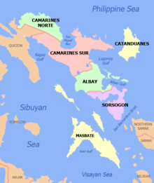
It is one of the three component cities of the province, along with Legazpi City and Ligao City. The mainland part of the city is bordered by the town of Malinao to the north, the towns of Polangui and Oas to the west, Ligao City to the southwest, Malilipot town to the southeast, and Lagonoy Gulf to the east.[5] The symmetric Mayon Volcano, the most active volcano in the Philippines, lies south of the city. Tabaco is one of the eight towns and cities that share jurisdiction on the volcano, dividing the peak like slices of a pie when viewed from above.
The island of San Miguel, the westernmost of the four main islands in the Lagonoy Gulf, falls under the jurisdiction of Tabaco. Five of the barangays of the city are located on the island for a total of 47 barangays composing the city.[6]
Etymology
It is not true that Tabaco got its name from "Tabak ko" which means "my bolo", but from tobacco (in Spanish "Tabaco"), a primary product of the city in the pre-Hispanic period. Nevertheless, the Official Seal of the city was still conceived from the "Tabak Ko" legend and was officially adopted through Municipal Council Resolution No. 29 on February 23, 1966.
History
Spanish Period
According to the Estado Geografico Estadistico Historico written in 1805 by Father De Huerta, the recorded history of the city began in 1587 through the missionary work of the first Franciscan Fathers. In 1616, Fr. Pedro De Alcareso became the first permanent parish priest and established a church dedicated to St. John the Baptist, the patron saint of the city.[7]
The first inhabitants settled along the seashore and engaged in fishing and crude farming. Due to the continuous attacks by the Moro raiders, the natives migrated to San Vicente and San Carlos, and started the foundation of the first poblacion in 1703, while the fishermen of the town transferred to the shores of the bay of what is now known as Barangay Cormidal. Under the administration of the first town executive, a church was built in Cormidal in 1731. Records on the elected Capitan municipal (town mayor) started only in 1731 with Martin Aguirre listed as the first mayor of Tabaco.[5]
In 1811, a terrible typhoon called Baguiong Oguis or White Typhoon brought havoc to the town. This was followed in 1814 by the most destructive eruption of the Mayon Volcano, which showered the areas with ashes and stone. These two events rendered many residents homeless and left the fields unproductive for many years after. It took a full decade for the people to recover, at which time they built a cemetery and laid the foundation of the present church which was completed in 17 years.[7]
American period and independence
The Americans landed at Tabaco on February 9, 1900, under the command of Col. Walter Howe. Despite the well-documented courage and patriotism of the Tabaqueños, the residents of Tabaco, the superior armaments and well-trained soldiers of the American army hastened its conquest of Tabaco and adjoining towns, starting the American rule in the area.[7]
With the restoration of peace after World War II, the Tabaqueños started rebuilding their lives and their land. By the time the Philippines gained independence in 1946, Tabaco was once again a thriving town.[7]
Other catastrophic events
Another catastrophe to hit the town was Typhoon Trix in 1952, which completely submerged Natunawan Island. A 1964 fire razed the commercial center, and in 1970, another destructive storm, Typhoon Sening, slashed through the town.[5]
Cityhood
Then Representative Krisel Lagman-Luistro introduced House Bill No. 7851, upgrading the municipality of Tabaco into a component city of the Province of Albay. Senate Bill No. 2244 was sponsored by Senators Sergio Osmeña III and Franklin Drilon as its counterpart in the Senate. The Republic Act No. 9020 converted the Municipality of Tabaco into a component city of the Province of Albay. It was signed into law by the president of the Philippines Gloria Macapagal-Arroyo on February 5, 2001. The municipality was finally converted into a city after the plebiscite conducted on March 4, 2001.
Geography
The City of Tabaco is located on the eastern coast of Albay province with an area of 117.14 km2 (45.23 sq mi). The terrain in the poblacion or town center of Tabaco is generally flat with the highest elevation at around 5 m (16 ft). The northwestern portion reaches 400 m (1,300 ft) above sea level. The city's southwest boundary reaches all the way to the top of Mayon at an elevation of 2,462 m (8,077 ft).
San Miguel Island is almost surrounded by groups of small hills with the highest elevation at about 35 m (115 ft) above sea level.
Total forest area in Tabaco is 2,572 ha (6,360 acres).
Barangays
Tabaco City is politically subdivided into 47 barangays. There are sixteen coastal barangays, five on the island of San Miguel and eleven in the mainland of the city. San Pedro became a barrio in 1952.[8]
Demographics
| Population census of Tabaco | ||
|---|---|---|
| Year | Pop. | ±% p.a. |
| 1903 | 21,946 | — |
| 1918 | 24,812 | +0.82% |
| 1939 | 29,957 | +0.90% |
| 1948 | 33,209 | +1.15% |
| 1960 | 46,416 | +2.83% |
| 1970 | 60,572 | +2.69% |
| 1975 | 65,254 | +1.50% |
| 1980 | 72,634 | +2.17% |
| 1990 | 85,697 | +1.67% |
| 1995 | 96,993 | +2.35% |
| 2000 | 107,166 | +2.16% |
| 2007 | 123,513 | +1.98% |
| 2010 | 125,083 | +0.46% |
| 2015 | 133,868 | +1.30% |
| Source: Philippine Statistics Authority[3][9][10][11] | ||
Climate
The City of Tabaco belongs to the Type II climate of the Philippines. It is characterized by no distinct dry season but with a very pronounced maximum rainfall from November to January.
The area has pronounced warmness and humidity throughout the year with a mean temperature of 26.0 °C (78.8 °F) and a humidity range up to 80%. February is the coldest month with a low of 21.0 °C (69.8 °F). The warmest temperature is experienced during May with a mean temperature of 27.0 °C (80.6 °F).
| Climate data for Tabaco City, Albay | |||||||||||||
|---|---|---|---|---|---|---|---|---|---|---|---|---|---|
| Month | Jan | Feb | Mar | Apr | May | Jun | Jul | Aug | Sep | Oct | Nov | Dec | Year |
| Average high °C (°F) | 27 (81) |
27 (81) |
28 (82) |
30 (86) |
31 (88) |
30 (86) |
29 (84) |
29 (84) |
29 (84) |
29 (84) |
28 (82) |
27 (81) |
29 (84) |
| Average low °C (°F) | 22 (72) |
22 (72) |
23 (73) |
24 (75) |
25 (77) |
25 (77) |
25 (77) |
25 (77) |
25 (77) |
24 (75) |
24 (75) |
23 (73) |
24 (75) |
| Average precipitation mm (inches) | 138 (5.4) |
83 (3.3) |
74 (2.9) |
50 (2.0) |
108 (4.3) |
165 (6.5) |
202 (8.0) |
165 (6.5) |
190 (7.5) |
186 (7.3) |
188 (7.4) |
183 (7.2) |
1,732 (68.3) |
| Average rainy days | 16.8 | 11.9 | 13.5 | 13.8 | 20.5 | 25.2 | 27.4 | 26.2 | 26.1 | 24.7 | 20.7 | 18.5 | 245.3 |
| Source: Meteoblue [12] | |||||||||||||
Language / Dialect
Bicolano or Gubatnon is the primary language in Tabaco and the region. The majority of people speak the Tabaqueño Dialect derived from Coastal Bicol. Although Bicolano Viejo is also spoken, it has fallen out of mainstream use and has since been reduced to the status of sociolect as only very few members of Tabaco's oldest and more affluent families still use it. As in most parts of The Philippines, Filipino and English are spoken and afforded official language status. Spanish, Hiligaynon, Cebuano, Arabic, Cantonese, Hokkien and Mandarin are also spoken owing to Tabaco's significant migrant and mestizo populations.
Religion
Christianity is the predominant religion with Roman Catholicism with the most number of practitioners. Other Christian denominations are also present in the city like Protestants, Baptist, Philippine Independent Church, United Pentecostal Church, Evangelical Christian and Iglesia ni Cristo. Islam, Mormonism, Hinduism, Jainism, Wicca, Modern Paganism and Buddhism also have followers in the city.
Economy

Agriculture
Its economy is still heavily dependent on agriculture. Major crops include rice, corn, cacao, pili, root crops, vegetables, coconuts and abacá. Poultry and livestock raising as well as aquaculture and fishing are very much alive.
International seaport

Tabaco today is rapidly growing with a thriving commercial center and port area. The city has the sole International Seaport in the region contributing to the city's vibrant economy.
Local Fishport
Situated in Barangay Fatima and San Roque. Which serves as the trading area of products ( fisheries, livestock, variety of fruits and vegetables, woods and charcoals), from neighboring islands in San Miguel, Bacacay, and Rapu-Rapu.
Other Industries
- Woodcraft. Wood furniture and accessories manufacturing.
- Metal Craft. Tabak (bolo knife) manufacturing or cutlery, scissors, razors, farm implements, window grills, iron gates and tricycle sidecars
- Rattan Craft. Furniture and fixtures made from rattan.
- Ceramics Industry. Hollow blocks, toilet bowls, floor tiles, and reinforced concrete pipes.
- Hat & Mat weaving from Paraguay leaves.
- Ship Repair and Building. Dry dock facility is available in Barangay Salvacion.
- Padyak(Pedicab), Trucks, Bus and AUV Manufacturing (Body Building)
Attractions
.jpg)
Places of interest
The Church of San Juan Bautista in San Juan, Tabaco City, is one of the most impressive religious structures in the province of Albay. The construction of the present church started in 1750. It was designated a National Historic Landmark by PD. 260 on August 1, 1973.[13][14]
Beaches and resorts:
- Dhio Endheka Spring Resort in Mayon Crossing, Buang
- Hacienda Long Beach Resort in Barangay Hacienda in San Miguel Island
- Jennifer's Garden and Resort in Barangay Bantayan
- Natunawan Cove
- Punta Island Beach Resort in Barangay Rawis in San Miguel Island
- San Lorenzo Beach in Barangay San Lorenzo
- Borcels Nature Springs in Barangay Marriroc
- Cassandra Spring Resort in Barangay Pinagbobong (near Borcels Nature Springs)
- Villa Azon in Barangay Matagbac
- KC Land Park in Cabangan
Historical:
- Angela Manalang Gloria Ancestral House at Quinale
Educational:
- Mayon Planetarium and Science Park in Buang is a planetarium with library, the virtual room, a mini-museum and an audiovisual hall.[15]
- San Miguel Island Marine Fishery Reserve located in Sagurong, San Miguel Island.
Institutions:
- Tabaco Port (International Port of Entry)
- Mayon Skyline Hotel and Convention Center in Buang. Formerly known as Mayon Resthouse, it is located on the northern slope of Mayon Volcano.[15]
Events/Festival
- Charter Day or the Founding Anniversary of Tabaco as a city is celebrated yearly on March 24.
- Tabak Festival is a week-long celebration showcasing the city's cutlery industry. It is held the third week of March culminating with the founding anniversary of Tabaco.[16][17]
- City Fiesta. In honor of the patron saint of Tabaco, St. John the Baptist, the city Fiesta is celebrated on June 24.
Transportation
Roads
Roads are good in Tabaco and they are classified as follows:
- National roads – 20 kilometres (12 mi)
- Provincial roads – 48.47 kilometres (30.12 mi)
- Municipal roads – 10.7855 kilometres (6.7018 mi)
- Barangay roads – 74.826 kilometres (46.495 mi)
Airport
The nearest airport is in Legazpi City – Legazpi Airport – about 30 kilometres (19 mi) from Tabaco City.
Seaport
The Port of Tabaco City is one of the ports of entry open to overseas shipping in the province of Albay. It also serves as a passenger and cargo movement facility to the islands of San Miguel, Cagraray, Batan and Rapu-Rapu as well as the provinces of Catanduanes and Camarines Sur. The main Sea Transportation operators in the port are:
- M/V Eugenia
- M/V Regina Calixta 2,3 and 4
Buses
There are regular transportation to and from Manila and to the other main cities in the Bicol Region.
Education
Secondary School
- Bantayan National High School
- Bogñabong National High School
- Common National High School
- Daniel B. Peña Memorial College Foundation
- Hacienda National High School
- Mariroc National High School
- San Antonio National High School
- San Isidro National High School
- San Miguel National High School
- San Lorenzo National High School
- St. Gregory the Great Seminary
- St. Louise de Marillac School now Catholic Central School (CCS)
- Tabaco National High School
- Tabaco Pei Ching School
Tertiary / Vocational / Technical Schools
- Amando Cope College, School of Nursing in Baranghawon
- Bicol Maritime Technical Colleges Foundation on Rizal St.
- Bicol University Tabaco Campus in Tashi
- Carolyn Institute of Technology Incorporated in San Roque
- Computer Communication Development Institute on Gen. Luna St.
- Daniel B. Peña Memorial College Foundation on Ziga Ave.
- Dr. Carlos S. Lanting College, Inc. / Casaul Technological College, Inc. in Tomas Cabiles Ave.
- Informatics Computer Institute is on the corner of Ziga Ave. and Karangahan Blvd.,
- Pacific Technical Institute in Tags
- Perpetual Help Paramedical College in Texas
- Polytechnic Institute of Tabaco in Panel
- Tabaco College on Tomas Cabiles Ave.
Public services
- Waste Disposal
In dealing with solid waste management, the City of Tabaco has adopted the usual means of dumping garbage in an open-pit dumpsite. Garbage is collected from each barangay in the Poblacion daily. The city has four garbage trucks and four compactors to ensure that the garbage is collected and disposed of in the waste disposal site located at Pinagbobong, about 4-kilometre (2.5 mi) distance from the central business district.
- Fire protection
- The Tabaco City Fire Station, Bureau of Fire Protection is located on Ziga Ave. A total of fifteen fire officers serve in the local fire department, including the City Fire Marshall.
- The local mall (LCC) has its volunteer fire brigade that helps the fire department in extending its services to the residents of Tabaco.
- Tabaco Chinese-Filipino Volunteer Fire Brigade.
Police and law enforcement
- Tabaco Police Force
- The Philippine National Police (PNP) Tabaco City Station is manned by five police officers and seventy-five police NCOs (non-commissioned officers), located at Llorente St., at the back of the City Hall, headed by Police Chief Superintendent Jose Lipa Capinpin. Police headquarters is now located in front of the Central Terminal, Pawa, Tabaco City
- PNP CID Regional Office
- Assisting the city police in its drive against criminality is the PNP Criminal Investigation & Detection Group Tabaco Regional Sub-Office. The station is under the direct command of the Provincial Officer and serves the first district of Albay.
- Tabaco City Jail
- The Tabaco City District Jail is situated at Burac St., San Lorenzo, Tabaco City, 3 km (1.9 mi) away from the city proper. The jail structure is composed of six (6) operation cells, manned by two BJMP officers and twenty non-officer ranks.
Utilities
- Power
Two power companies provide electricity to the city.
- Albay Power Electric Cooperative (APEC) in Matagbac, Tabaco City serves 35 of the 47 barangays of the town or 74% of the city.
- ASCO-Tabaco, located in A.A. Berces Street, San Juan, Tabaco City serves the rest of the city.????
- Water
Water supply is managed by the Tabaco Water District (TAWAD) located in Karangahan Blvd. Tabaco City. Its present service area encompasses the Poblacion and 21 other barangays, serving about 25,000 people in 2,933 households presently connected to the system.[5]
References
- "City". Quezon City, Philippines: Department of the Interior and Local Government. Retrieved 30 May 2013.
- "Province: Albay". PSGC Interactive. Quezon City, Philippines: Philippine Statistics Authority. Retrieved 12 November 2016.
- Census of Population (2015). "Region V (Bicol Region)". Total Population by Province, City, Municipality and Barangay. PSA. Retrieved 20 June 2016.
- "PSA releases the 2015 Municipal and City Level Poverty Estimates". Quezon City, Philippines. Retrieved 1 January 2020.
- "Tabaco Town, Albay Province, Region V, Philippines". Archived from the original on 11 July 2011. Retrieved 17 December 2010.
- "City of Tabaco" Archived 2012-05-27 at the Wayback Machine. PSGC Interactive of National Statistical Coordination Board. Retrieved on 2012-04-20.
- "Historical Tabaco". Tabaco City Official Website. Retrieved on 2012-04-20.
- "An Act Creating the Barrio of San Pedro in the Municipality of Tabaco, Province of Albay". LawPH.com. Retrieved 2011-04-09.
- Census of Population and Housing (2010). "Region V (Bicol Region)". Total Population by Province, City, Municipality and Barangay. NSO. Retrieved 29 June 2016.
- Censuses of Population (1903–2007). "Region V (Bicol Region)". Table 1. Population Enumerated in Various Censuses by Province/Highly Urbanized City: 1903 to 2007. NSO.
- "Province of Albay". Municipality Population Data. Local Water Utilities Administration Research Division. Retrieved 17 December 2016.
- "Tabaco City, Albay : Average Temperatures and Rainfall". Meteoblue. Retrieved 29 December 2018.
- "Church of Tabaco". National Registry of Historic Sites and Structures in the Philippines. Retrieved on 2012-05-24.
- Wow Legazpi (2010-03-27). "Visita Iglesia: Tabaco Church". Wow, Legazpi. Retrieved on 2010-06-29.
- Gil Francis Arevalo (2006-07-20). "Mayon planetarium also in danger zone Archived 2012-09-15 at the Wayback Machine". Mayon Monitor. Retrieved on 2010-06-29.
- Albay Provincial Government. "Festivals of Albay". Albay Tourism. Retrieved on 2010-07-01.
- Department of Tourism, Region V, "Festival & Events". WowBicol. Retrieved on 2010-07-01.
- "RESOLUTION EXPRESSING INTENTION FOR SISTERHOOD AND TWINNING WITH TAGUIG CITY". Tabaco City.com. March 21, 2011.
External links
| Wikivoyage has a travel guide for Tabaco. |
| Wikimedia Commons has media related to Tabaco City. |
- Tabaco Profile at PhilAtlas.com
- Tabaco City profile on the Albay official website
- Albay Province Official Tourism Site
- Tabaco National High School
- . Encyclopædia Britannica (11th ed.). 1911.
Places adjacent to Tabaco | ||||||||||
|---|---|---|---|---|---|---|---|---|---|---|
| ||||||||||
| Authority control |
|
|---|