Bato, Camarines Sur
Bato (Rinconada Bikol: Banwāan ka Bato; Tagalog: Bayan ng Bato), officially the Municipality of Bato, is a 3rd class municipality in the province of Camarines Sur, Philippines. According to the 2015 census, it has a population of 52,137 people.[3]
Bato | |
|---|---|
| Municipality of Bato | |
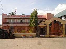 Municipal Hall | |
 Seal | |
 Map of Camarines Sur with Bato highlighted | |
OpenStreetMap 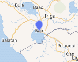
| |
.svg.png) Bato Location within the Philippines | |
| Coordinates: 13°21′22″N 123°21′50″E | |
| Country | |
| Region | Bicol Region (Region V) |
| Province | Camarines Sur |
| District | 5th district |
| Barangays | 33 (see Barangays) |
| Government | |
| • Type | Sangguniang Bayan |
| • Mayor | Frank B. Bernaldez |
| • Vice Mayor | Domingo L. Zorilla Jr. |
| • Congressman | Jocelyn F. Fortuno |
| • Electorate | 31,657 voters (2019) |
| Area | |
| • Total | 107.12 km2 (41.36 sq mi) |
| Elevation | 12.3 m (40.4 ft) |
| Population (2015 census)[3] | |
| • Total | 52,137 |
| • Density | 490/km2 (1,300/sq mi) |
| • Households | 9,720 |
| Economy | |
| • Income class | 3rd municipal income class |
| • Poverty incidence | 41.22% (2015)[4] |
| • Revenue (₱) | 105,486,888.64 (2016) |
| Time zone | UTC+8 (PST) |
| ZIP code | 4435 |
| PSGC | |
| IDD : area code | +63 (0)54 |
| Climate type | tropical rainforest climate |
| Native languages | Rinconada Bikol Central Bikol Tagalog |
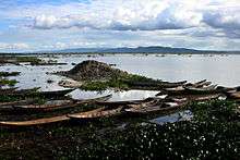
The municipality of Bato, like Buhi town, is home to a lake teeming with various kinds of fishes. Sinarapan, the world's smallest commercially harvested fish, occupies the waters of Lake Bato. Also present, the lake abounds with tilapia housed in fish cages.
History
This town was formerly called as "Kaliligno" or "Caligno" named by the natives that settled along the river area. See also, the Bato's native Pre-Spanish Era Early Settlers.
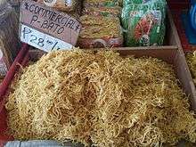
This small village later was elevated into a status of a town under the decree of Spanish Superior Government on February 15, 1753. Years back, a parish was already existing which was also made under the same decree. This parish adopted "The Most Holy Trinity" as its patron; its feastday is celebrated every Sunday after the Pentecost.Known for best noodles called Pansit Bato.
Geography
Barangays
Bato is politically subdivided into 33 barangays.
- boboo
- Bacolod
- Buluang
- Caricot
- Cawacagan
- Cotmon
- Cristo Rey
- Del Rosario
- Divina Pastora (Poblacion)
- Goyudan
- Lobong
- Lubigan
- Mainit
- Manga (Mangga)
- Masoli
- Neighborhood
- Niño Jesus
- Pagatpatan
- Palo
- Payak
- Sagrada (Sagrada Familia)
- Salvacion
- San Isidro
- San Juan
- San Miguel
- San Rafael (Poblacion)
- San Roque
- San Vicente
- Santa Cruz (Poblacion)
- Santiago (Poblacion)
- Sooc
- Tagpolo
- Tres Reyes (Poblacion)
Climate
| Climate data for Bato, Camarines Sur | |||||||||||||
|---|---|---|---|---|---|---|---|---|---|---|---|---|---|
| Month | Jan | Feb | Mar | Apr | May | Jun | Jul | Aug | Sep | Oct | Nov | Dec | Year |
| Average high °C (°F) | 33 (91) |
32 (90) |
35 (95) |
37 (99) |
37 (99) |
36 (97) |
35 (95) |
33 (91) |
35 (95) |
34 (93) |
33 (91) |
32 (90) |
34 (94) |
| Average low °C (°F) | 26 (79) |
26 (79) |
28 (82) |
30 (86) |
31 (88) |
31 (88) |
29 (84) |
28 (82) |
29 (84) |
28 (82) |
28 (82) |
27 (81) |
28 (83) |
| Average precipitation mm (inches) | 51.03 (2.01) |
78.13 (3.08) |
55.3 (2.18) |
83.07 (3.27) |
159.34 (6.27) |
239.88 (9.44) |
385.8 (15.19) |
391.75 (15.42) |
293.65 (11.56) |
401.33 (15.80) |
108.2 (4.26) |
334.9 (13.19) |
2,582.38 (101.67) |
| Average rainy days | 21 | 24 | 19 | 20 | 25 | 29 | 31 | 29 | 29 | 29 | 27 | 30 | 313 |
| Source: World Weather Online[5] | |||||||||||||
Demographics
| Population census of Bato | |||||||||||||||||||||||||||||||||||||||||||||||||
|---|---|---|---|---|---|---|---|---|---|---|---|---|---|---|---|---|---|---|---|---|---|---|---|---|---|---|---|---|---|---|---|---|---|---|---|---|---|---|---|---|---|---|---|---|---|---|---|---|---|
|
| ||||||||||||||||||||||||||||||||||||||||||||||||
| Source: Philippine Statistics Authority[3][6][7][8] | |||||||||||||||||||||||||||||||||||||||||||||||||
In the 2015 census, the population of Bato, Camarines Sur, was 52,137 people,[3] with a density of 490 inhabitants per square kilometre or 1,300 inhabitants per square mile.
Only about 58.27% of the household population is considered as literate.
Mother tongue of the majority is Riŋkonāda also known as Bikol Rinconada, one of the languages of Bicol region. The population speaks a different form of Rinconada Bikol called Bato variant, a lowland dialect (sinaranəw). Natives are also conversant with Coastal Bikol, Filipino/Tagalog and English languages.
Religious affiliation:
- Roman Catholicism is the predominant religion, followed by the Iglesia Ni Cristo as the largest minority.
- Other religious denominations include Church of Jesus Christ of Latter Day Saints; United Churches of Christ in the Philippines Seventh Day Adventist; Bible Baptist; Born Again; Jehovah’s Witnesses; Protestants; Aglipay and Islam.
Economy
Majority of employment is within agriculture, fishery, poultry and construction industry groups.[9]
Commerce and industry:
- 96 commercial establishments engaged in retail trade
- 46 commercial establishments engaged in services
- 1 commercial establishment engaged in real estate - MTBK Co.
- 1 engaged in banking and finance
- 31 industrial establishments
- 2 Hotels - Casa de Piedra and MTBK Hotel
Natural resources include clams, pearls, local shrimps, tabios, and tilapia, particularly within Lake Bato; forest products such as anahaw leaves and local bamboo; non-metallic mineral resources such as white clay among others.
Agriculture Sector:
- 78.087 square kilometers of Agricultural Lands devoted to crop production
- Rice, corn, coconut, root crops, vegetables, and fruit-bearing trees.
- Numerous farm and poultry products found
Tourist attractions
- white sand beaches, white caves, natural falls and springs
- Bato Parish Church considered as Historical landmark
- seven last words at Mount Calvary foot and lacustral procession during town fiesta celebration and the Annual Foundation Day Celebration
- MTBK Hotel - Poblacion Rd, Santiago, Bato, Camarines Sur
Infrastructure
Health
- Municipal Health Center and Barangay Health Stations total bed capacity: Eight (8) beds
- Health personnel numbers only about seventeen (17)
Security
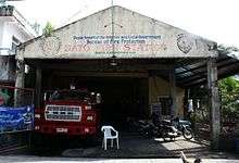
Facilities for police protection include Police Station Headquarters near the Municipal Hall in the Poblacion, Police Substation in Barangay Tres Reyes, Police Outpost in Barangay San Miguel. The bureau of Fire Protection of Bato has about eleven (11) firemen personnel.
Transportation
- 19.550 kilometers of National Roads
- 45,650 kilometers of Provincial Road
- 7.206 kilometers of municipal roads
- 38.683 kilometers of Barangays Roads
- six (6) bridges
- 235 privately owned vehicles
- public utility vehicles and government vehicles
Utilities
Water supply is provided on 3 levels:
- Level I: wells, springs, or water peddlers common in rural barangays and households
- Level II: communal faucet system
- Level III: Bato Water District provides Level III Water Supply Service generally within the poblacion only
Power and electricity:
- Camarines Sur Electric Cooperative (CASURECO) which provides retails electrical supply to the municipality and maintains a substation
- Domestic Consumptions
- 95.18% with total average consumption rate of 35,595.40 KWH/month Industrial and Commercial Consumption have only about 0.48% connections
- Public buildings, streetlights and other account for the remaining 1.72% number of consumption
Communication facilities include telephone/cellular services, postal services, telegraph services, cable television services, and print and broadcast media services.
Education
- 3 private college Holy Trinity College of Cam. Sur/Mataas na Paaralan ng Pagatpatan/Saint John the Baptist
- 15 public elementary schools
- 4 public secondary schools
- 4 private schools
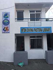
- 1 public library - MTBK Divina Pastora Library
Notable people
- Maria Venus Raj - Binibining Pilipinas-Universe 2010 and placed 4th Runner-Up in Miss Universe 2010 pageant. Froilan Canlas, 3rd place. Tawag ng Tanghalan in It's Showtime.
References
- "Municipality". Quezon City, Philippines: Department of the Interior and Local Government. Retrieved 31 May 2013.
- "Province: Camarines Sur". PSGC Interactive. Quezon City, Philippines: Philippine Statistics Authority. Retrieved 12 November 2016.
- Census of Population (2015). "Region V (Bicol Region)". Total Population by Province, City, Municipality and Barangay. PSA. Retrieved 20 June 2016.
- "PSA releases the 2015 Municipal and City Level Poverty Estimates". Quezon City, Philippines. Retrieved 1 January 2020.
- "Bato, Camarines Sur: Average Temperatures and Rainfall". World Weather Online. Retrieved 29 October 2017.
- Census of Population and Housing (2010). "Region V (Bicol Region)". Total Population by Province, City, Municipality and Barangay. NSO. Retrieved 29 June 2016.
- Censuses of Population (1903–2007). "Region V (Bicol Region)". Table 1. Population Enumerated in Various Censuses by Province/Highly Urbanized City: 1903 to 2007. NSO.
- "Province of Camarines Sur". Municipality Population Data. Local Water Utilities Administration Research Division. Retrieved 17 December 2016.
- municipal profile
External links
| Wikimedia Commons has media related to Bato, Camarines Sur. |
- Bato Profile at PhilAtlas.com
- Philippine Standard Geographic Code
- Philippine Census Information
- Official Site of the Province of Camarines Sur
Places adjacent to Bato, Camarines Sur | ||||||||||
|---|---|---|---|---|---|---|---|---|---|---|
| ||||||||||
Pili (capital) | |
| Municipalities | |
| Component city | |
| Independent component city |
|