Jovellar
Jovellar, officially the Municipality of Jovellar, is a 4th class municipality in the province of Albay, Philippines. According to the 2015 census, it has a population of 17,308 people.[4]
Jovellar | |
|---|---|
| Municipality of Jovellar | |
 Seal | |
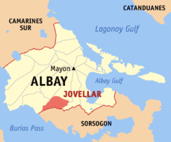 Map of Albay with Jovellar highlighted | |
OpenStreetMap 
| |
.svg.png) Jovellar Location within the Philippines | |
| Coordinates: 13°04′N 123°36′E | |
| Country | |
| Region | Bicol Region (Region V) |
| Province | Albay |
| District | 3rd district |
| Barangays | 23 (see Barangays) |
| Government | |
| • Type | Sangguniang Bayan |
| • Mayor | Joseph L. Arcangel |
| • Vice Mayor | Jorem L. Arcangel |
| • Congressman | Fernando T. Cabredo |
| • Electorate | 11,862 voters (2019) |
| Area | |
| • Total | 105.40 km2 (40.70 sq mi) |
| Elevation | 27.6 m (90.6 ft) |
| Population (2015 census)[4] | |
| • Total | 17,308 |
| • Density | 160/km2 (430/sq mi) |
| • Households | 3,811 |
| Economy | |
| • Income class | 4th municipal income class |
| • Poverty incidence | 37.87% (2015)[5] |
| • Revenue (₱) | 47,206,826.99 (2016) |
| Time zone | UTC+8 (PST) |
| ZIP code | 4515 |
| PSGC | |
| IDD : area code | +63 (0)52 |
| Climate type | tropical rainforest climate |
| Native languages | Albay Bikol language Tagalog |
The town was named in honor of Spanish governor-general Joaquín Jovellar y Soler.
Main access to the town is via Guinobatan. Jeepneys ply the 16-kilometre (9.9 mi) distance from Guinobatan to Jovellar daily with the first trip from Guinobatan leaving as early as 5 AM and the last trip to Jovellar usually at around 5 PM.
Jovellar's main industry is agriculture. Primary crops are rice, copra, abaca, and corn.
Quipia River runs through the town and the river leads all the way to Donsol in Sorsogon.
Tourist activities in the area may include a trip to the river just behind the local school or a trip to Pariaan pool. Once at the town center, one can find a statue of the national hero, Jose Rizal, and the town church in front of it.
Geography
Jovellar is located at 13°04′N 123°36′E.
According to the Philippine Statistics Authority, the municipality has a land area of 105.40 square kilometres (40.70 sq mi) [2] constituting 4.09% of the 2,575.77-square-kilometre- (994.51 sq mi) total area of Albay.
Barangays
Jovellar is politically subdivided into 23 barangays.[6]
| PSGC | Barangay | Population | ±% p.a. | |||
|---|---|---|---|---|---|---|
| 2015[4] | 2010[7] | |||||
| 050505025 | Aurora Poblacion (Barangay 6) | 0.6% | 96 | 120 | −4.16% | |
| 050505003 | Bagacay | 5.7% | 985 | 937 | 0.96% | |
| 050505011 | Bautista | 5.3% | 920 | 993 | −1.44% | |
| 050505012 | Cabraran | 9.5% | 1,636 | 1,569 | 0.80% | |
| 050505008 | Calzada Poblacion (Barangay 7) | 3.0% | 523 | 461 | 2.43% | |
| 050505013 | Del Rosario | 3.9% | 679 | 687 | −0.22% | |
| 050505014 | Estrella | 3.0% | 513 | 438 | 3.06% | |
| 050505015 | Florista | 4.6% | 790 | 882 | −2.08% | |
| 050505005 | Mabini Poblacion (Barangay 2) | 3.7% | 636 | 680 | −1.27% | |
| 050505007 | Magsaysay Poblacion (Barangay 4) | 0.7% | 126 | 186 | −7.15% | |
| 050505016 | Mamlad | 6.0% | 1,044 | 968 | 1.45% | |
| 050505017 | Maogog | 7.5% | 1,297 | 1,143 | 2.44% | |
| 050505018 | Mercado Poblacion (Barangay 5) | 1.3% | 221 | 234 | −1.08% | |
| 050505006 | Plaza Poblacion (Barangay 3) | 1.0% | 168 | 197 | −2.99% | |
| 050505009 | Quitinday Poblacion (Barangay 8) | 1.5% | 254 | 279 | −1.77% | |
| 050505004 | Rizal Poblacion (Barangay 1) | 2.1% | 360 | 396 | −1.80% | |
| 050505019 | Salvacion | 2.3% | 400 | 424 | −1.10% | |
| 050505020 | San Isidro | 5.9% | 1,020 | 993 | 0.51% | |
| 050505021 | San Roque | 8.5% | 1,470 | 1,415 | 0.73% | |
| 050505022 | San Vicente | 11.4% | 1,976 | 1,838 | 1.39% | |
| 050505023 | Sinagaran | 3.3% | 570 | 504 | 2.37% | |
| 050505024 | Villa Paz | 5.0% | 872 | 817 | 1.25% | |
| 050505010 | White Deer Poblacion (Barangay 9) | 4.3% | 752 | 738 | 0.36% | |
| Total | 17,308 | 16,899 | 0.46% | |||
Demographics
| Population census of Jovellar | ||
|---|---|---|
| Year | Pop. | ±% p.a. |
| 1903 | 5,423 | — |
| 1918 | 6,854 | +1.57% |
| 1939 | 9,513 | +1.57% |
| 1948 | 10,308 | +0.90% |
| 1960 | 12,025 | +1.29% |
| 1970 | 14,003 | +1.53% |
| 1975 | 14,121 | +0.17% |
| 1980 | 15,016 | +1.24% |
| 1990 | 14,884 | −0.09% |
| 1995 | 16,876 | +2.38% |
| 2000 | 17,357 | +0.60% |
| 2007 | 17,615 | +0.20% |
| 2010 | 16,899 | −1.50% |
| 2015 | 17,308 | +0.46% |
| Source: Philippine Statistics Authority[4][7][8][9] | ||
In the 2015 census, Jovellar had a population of 17,308.[4] The population density was 160 inhabitants per square kilometre (410/sq mi).
Climate
| Climate data for Jovellar, Albay | |||||||||||||
|---|---|---|---|---|---|---|---|---|---|---|---|---|---|
| Month | Jan | Feb | Mar | Apr | May | Jun | Jul | Aug | Sep | Oct | Nov | Dec | Year |
| Average high °C (°F) | 27 (81) |
28 (82) |
29 (84) |
31 (88) |
31 (88) |
30 (86) |
29 (84) |
29 (84) |
29 (84) |
29 (84) |
29 (84) |
28 (82) |
29 (84) |
| Average low °C (°F) | 22 (72) |
21 (70) |
22 (72) |
23 (73) |
24 (75) |
25 (77) |
25 (77) |
25 (77) |
24 (75) |
24 (75) |
23 (73) |
22 (72) |
23 (74) |
| Average precipitation mm (inches) | 65 (2.6) |
44 (1.7) |
42 (1.7) |
39 (1.5) |
87 (3.4) |
150 (5.9) |
184 (7.2) |
153 (6.0) |
163 (6.4) |
154 (6.1) |
127 (5.0) |
100 (3.9) |
1,308 (51.4) |
| Average rainy days | 13.9 | 9.2 | 11.1 | 12.5 | 19.6 | 24.3 | 26.5 | 25.0 | 25.5 | 24.4 | 19.4 | 15.1 | 226.5 |
| Source: Meteoblue [10] | |||||||||||||
References
- "Municipality". Quezon City, Philippines: Department of the Interior and Local Government. Retrieved 31 May 2013.
- "Province: Albay". PSGC Interactive. Quezon City, Philippines: Philippine Statistics Authority. Retrieved 12 November 2016.
- "Jovellar, Albay Profile". PhilAtlas.com. Retrieved 15 June 2020.
- Census of Population (2015). "Region V (Bicol Region)". Total Population by Province, City, Municipality and Barangay. PSA. Retrieved 20 June 2016.
- "PSA releases the 2015 Municipal and City Level Poverty Estimates". Quezon City, Philippines. Retrieved 1 January 2020.
- "Municipal: Jovellar". PSGC Interactive. Quezon City, Philippines: Philippine Statistics Authority. Retrieved 8 January 2016.
- Census of Population and Housing (2010). "Region V (Bicol Region)". Total Population by Province, City, Municipality and Barangay. NSO. Retrieved 29 June 2016.
- Censuses of Population (1903–2007). "Region V (Bicol Region)". Table 1. Population Enumerated in Various Censuses by Province/Highly Urbanized City: 1903 to 2007. NSO.
- "Province of Albay". Municipality Population Data. Local Water Utilities Administration Research Division. Retrieved 17 December 2016.
- "Jovellar, Albay : Average Temperatures and Rainfall". Meteoblue. Retrieved 29 December 2018.