Pio Duran, Albay
Pio Duran, officially the Municipality of Pio Duran (Central Bicolano: Banwaan kan Pio Duran; Tagalog: Bayan ng Pio Duran), is a 3rd class municipality in the province of Albay, Philippines. According to the 2015 census, it has a population of 46,693 people.[4]
Pio Duran | |
|---|---|
| Municipality of Pio Duran | |
 Seal | |
 Map of Albay with Pio Duran highlighted | |
OpenStreetMap 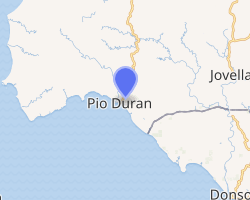
| |
.svg.png) Pio Duran Location within the Philippines | |
| Coordinates: 13°02′N 123°27′E | |
| Country | |
| Region | Bicol Region (Region V) |
| Province | Albay |
| District | 3rd district |
| Barangays | 33 (see Barangays) |
| Government | |
| • Type | Sangguniang Bayan |
| • Mayor | Alan R. Arandia |
| • Vice Mayor | Marvin Thomas N. Quiroz |
| • Congressman | Fernando T. Cabredo |
| • Electorate | 33,750 voters (2019) |
| Area | |
| • Total | 133.70 km2 (51.62 sq mi) |
| Elevation | 17.7 m (58.1 ft) |
| Population (2015 census)[4] | |
| • Total | 46,693 |
| • Density | 350/km2 (900/sq mi) |
| • Households | 9,452 |
| Economy | |
| • Income class | 3rd municipal income class |
| • Poverty incidence | 37.40% (2015)[5] |
| • Revenue (₱) | 108,046,767.50 (2016) |
| Time zone | UTC+8 (PST) |
| ZIP code | 4516 |
| PSGC | |
| IDD : area code | +63 (0)52 |
| Climate type | tropical rainforest climate |
| Native languages | Albay Bikol language Tagalog |
| Website | www |
Access to the town is via Ligao. It is considered as one of the major route going to Masbate.
It was named after the Filipino Pan-Asianist, Lawyer and Legislator, Pio Saceda Duran (1900–1961).
Geography
Pio Duran is located at 13°02′N 123°27′E.
According to the Philippine Statistics Authority, the municipality has a land area of 133.70 square kilometres (51.62 sq mi) [2] constituting 5.19% of the 2,575.77-square-kilometre- (994.51 sq mi) total area of Albay.
Barangays
Pio Duran is politically subdivided into 33 barangays.[6]
| PSGC | Barangay | Population | ±% p.a. | |||
|---|---|---|---|---|---|---|
| 2015[4] | 2010[7] | |||||
| 050513001 | Agol | 2.4% | 1,135 | 1,240 | −1.67% | |
| 050513002 | Alabangpuro | 1.8% | 835 | 831 | 0.09% | |
| 050513005 | Banawan (Binawan) | 6.9% | 3,235 | 3,149 | 0.51% | |
| 050513023 | Barangay I (Poblacion) | 8.7% | 4,070 | 4,048 | 0.10% | |
| 050513024 | Barangay II (Poblacion) | 3.8% | 1,796 | 1,710 | 0.94% | |
| 050513025 | Barangay III (Poblacion) | 2.1% | 986 | 1,075 | −1.63% | |
| 050513026 | Barangay IV (Poblacion) | 3.2% | 1,472 | 1,637 | −2.00% | |
| 050513027 | Barangay V (Poblacion) | 5.1% | 2,362 | 2,177 | 1.57% | |
| 050513003 | Basicao Coastal | 4.9% | 2,300 | 2,333 | −0.27% | |
| 050513004 | Basicao Interior | 1.3% | 599 | 499 | 3.54% | |
| 050513006 | Binodegahan | 5.4% | 2,517 | 2,319 | 1.57% | |
| 050513007 | Buenavista | 2.7% | 1,247 | 1,153 | 1.50% | |
| 050513008 | Buyo | 1.0% | 452 | 422 | 1.32% | |
| 050513009 | Caratagan | 9.7% | 4,536 | 4,049 | 2.19% | |
| 050513010 | Cuyaoyao | 3.5% | 1,618 | 1,616 | 0.02% | |
| 050513011 | Flores | 3.0% | 1,410 | 1,318 | 1.29% | |
| 050513033 | La Medalla | 3.9% | 1,837 | 1,647 | 2.10% | |
| 050513012 | Lawinon | 2.7% | 1,280 | 1,260 | 0.30% | |
| 050513013 | Macasitas | 1.1% | 508 | 472 | 1.41% | |
| 050513014 | Malapay | 2.3% | 1,087 | 1,035 | 0.94% | |
| 050513015 | Malidong | 4.4% | 2,062 | 2,041 | 0.20% | |
| 050513016 | Mamlad | 1.1% | 503 | 483 | 0.78% | |
| 050513017 | Marigondon | 3.3% | 1,562 | 1,489 | 0.92% | |
| 050513018 | Matanglad | 1.5% | 681 | 655 | 0.74% | |
| 050513019 | Nablangbulod | 1.4% | 657 | 689 | −0.90% | |
| 050513020 | Oringon | 1.4% | 667 | 655 | 0.35% | |
| 050513021 | Palapas | 2.5% | 1,181 | 1,109 | 1.20% | |
| 050513022 | Panganiran | 1.3% | 621 | 586 | 1.11% | |
| 050513028 | Rawis | 1.9% | 875 | 772 | 2.41% | |
| 050513029 | Salvacion | 1.3% | 621 | 552 | 2.27% | |
| 050513030 | Santo Cristo | 1.0% | 451 | 398 | 2.41% | |
| 050513031 | Sukip | 1.9% | 868 | 839 | 0.65% | |
| 050513032 | Tibabo | 1.4% | 662 | 770 | −2.84% | |
| Total | 46,693 | 45,028 | 0.69% | |||
Demographics
| Population census of Pio Duran | ||
|---|---|---|
| Year | Pop. | ±% p.a. |
| 1970 | 26,443 | — |
| 1975 | 31,188 | +3.37% |
| 1980 | 33,835 | +1.64% |
| 1990 | 36,859 | +0.86% |
| 1995 | 41,850 | +2.41% |
| 2000 | 44,423 | +1.29% |
| 2007 | 44,972 | +0.17% |
| 2010 | 45,028 | +0.05% |
| 2015 | 46,693 | +0.69% |
| Source: Philippine Statistics Authority[4][7][8][9] | ||
In the 2015 census, Pio Duran had a population of 46,693.[4] The population density was 350 inhabitants per square kilometre (910/sq mi).
Climate
| Climate data for Pio Duran, Albay | |||||||||||||
|---|---|---|---|---|---|---|---|---|---|---|---|---|---|
| Month | Jan | Feb | Mar | Apr | May | Jun | Jul | Aug | Sep | Oct | Nov | Dec | Year |
| Average high °C (°F) | 27 (81) |
28 (82) |
29 (84) |
31 (88) |
31 (88) |
30 (86) |
29 (84) |
29 (84) |
29 (84) |
29 (84) |
29 (84) |
28 (82) |
29 (84) |
| Average low °C (°F) | 22 (72) |
21 (70) |
22 (72) |
23 (73) |
24 (75) |
25 (77) |
25 (77) |
25 (77) |
24 (75) |
24 (75) |
23 (73) |
22 (72) |
23 (74) |
| Average precipitation mm (inches) | 65 (2.6) |
44 (1.7) |
42 (1.7) |
39 (1.5) |
87 (3.4) |
150 (5.9) |
184 (7.2) |
153 (6.0) |
163 (6.4) |
154 (6.1) |
127 (5.0) |
100 (3.9) |
1,308 (51.4) |
| Average rainy days | 13.9 | 9.2 | 11.1 | 12.5 | 19.6 | 24.3 | 26.5 | 25.0 | 25.5 | 24.4 | 19.4 | 15.1 | 226.5 |
| Source: Meteoblue [10] | |||||||||||||
Notable personalities
- Jona Viray
References
- "Municipality". Quezon City, Philippines: Department of the Interior and Local Government. Retrieved 31 May 2013.
- "Province: Albay". PSGC Interactive. Quezon City, Philippines: Philippine Statistics Authority. Retrieved 12 November 2016.
- "Pio Duran, Albay Profile". PhilAtlas.com. Retrieved 15 June 2020.
- Census of Population (2015). "Region V (Bicol Region)". Total Population by Province, City, Municipality and Barangay. PSA. Retrieved 20 June 2016.
- "PSA releases the 2015 Municipal and City Level Poverty Estimates". Quezon City, Philippines. Retrieved 1 January 2020.
- "Municipal: Pio Duran, Albay". PSGC Interactive. Quezon City, Philippines: Philippine Statistics Authority. Retrieved 8 January 2016.
- Census of Population and Housing (2010). "Region V (Bicol Region)". Total Population by Province, City, Municipality and Barangay. NSO. Retrieved 29 June 2016.
- Censuses of Population (1903–2007). "Region V (Bicol Region)". Table 1. Population Enumerated in Various Censuses by Province/Highly Urbanized City: 1903 to 2007. NSO.
- "Province of Albay". Municipality Population Data. Local Water Utilities Administration Research Division. Retrieved 17 December 2016.
- "Pio Duran, Albay : Average Temperatures and Rainfall". Meteoblue. Retrieved 29 December 2018.
External links
Places adjacent to Pio Duran, Albay | |
|---|---|
Legazpi (capital) | |
| Municipalities | |
| Component cities | |