Labo, Camarines Norte
Labo, officially the Municipality of Labo, is a 1st class municipality in the province of Camarines Norte, Philippines. According to the 2015 census, it has a population of 101,082 people.[4]
Labo | |
|---|---|
| Municipality of Labo | |
 | |
 Seal | |
 Map of Camarines Norte with Labo highlighted | |
OpenStreetMap 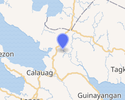
| |
.svg.png) Labo Location within the Philippines | |
| Coordinates: 14°01′N 122°21′E | |
| Country | |
| Region | Bicol Region (Region V) |
| Province | Camarines Norte |
| District | 1st district |
| Founded | September 8, 1800 |
| Barangays | 52 (see Barangays) |
| Government | |
| • Type | Sangguniang Bayan |
| • Mayor | Joseph V. Ascutia |
| • Vice Mayor | Dindo V. Pardo |
| • Congressman | Josefina B. Tallado |
| • Electorate | 60,165 voters (2019) |
| Area | |
| • Total | 589.36 km2 (227.55 sq mi) |
| Elevation | 15.5 m (50.9 ft) |
| Population (2015 census)[4] | |
| • Total | 101,082 |
| • Density | 170/km2 (440/sq mi) |
| • Households | 22,201 |
| Economy | |
| • Income class | 1st municipal income class |
| • Poverty incidence | 39.44% (2015)[5] |
| • Revenue (₱) | 243,935,573.89 (2016) |
| Time zone | UTC+8 (PST) |
| ZIP code | 4604 |
| PSGC | |
| IDD : area code | +63 (0)54 |
| Climate type | tropical rainforest climate |
| Native languages | Manide Tagalog |
Geography
The town of Labo is geographically located relatively at the center of the province of Camarines Norte. It is approximately 335 kilometers south of Manila and 15 kilometers away from Daet, the capital town of the province. It is situated at the coordinates between 14°01'06" and 14°11" North latitudes and 122°21'00" and 122°52'20" East longitudes. On the North, it is bounded by the municipalities of Paracale, Jose Panganiban, and Capalonga, on the South, by the province of Quezon, adjoining province of Camarines Sur, on the East by the municipalities of Vinzons and San Vicente, and on the West by the municipality of Santa Elena. The Maharlika highway links this municipality to provinces and cities of the Bicol Region and the Calabarzon (Region IV-A) region.
Its aggregate land area of 648.84 km² occupies more than 25% of the total land area of the province. Its 52 component barangays represent 18.44% of the total barangays of the province. There are ten (10) classified as urban barangays namely Bagacay, Cabusay, Fundado, Anahaw, Bagong Silang I, Dalas, Gumamela, Kalamunding, Malasugui, Pinya, San Francisco, Talobatib and Tulay na Lupa, and the remaining forty two are considered as rural.
The surface of the municipality is generally rugged, rolling hills and mountainous terrain with relative small rollings and flat terrain. Mt. Cadig (736 meters above sea level), Mt. Labo(1544 meters above sea level), Mt. Bagacay (786 meters above sea level) and Mt. Nalisbitan (265 meters above sea level) form the Southern Cordillera. Boundaries of Camarines Norte, Camarines Sur, and Quezon provinces converge on Mt. Labo, which is the highest peak in the province. Mt. Bagacay serves as a boundary between municipalities of Paracale and Labo and it as well guards the municipality from strong north winds especially during typhoons. Mt. Labo, Mt. Bagacay, and Mt. Cadig are the three major known dormant volcanoes in the municipality. The north-west portion of the municipality is greatly affected by 2 major fault and earthquake lines accruing in the province, while other trends affect north-north-west along Mt. Cadig passing through the barangays of Guisican and Bayabas. Like its neighbors, Panganiban and Paracale, there is a vast deposit of gold ore in the mountains of Labo, Camarines Norte. It is believed that Mt. Bagacay hides the treasures of Gen. Yamashita and is the target of both local and foreign treasure hunters and bounty seekers.
Climate
There is no pronounced dry season and maximum rain period from December to January.
Barangays
Labo is politically subdivided into 52 barangays.
- Anahaw (Poblacion)
- Anameam
- Awitan
- Baay
- Bagacay
- Bagong Silang I
- Bagong Silang II
- Bagong Silang III
- Bakiad
- Bautista
- Bayabas
- Bayan-bayan
- Benit
- Bulhao
- Cabatuhan
- Cabusay
- Calabasa
- Canapawan
- Daguit
- Dalas
- Dumagmang
- Exciban
- Fundado
- Guinacutan
- Guisican
- Gumamela (Poblacion)
- Iberica
- Kalamunding (Poblacion)
- Lugui
- Mabilo I
- Mabilo II
- Macogon
- Mahawan-hawan
- Malangcao-Basud
- Malasugui
- Malatap
- Malaya
- Malibago
- Maot
- Masalong
- Matanlang
- Napaod
- Pag-Asa
- Pangpang
- Pinya (Poblacion)
- San Antonio
- San Francisco (Poblacion)
- Santa Cruz
- Submakin
- Talobatib
- Tigbinan
- Tulay Na Lupa
Demographics
| Population census of Labo | ||
|---|---|---|
| Year | Pop. | ±% p.a. |
| 1903 | 5,246 | — |
| 1918 | 8,062 | +2.91% |
| 1939 | 13,181 | +2.37% |
| 1948 | 14,977 | +1.43% |
| 1960 | 33,168 | +6.85% |
| 1970 | 47,916 | +3.74% |
| 1975 | 52,781 | +1.96% |
| 1980 | 56,690 | +1.44% |
| 1990 | 70,371 | +2.19% |
| 1995 | 77,414 | +1.80% |
| 2000 | 81,388 | +1.08% |
| 2007 | 88,087 | +1.10% |
| 2010 | 92,041 | +1.61% |
| 2015 | 101,082 | +1.80% |
| Source: Philippine Statistics Authority[4][6][7][8] | ||
In the 2015 census, the population of Labo, Camarines Norte, was 101,082 people,[4] with a density of 170 inhabitants per square kilometre or 440 inhabitants per square mile.
Climate
| Climate data for Labo, Camarines Norte | |||||||||||||
|---|---|---|---|---|---|---|---|---|---|---|---|---|---|
| Month | Jan | Feb | Mar | Apr | May | Jun | Jul | Aug | Sep | Oct | Nov | Dec | Year |
| Average high °C (°F) | 27 (81) |
27 (81) |
29 (84) |
31 (88) |
31 (88) |
30 (86) |
29 (84) |
29 (84) |
29 (84) |
29 (84) |
28 (82) |
27 (81) |
29 (84) |
| Average low °C (°F) | 22 (72) |
22 (72) |
22 (72) |
23 (73) |
25 (77) |
25 (77) |
25 (77) |
24 (75) |
24 (75) |
24 (75) |
24 (75) |
23 (73) |
24 (74) |
| Average precipitation mm (inches) | 85 (3.3) |
55 (2.2) |
53 (2.1) |
47 (1.9) |
112 (4.4) |
156 (6.1) |
213 (8.4) |
159 (6.3) |
201 (7.9) |
216 (8.5) |
197 (7.8) |
141 (5.6) |
1,635 (64.5) |
| Average rainy days | 15.4 | 11.6 | 13.6 | 12.3 | 19.9 | 23.7 | 27.3 | 26.0 | 26.0 | 24.6 | 21.8 | 19.1 | 241.3 |
| Source: Meteoblue [9] | |||||||||||||
Economy
Labo being located at the center of the province serves as the agricultural center as well as potential investment destination and promotion center for business, trades, and secondary industrial growth center. It is abundant with natural resources such as gold, nickel, iron, magnetite sand, copper, lead and manganese. Most of the provincial water supplies are located at barangay Tulay na Lupa and Lugui which serves seven out of the 12 municipalities. Agriculture is the leading livelihood of the residents of Labo. Due to abundant forest products such as rattan and bamboo, local folks tend to manufacture and market handicrafts.
An area of 390.39 km² (65.17% of municipal's land area) is devoted to agricultural crop production, 343.46 km² of which are coconut plantations. On the other hand, 18.47 km² is used for rice production. Banana production is also popular in the province, followed by Pineapple and Pili.
Tourism is also a good source of income for Labo, being surrounded by freshwater and mountains suitable for hikings.
Other community livelihood follows: pineapple and coco-based processing and preservation, pineapple weaving (Barong), jewelry making and accessories, foods manufacturing and beverages processing, other tourism related industries and wood and bamboo furniture making.
Culture, tradition and folklore
- Social traditions and beliefs - It is typical Filipino to be religious. They believe on spirits that affects the daily lives. These beliefs and traditions are passed through generations.
- Conception and Giving Birth - A pregnant woman is prohibited to frown or laugh at despicable things for the baby will acquire properties of the despised thing. She is also prohibited to go to isolated places because when a bad spirit sees her, she may give birth too soon.
- Baptism - It is important that a baby should be baptized on time. Unbaptized babies are closer to the devil because they are not holy to protect themselves. It is also important that the Godparents of the baby are good individuals because the baby will get such behavior from them.
- Courting and Engagement - There are instances that marriage is agreed by the parents while the boy and the girl are still babies. Unknowingly, a woman may have been agreed to be married to a specific man. Most of the time, a man who likes a lady, talks to the lady's parent's to win their approval. The man, helps with the household chores and avoids to do things perfectly, any mistake may mean failure.
These traditions and beliefs are still widely practiced. Despite the growth of modern technologies, almost everybody still believes in luck.
Attractions
- Waterfalls
- Saltahan Falls - barangay Awitan
- Palanas Falls - barangay Pag-asa
- Maligaya Falls - barangay Submakin
- Binuang Falls - barangay Daguit
- Malatap Falls - barangay Malatap
- Burok-Busok Falls - barangay Bagong Silang II
- Turayog Falls - barangay Fundado
- Caves
- Mt. Cadig Cave - Located at Mt. Cadig, barangay Bayabas. Along the highway it is 52 km drive from the town proper. From Maharlika highway it can be hiked via barangay Bayabas or barangay Guisican. Hills, trees and rocky slopes hide this cave from view. The cave is composed of several dark compartments of stalactites and stalagmites. This cave is getting attention to become town's priority tourist attraction.
- Mambuaya Cave - barangay Fundado
- Pintong Gubat
- Rivers
- Busig-on River
- Labo River
- Matogdon River
- Abasig River - barangay Baay
- Sinag-Tala
- Recreation and hiking
- Saltahan Falls - barangay Awitan
- Labo People's Park
- Kukod Kabayo Rest Area
- Tan-awan / Bilad na Bato - barangay Fundado
- Festivals and cultural entertainment
- Busig-on Festival
- May Festival
- Agro-Industrial Fair
- Search for "Miss Labo"
- Search for "Mr. Labo"
- Miss Gay Beauty Pageant
- Annual Marian Exhibit and procession - held every 8 September as part of Mary's birthday celebration and the founding anniversary of Labo, an exposition of priceless arts composed of antiques, vintages and new images of Maria the mother of Jesus. The local artisans, camameros and florists of Camarines Norte and Camarines Sur joined together in cooperation with the local government of Labo and the Diocese of Daet for the preparation of this event, from the exhibition ended with Marian procession.
- Historical landmarks
- Gen. Vicente R. Lukban Landmark
- Battle of Tigbinan
- Hagdan Bato
- Labo Museum
- Veteran's Monument
- Centennial Monument
- Basilio Bautista
- Churches
- Parish of Saint John The Apostle & Evangelist
- Parish of Saint Didacus of Alcala in Bagong Silang
- Quasi-Parish of the Holy Family in Talobatib
- Holy Trinity College Seminary in Bautista
- Saint Cajetan Parish Church Tulay na Lupa
References
- "Municipality". Quezon City, Philippines: Department of the Interior and Local Government. Retrieved 31 May 2013.
- "Province: Camarines Norte". PSGC Interactive. Quezon City, Philippines: Philippine Statistics Authority. Retrieved 12 November 2016.
- "Labo, Camarines Norte Profile". PhilAtlas.com. Retrieved 15 June 2020.
- Census of Population (2015). "Region V (Bicol Region)". Total Population by Province, City, Municipality and Barangay. PSA. Retrieved 20 June 2016.
- "PSA releases the 2015 Municipal and City Level Poverty Estimates". Quezon City, Philippines. Retrieved 1 January 2020.
- Census of Population and Housing (2010). "Region V (Bicol Region)". Total Population by Province, City, Municipality and Barangay. NSO. Retrieved 29 June 2016.
- Censuses of Population (1903–2007). "Region V (Bicol Region)". Table 1. Population Enumerated in Various Censuses by Province/Highly Urbanized City: 1903 to 2007. NSO.
- "Province of Camarines Norte". Municipality Population Data. Local Water Utilities Administration Research Division. Retrieved 17 December 2016.
- "Labo, Camarines Norte: Average Temperatures and Rainfall". Meteoblue. Retrieved 27 December 2018.
- Labo - the Hidden Paradise brochure
- Jose Ramon B. Lagatuz, Kasaysay - Pamana ng Lahi, Alay sa mga Taga-Labo
- Labo Municipal Annual Accomplishment Report
- Daloy ng Kasaysayan I
- Carlos C. Galvez, contributed the "Ang Epiko ni Busig-on." He is the main contributor of the BUSIG-ON Festival.
External links
- Labo Profile at PhilAtlas.com
- Labo at Camarines Norte provincial website
- Philippine Standard Geographic Code
- Philippine Census Information
Places adjacent to Labo, Camarines Norte | ||||||||||
|---|---|---|---|---|---|---|---|---|---|---|
| ||||||||||