Armstrong County, Texas
Armstrong County is a county located in the U.S. state of Texas. As of the 2010 census, the population was 1,901.[1] Its county seat is Claude.[2] The county was formed in 1876 and later organized in 1890.[3] It was named for one of several Texas pioneer families named Armstrong.
Armstrong County | |
|---|---|
 The Armstrong County Courthouse in Claude | |
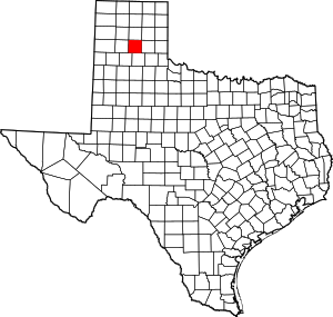 Location within the U.S. state of Texas | |
 Texas's location within the U.S. | |
| Coordinates: 34°58′N 101°21′W | |
| Country | |
| State | |
| Founded | 1890 |
| Seat | Claude |
| Largest city | Claude |
| Area | |
| • Total | 914 sq mi (2,370 km2) |
| • Land | 909 sq mi (2,350 km2) |
| • Water | 4.7 sq mi (12 km2) 0.5%% |
| Population (2010) | |
| • Total | 1,901 |
| • Density | 2.1/sq mi (0.8/km2) |
| Time zone | UTC−6 (Central) |
| • Summer (DST) | UTC−5 (CDT) |
| Congressional district | 13th |
| Website | www |
Armstrong County is included in the Amarillo, TX Metropolitan Statistical Area.
History
Native Americans
Paleo-Indians first inhabitants as far back as 10,000 BC. Apachean cultures roamed the county until Comanche dominated around 1700. The Comanches were defeated by the United States Army in the Red River War of 1874. Later tribes include Kiowa and Cheyenne.[4]
County established and growth
Armstrong County was formed from Bexar County in 1876, and organized in 1890, with Claude as the county seat.[4]
Charles Goodnight and John George Adair established ranching in the county. In 1876, Goodnight brought a herd of 1,600 cattle into the Palo Duro Canyon. The JA Ranch encompassed over a million acres (4,000 km²), including Armstrong County and five adjoining counties. The county land use was primarily ranch-related, even after the trickling in of homesteaders, for the remainder of the 19th century.[5]
In 1887, the JA Ranch split up, giving way to a terminus for the Fort Worth and Denver City Railway. The first town from the ranch was Goodnight.[6]
Landowner Robert E. Montgomery platted the town of Washburn, named after railroad executive D.W. Washburn.[7]
The next year, railroad lines turned Washburn into a boom town. In the same year, Armstrong City was renamed Claude in honor of railroad engineer Claude Ayers.[8]
In 1890, the two towns competed for the county seat, with Claude winning. Many scenes of the 1963 Paul Newman film Hud were filmed at Goodnight and Claude.[9][10][11]
At the beginning of the 20th century, ranching began to share the land with cotton and wheat crops, although ranching remained the leading industry. The Great Depression had a severe effect on the county's economy, and recovery took years. Ranches still occupied about 68% of the land in the county in 2005.[4]
Geography
According to the U.S. Census Bureau, the county has a total area of 914 square miles (2,370 km2), of which 909 square miles (2,350 km2) are land and 4.7 square miles (12 km2) (0.5%) are covered by water.[12]
Major highways


Adjacent counties
- Carson County (north)
- Gray County (northeast)
- Donley County (east)
- Briscoe County (south)
- Swisher County (southwest)
- Randall County (west)
- Potter County (northwest)
Demographics
| Historical population | |||
|---|---|---|---|
| Census | Pop. | %± | |
| 1880 | 31 | — | |
| 1890 | 944 | 2,945.2% | |
| 1900 | 1,205 | 27.6% | |
| 1910 | 2,682 | 122.6% | |
| 1920 | 2,816 | 5.0% | |
| 1930 | 3,329 | 18.2% | |
| 1940 | 2,495 | −25.1% | |
| 1950 | 2,215 | −11.2% | |
| 1960 | 1,966 | −11.2% | |
| 1970 | 1,895 | −3.6% | |
| 1980 | 1,994 | 5.2% | |
| 1990 | 2,021 | 1.4% | |
| 2000 | 2,148 | 6.3% | |
| 2010 | 1,901 | −11.5% | |
| Est. 2019 | 1,887 | [13] | −0.7% |
| U.S. Decennial Census[14] 1850–2010[15] 2010–2014[1] | |||
As of the census[16] of 2000, 2,148 people, 802 households, and 612 families resided in the county. The population density was 2 people per square mile (1/km²). The 920 housing units averaged 1 per square mile (0/km²). The racial makeup of the county was 95.44% White, 0.28% Black or African American, 0.65% Native American, 2.79% from other races, and 0.84% from two or more races. About 5.40% of the population was Hispanic or Latino of any race.
Of the 802 households, 33.90% had children under the age of 18 living with them, 67.20% were married couples living together, 6.10% had a female householder with no husband present, and 23.60% were non-families. About 21.40% of all households were made up of individuals, and 12.00% had someone living alone who was 65 years of age or older. The average household size was 2.58 and the average family size was 2.99.
In the county, the population was distributed as 26.00% under the age of 18, 6.10% from 18 to 24, 24.80% from 25 to 44, 23.80% from 45 to 64, and 19.20% who were 65 years of age or older. The median age was 41 years. For every 100 females, there were 93.20 males. For every 100 females age 18 and over, there were 90.30 males.
The median income for a household in the county was $38,194, and for a family was $43,894. Males had a median income of $30,114 versus $21,786 for females. The per capita income for the county was $17,151. About 7.90% of families and 10.60% of the population were below the poverty line, including 15.80% of those under age 18 and 11.60% of those age 65 or over.
Education
The Claude Independent School District serves almost all of Armstrong County.
Three school districts headquartered in surrounding counties, Clarendon Consolidated Independent School District, Groom Independent School District, and Happy Independent School District, include small unincorporated portions of Armstrong County.
Politics
| Year | Republican | Democratic | Third parties |
|---|---|---|---|
| 2016 | 90.5% 924 | 6.9% 70 | 2.6% 27 |
| 2012 | 88.6% 828 | 10.5% 98 | 1.0% 9 |
| 2008 | 86.5% 856 | 12.9% 128 | 0.6% 6 |
| 2004 | 82.7% 830 | 16.9% 170 | 0.4% 4 |
| 2000 | 82.3% 772 | 16.0% 150 | 1.7% 16 |
| 1996 | 62.2% 582 | 29.1% 272 | 8.8% 82 |
| 1992 | 54.6% 561 | 27.0% 278 | 18.4% 189 |
| 1988 | 69.2% 720 | 30.2% 314 | 0.6% 6 |
| 1984 | 76.5% 791 | 23.0% 238 | 0.5% 5 |
| 1980 | 66.6% 709 | 31.3% 333 | 2.2% 23 |
| 1976 | 49.3% 506 | 50.0% 513 | 0.8% 8 |
| 1972 | 80.8% 768 | 18.6% 177 | 0.6% 6 |
| 1968 | 46.1% 434 | 32.0% 301 | 21.9% 206 |
| 1964 | 40.2% 365 | 59.9% 544 | |
| 1960 | 56.7% 488 | 42.4% 365 | 0.8% 7 |
| 1956 | 46.6% 372 | 52.9% 422 | 0.5% 4 |
| 1952 | 56.4% 562 | 42.7% 425 | 0.9% 9 |
| 1948 | 11.9% 97 | 84.1% 686 | 4.1% 33 |
| 1944 | 16.5% 132 | 77.9% 623 | 5.6% 45 |
| 1940 | 8.4% 82 | 91.5% 891 | 0.1% 1 |
| 1936 | 3.5% 33 | 96.1% 897 | 0.3% 3 |
| 1932 | 7.2% 63 | 92.7% 813 | 0.1% 1 |
| 1928 | 45.8% 316 | 54.1% 373 | 0.1% 1 |
| 1924 | 19.1% 106 | 76.6% 426 | 4.3% 24 |
| 1920 | 17.5% 87 | 81.5% 405 | 1.0% 5 |
| 1916 | 10.6% 43 | 86.7% 353 | 2.7% 11 |
| 1912 | 9.4% 32 | 80.4% 274 | 10.3% 35 |
See also
- Armstrong County Sheriff's Office
- List of museums in the Texas Panhandle
- National Register of Historic Places listings in Armstrong County, Texas
- Recorded Texas Historic Landmarks in Armstrong County
References
- "State & County QuickFacts". United States Census Bureau. Archived from the original on December 1, 2015. Retrieved December 8, 2013.
- "Find a County". National Association of Counties. Archived from the original on 2011-05-31. Retrieved 2011-06-07.
- "Texas: Individual County Chronologies". Texas Atlas of Historical County Boundaries. The Newberry Library. 2008. Retrieved May 20, 2015.
- Abbe, Donald R. "Armstrong County". Handbook of Texas Online. Texas State Historical Association. Archived from the original on 21 December 2010. Retrieved 13 December 2010.
- Hagen, William Thomas (2007). "Launching the JA Ranch 1877-1880". Charles Goodnight: Father of the Texas Panhandle. University of Oklahoma Press. pp. 45–60. ISBN 978-0-8061-3827-5.
- "Goodnight, Texas and Charles Goodnight". Texas Escapes. Texas Escapes - Blueprints For Travel, LLC. Archived from the original on 21 December 2010. Retrieved 13 December 2010.
- "Washburn, Texas". Texas Escapes. Texas Escapes - Blueprints For Travel, LLC. Retrieved 13 December 2010.
- "Claude, Texas". Texas Escapes. Texas Escapes - Blueprints For Travel, LLC. Retrieved 13 December 2010.
- Dingus, Anne (July 1991). "Texas Movies". Texas Monthly: 92.
- Baker, T. Lindsay (2005). More Ghost Towns of Texas. University of Oklahoma Press. pp. 68–69. ISBN 978-0-8061-3724-7.
- Jackson, Carlton (1994). Picking Up the Tab: The Life and Movies of Martin Ritt. Popular Press 1. p. 70. ISBN 978-0-87972-672-0.
- "2010 Census Gazetteer Files". United States Census Bureau. August 22, 2012. Retrieved April 18, 2015.
- "Population and Housing Unit Estimates". United States Census Bureau. May 24, 2020. Retrieved May 27, 2020.
- "U.S. Decennial Census". United States Census Bureau. Retrieved April 18, 2015.
- "Texas Almanac: Population History of Counties from 1850–2010" (PDF). Texas Almanac. Retrieved April 18, 2015.
- "U.S. Census website". United States Census Bureau. Retrieved 2011-05-14.
- Leip, David. "Dave Leip's Atlas of U.S. Presidential Elections". uselectionatlas.org. Retrieved 2018-07-19.
External links
- Armstrong County
- Armstrong County, Texas from the Handbook of Texas Online
- Armstrong County from the Texas Almanac
- Armstrong County from the TXGenWeb Project
- Armstrong County Profile from the Texas Association of Counties
- Interactive Texas Map
- Texas Map Collection
Places adjacent to Armstrong County, Texas | ||||||||||
|---|---|---|---|---|---|---|---|---|---|---|
| ||||||||||
Municipalities and communities of Armstrong County, Texas, United States | ||
|---|---|---|
| City | Armstrong County map | |
| Unincorporated communities | ||
