Danville, Pennsylvania
| Danville, Pennsylvania | |
|---|---|
| Borough | |
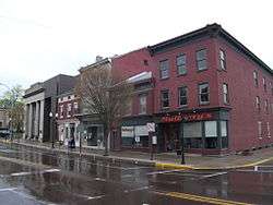 Downtown Danville | |
| Nickname(s): Ironmen Country, D-Block | |
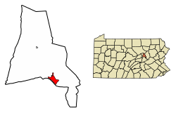 Location of Danville in Montour County, Pennsylvania. | |
 Danville Location within the U.S. state of Pennsylvania  Danville Danville (the US) | |
| Coordinates: 40°57′42″N 76°36′43″W / 40.96167°N 76.61194°WCoordinates: 40°57′42″N 76°36′43″W / 40.96167°N 76.61194°W | |
| Country | United States |
| State | Pennsylvania |
| County | Montour |
| Settled | 1776 |
| Incorporated (borough) | 1792 |
| Government | |
| • Mayoress | Bernie Swank (Republican) |
| Area[1] | |
| • Total | 1.57 sq mi (4.08 km2) |
| • Land | 1.55 sq mi (4.03 km2) |
| • Water | 0.02 sq mi (0.05 km2) |
| Elevation[2] | 500 ft (200 m) |
| Population (2010) | |
| • Total | 4,699 |
| • Estimate (2016)[3] | 4,618 |
| • Density | 2,969.77/sq mi (1,146.28/km2) |
| Time zone | Eastern (EST) |
| • Summer (DST) | EDT |
| ZIP code | 17821 17822 |
| Area code(s) | 570 |
| FIPS code | 42-18136 |
| Website | Danville |
Danville is a borough in and the county seat of Montour County, Pennsylvania, United States,[4] along the North Branch of the Susquehanna River. Danville was home to 8,042 people in 1900, 7,517 people in 1910, and 7,122 people in 1940. The population was 4,699 at the 2010 census.
Danville is part of the Bloomsburg–Berwick Micropolitan Statistical Area.
History
Native American history
As Europeans explored the coastal regions reachable from ships at the dawn of the 17th Century, the whole valley of the Susquehanna from South-central New York state to the upper Chesapeake Bay was owned by the fierce Iroquois-like Susquehannock people, like the Erie people, an Iroquoian speaking tribe with a similar related culture.[5] As the European wars of religion lulled before the cataclysm of the Thirty Years' War, ca. 1600 AD the protestant Dutch traders first entered the Delaware Valley and began regularly trading firearms for furs, especially highly valued Beaver Pelts with the inland Susquehannock people in the vicinity of greater Philadelphia.
Although the Susquehannocks lived well inland their hunting range owned the rich Beaver territory of the entire Susquehanna River drainage basin, since the Susquehannock's range also included hunting the Schuylkill and Lehigh Rivers and their tributaries (which they historically disputed by occasional mutual raiding with the Algonquian Delaware people dwelling along the Atlantic coastal strip extending west from Delaware and southern New Jersey into the Poconos), the Susquehanna had a wealth of coveted Beaver pelts, and so became formidably well armed.
The Beaver Wars
About the time New Sweden (1638) was founded, the Iroquois Confederacy began a series of escalating wars setting Indian versus Indian called the Beaver Wars—that ultimately would open up the frontier to white settlers—deadly long running territorial wars between Amerindian peoples for fur hunting and trapping territories. Forearmed by their traders knowledge, the Swedes settled both sides of the Delaware, and almost immediately became allies with the Susquehannock, who already well armed, would soon after have a confederacy well armed enough to win a war declared by the colonial Province of Maryland, subjugate several Delaware tribes and would inflict several stinging defeats on Iroquois forces.
By the mid-1650s New Netherlands absorbed New Sweden, and in 1666-67, the English took over New Netherlands, but most of the colonial populations in both cases, including traders, merely switched governors and went on with business as usual, where the most lucrative business was for Furs.
What little is known of the Susquehannock tribe comes mostly from a few traders and the work of a single Dutch missionary who lived with them for a time about 1640.[5] They were a fierce and powerful people holding off territorial infringements from the tribes on all sides of their range from the Potomac to the Mohawk valley, and the Poconos to the Alleghenies.[5] Danville, located in the southern center of the valley would have been at least a summer hunting camp for these people, who were to become horribly affected by epidemic plagues of disease over multiple years circa 1668-72.[5] This sudden weakness in population ironically occurred shortly after the Susquehannocks gave a serious drubbing about 1665-66 over 2-3 years[5] to two of the Five Nations of the Iroquois in the local Beaver Wars. After the drastic weakening, they were attacked on all sides by subjected tribes, colonists, and the Iroquois, suffering further large losses.[5]
By 1678, the Iroquois would agree in a treaty to absorb most of the remaining Iroquoian Susquehannocks whose civilization had collapsed,[5] though several hundred remnants migrated to live south and west of the Wyoming Valley, and would be called the Conestoga by the new English settlers in the colony of Pennsylvania,[5] whilst the Susquehannock confederation would go extinct as an Iroquoian people and its surviving people would be absorbed into other tribes.[5] Hence, Danville was Iroquois land until a 1768 treaty after the French and Indian War.
16th-18th century
Chester County native and American Revolutionary War figure William Montgomery purchased a plot of land in 1774 and established a trading post called Montgomery's Landing. In 1792 he constructed a house there, which is now a small museum inside the town. In the same year his son Daniel plotted the area between Mill Street and Church Street, the historic core of the town which now bears his name.
Early 19th century
Danville was part of Northumberland County, Pennsylvania, when it was founded. In 1813, Columbia County, Pennsylvania was formed from part of Northumberland Co. Danville became the county seat of Columbia Co. until 1845, when an election moved the seat to Bloomsburg, Pennsylvania. In 1850, Montour County was formed from part of Columbia. Danville then became the county seat of Montour.
Danville became a transportation center in the mid19th century as the technology of early railroads developed, allowing accelerated development of inland communities. Danville first serviced canal boats plying the navigations on the Susquehanna between the coal docks in Pittston and Wilkes-Barre connecting to the Union Canal, and Harrisburg. Subsequently, it became served by several railroads also running along the banks of the North Branch of the Susquehanna River. Coal and iron mines in the surrounding hills and mountains fueled the local economy, and by mid-century Danville was an important iron mill town. Many of the rails of the nation's expanding railroad system were made in Danville, an important contribution to a network which grew explosively for decades. By the 1890s there were 7-8 major railroads running into the Wyoming Valley for Anthracite. A local marker claims that the first T-rail rolled in the United States was rolled in Danville, on October 8, 1845 at the Montour Iron Company, though this is claimed for Mount Savage, Maryland, as well.
Late 19th century
Montour and several other enormous iron mills dominated the town for most of the 19th century and the iron industry was the chief employer in the region. The iron mills fell into decline, however, as steel replaced iron in the 20th century. The city celebrates this era with an annual Iron Heritage Festival in July, and the main street is still named "Mill Street".
In 1869 the Danville State Hospital was built as a state institution for the treatment and care of the mentally ill.
20th century and beyond
Abigail Geisinger, widow of iron magnate George Geisinger, used his fortune to build a hospital and clinic intended to be a regional medical center modeled after the Mayo Clinic. The Geisinger Hospital was completed in 1915, and has grown over the years. Today, the Geisinger Medical Center is the most important tertiary referral center in northern Pennsylvania. Geisinger and its affiliated institutions are also one of the largest employers in the region.
In the early 1960s, local company Susquehanna Danville Airport produced airboats for evaluation by the U.S. Army. Susquehanna was a joint venture between Ken Burrows-owned Danville Airport of Danville and Mari-Mar Industries of Port Trevorton, Pennsylvania.[6] The airboats, called Susquehanna Skimmers, were evaluated in Vietnam between June 1964 and late 1965. The six Skimmers competed with six Hurricane Aircats, made by the Hurricane Fiberglass Products Company of Auburndale, Florida.[7] The Skimmer lost to the Aircat, which was found to be more durable, manueverable, and have greater obstacle crossing capabilities than the Susquehanna Skimmer, although the Skimmer outperformed the Aircat in deep water.[8]
The Thomas Beaver Free Library and Danville YMCA, Danville Historic District, Danville West Market Street Historic District, and General William Montgomery House are listed on the National Register of Historic Places.[9]
In 2014, Republican Bernie Swank replaced Democrat Ed Coleman as Mayor. Coleman was Mayor of Danville for 16 years. Swank defeated Democrat Tom Graham by 50 votes out of 682 votes cast. She previously served as mayor from 1989 to 1996.[10]
Geography
Danville is located in northeastern Pennsylvania at 40°57′42″N 76°36′43″W / 40.96167°N 76.61194°W (40.961607, -76.611947).[11] It is located on the north bank of the North Branch of the Susquehanna River. The contiguous community south of the river is Riverside. The surrounding country is low mountain ridges of the Appalachian range. The town is bisected by U.S. Route 11 and has an exit from Interstate 80 to the north. There are also deposits of limestone in the vicinity.
According to the United States Census Bureau, the borough has a total area of 1.6 square miles (4.1 km2), all of which is land area.
Demographics
| Historical population | |||
|---|---|---|---|
| Census | Pop. | %± | |
| 1850 | 3,302 | — | |
| 1860 | 6,385 | 93.4% | |
| 1870 | 8,436 | 32.1% | |
| 1880 | 8,346 | −1.1% | |
| 1890 | 7,998 | −4.2% | |
| 1900 | 8,042 | 0.6% | |
| 1910 | 7,517 | −6.5% | |
| 1920 | 6,952 | −7.5% | |
| 1930 | 7,185 | 3.4% | |
| 1940 | 7,122 | −0.9% | |
| 1950 | 6,994 | −1.8% | |
| 1960 | 6,889 | −1.5% | |
| 1970 | 6,176 | −10.3% | |
| 1980 | 5,239 | −15.2% | |
| 1990 | 5,165 | −1.4% | |
| 2000 | 4,897 | −5.2% | |
| 2010 | 4,699 | −4.0% | |
| Est. 2016 | 4,618 | [3] | −1.7% |
| Sources:[12][13][14] | |||
2000
As of the census[13] of 2000, there were 4,897 people, 2,277 households, and 1,238 families residing in the borough. The population density was 3,087.2 people per square mile (1,189.1/km2). There were 2,523 housing units at an average density of 1,590.5 per square mile (612.7/km2). The racial makeup of the borough was 96.06% White, 0.78% African American, 0.12% Native American, 1.80% Asian, 0.47% from other races, and 0.78% from two or more races. Hispanic or Latino of any race were 1.14% of the population.
There were 2,277 households, out of which 24.1% had children under the age of 18 living with them, 39.4% were married couples living together, 12.3% had a female householder with no husband present, and 45.6% were non-families. 40.3% of all households were made up of individuals, and 16.6% had someone living alone who was 65 years of age or older. The average household size was 2.10 and the average family size was 2.84.
In the borough the age distribution of the population shows 21.7% under the age of 18, 7.6% from 18 to 24, 31.2% from 25 to 44, 20.0% from 45 to 64, and 19.4% who were 65 years of age or older. The median age was 38 years. For every 100 females, there were 84.0 males. For every 100 females age 18 and over, there were 79.1 males.
The median income for a household in the borough was $30,498, and the median income for a family was $38,778. Males had a median income of $30,375 versus $24,313 for females. The per capita income for the borough was $16,693. 10.6% of the population and 6.0% of families were below the poverty line. 16.1% of those under the age of 18 and 8.4% of those 65 and older are living below the poverty line.
2010
As of the census[13] of 2010, there were 4,697 people, 2,173 households, and 1,148 families residing in the borough. The population density was 2,936.9 people per square mile (1,133.9/km2). There were 2,527 housing units at an average density of 1,579.4 per square mile (609.8/km2). The racial makeup of the borough was 94.2% White, 0.4% African American, 0% Native American, 3.60% Asian, 0.4% from other races, and 1.4% from two or more races. Hispanic or Latino of any race were 3.7% of the population.
In the borough the age distribution of the population shows 20.3% age 19 and under, 5.5% from 20 to 24, 26.1% from 25 to 44, 28.2% from 45 to 64, and 19.9% who were 65 years of age or older. The median age was 39 years. For every 100 females, there were 81.9 males.[15][16]
The median income for a household in the borough was $37,238, and the median income for a family was $44,955. Males had a median income of $38,194 versus $29,735 for females. The per capita income for the borough was $21,344. 18.5% of the population and 12.2% of families were below the poverty line. 33.9% of those under the age of 18 and 15.2% of those 65 and older are living below the poverty line.[17]
Education
Danville Area School District is the local public education agency. The District provides: Prekindergarten to 4 year olds (Head Start), full day Kindergarten, and all 12 subsequent grades. In 2014, Danville Area School District's enrollment declined to 2,261 students.[18] Danville Area School District ranked 67th out of the 494 ranked Pennsylvania School Districts in 2017, by the Pittsburgh Business Times.[19] The district ranked 87th out of the 496 ranked Pennsylvania School Districts in 2015.[20] In 2007, the Pittsburgh Business Times ranked the District 119th out of 499 Pennsylvania public school districts based on three years of Pennsylvania System of Student Assessment test scores.
In 2014, Danville Area High School applied for and received Blue Ribbon School federal recognition.[21]
High school aged students can attend the taxpayer funded Columbia-Montour Area Vocational-Technical School, located in Bloomsburg, Pennsylvania, for training in the building trades, auto mechanics, culinary arts, allied health careers and other areas. The school participates in Penn College NOW, a dual enrollment program which permits students to earn college credits while enrolled in the tech school. Columbia-Montour Area Vocational Technical School is funded by a consortium of the school districts, which includes: Danville Area School District, Benton Area School District, Millville Area School District, Bloomsburg Area School District, Central Columbia School District, Southern Columbia Area School District, and Berwick Area School District.
Danville Borough residents may also apply to attend any of the Commonwealth's 14 public cyber charter schools (in 2013) at no additional cost to the parents. This includes SusQ Cyber Charter School which is locally operated in Bloomsburg. The resident’s public school district is required to pay the public charter school and public cyber charter school tuition for residents who attend any of these schools.[22][23] The tuition rate that Danville Area School District must pay was $8,926.16 in 2013. The District's own per pupil spending in 2013 was $13,132.18.[24] Residents may also seek admission for their school aged child to any other public school district. When accepted for admission, the student's parents are responsible for paying an annual tuition fee set by the Pennsylvania Department of Education.
Central Susquehanna Intermediate Unit #16 provides a wide variety of services to children living in its region which includes Danville. Early screening, special education services, speech and hearing therapy, autistic support, preschool classes and many other services like driver education are available. Services for children during the preschool years are provided without cost to their families when the child is determined to meet eligibility requirements. Intermediate units receive taxpayer funding: through subsidies paid by member school districts; through direct charges to users for some services; through the successful application for state and federal competitive grants and through private grants.[25]
- Parochial school
Residents of Washingtonville may also choose to attend St. Joseph School in Danville. The Catholic school provides grades kindergarten through 8th.[26] In 2017, the tuition was $3910.[27] By Commonwealth law, Danville Area School District must provide transportation between the school and the borough residents at no added cost to taxpayers.[28] Each school year, the state provides a transportation subsidy to each school district that provides transportation to its pupils.[29]
- Public Library
Community members have access to the Thomas Beaver Free Library. Through the local public library, Pennsylvania residents have access to all POWER Library online resources. By state law the school district is required to open its libraries at least once a week to residents.[30][31]
Recreation
The Borough Council is a partner of the Montour Area Recreation Commission. They hope to attract state funding to study recreational opportunities along the Susquehanna River.[32] Hess Field is a park located on Meadow Lane.
The Montour Area Recreation Commission (MARC) led a local volunteer effort to clear the abandoned towpath of the North Branch Canal along the Susquehanna River. A mile of the towpath was cleared, permitting biking, walking and running near the Danville Soccer Park. The canal is over 200 years old. It was an important part of the region's transportation system. Canal boats and rafts moved farm produce, lumber and people up and down the river.[33] This is part of a greenway effort to develop recreation and commercial opportunities along the river. The long-term vision is to create a regional trail that connects Northumberland to Catawissa and on to Bloomsburg, Pennsylvania.
Running through the outskirts of Danviile, the J. Manley Robbins trail is alleged to be the oldest documented rail-trail in the United States. The former railroad line for the "Montour," a 10-ton narrow gauge locomotive used for carrying iron ore between deposits and furnaces, the line was converted to a bicycle path in 1890s. The original one mile railbed trail section now connects with adjacent additional trails and recreation amenities near the Mahoning Creek.[34]
Nearby communities
- Riverside
- Mechanicsville
- Mausdale
Notable people
- Alice Dalton Brown (born 1939), realist painter
- Jacob Coxey, socialist and populist American politician, and minor party candidate for the office of President of the United States. Was the leader of Coxey's Army, considered to be the first significant protest march on Washington, D.C.
- Theodore L. Kramer (1847-1910), Recipient of the Medal of Honor in the American Civil War. Kramer entered service in Danville.[35]
- John Nevin Schaeffer, classicist
- Joseph Parry, Welsh-born composer of hymn whose song 'Aberystwyth' was adapted into Nkosi Sikelel' iAfrika, a component of the national anthem of South Africa.
- Christopher Latham Sholes, inventor of the first practical typewriter and the QWERTY keyboard configuration still in use today.[36]
- Elizabeth Currid-Halkett a University of Southern California professor and internationally recognized author attended Danville High School from 1992-1996.
- Matthew Lysiak nationally recognized journalist and Author attended Danville High School from 2000-2004.
- Dan Washburn, born in Danville, PA, author of The Forbidden Game: Golf and the Chinese Dream
- William Ward Watkin (1886-1952), American architect, professor and head of the Architecture Department at Rice University.
- Bill Yerrick, baseball player.
See also
References
- ↑ "2016 U.S. Gazetteer Files". United States Census Bureau. Retrieved Aug 14, 2017.
- ↑ "Danville, Pennsylvania (PA 17821, 17822) profile: population, maps, real estate, averages, homes, statistics, relocation, travel, jobs, hospitals, schools, crime, moving, houses, news". City-data.com. Retrieved 2013-10-03.
- 1 2 "Population and Housing Unit Estimates". Retrieved June 9, 2017.
- ↑ "Find a County". National Association of Counties. Archived from the original on 2011-05-31. Retrieved 2011-06-07.
- 1 2 3 4 5 6 7 8 9 see Susquehannock#History main article coverage and citations.
- ↑ "Pennsylvania Boats Go To Viet Nam War". The Progress. Clearfield, PA. July 17, 1965. p. 13.
- ↑ "Vietnam Airboats -- Book Review". VietnamGear.com. October 13, 2008. Retrieved July 11, 2018.
- ↑ Enfield, Samuel; Burr, R.; Badgett, R., eds. (April 15, 1966). Airboats (PDF) (Technical report). San Francisco: Army Concept Team in Vietnam. p. B-1. R-1590.0 – via DTIC.
- ↑ National Park Service (2010-07-09). "National Register Information System". National Register of Historic Places. National Park Service.
- ↑ Blackledge, Karen. "Swank gets another turn as Danville mayor". The Daily Item. Retrieved 2016-05-22.
- ↑ "US Gazetteer files: 2010, 2000, and 1990". United States Census Bureau. 2011-02-12. Retrieved 2011-04-23.
- ↑ "Census of Population and Housing". U.S. Census Bureau. Archived from the original on 12 May 2015. Retrieved 11 December 2013.
- 1 2 3 "American FactFinder". United States Census Bureau. Archived from the original on 2013-09-11. Retrieved 2008-01-31.
- ↑ "Incorporated Places and Minor Civil Divisions Datasets: Subcounty Resident Population Estimates: April 1, 2010 to July 1, 2012". Population Estimates. U.S. Census Bureau. Archived from the original on 17 June 2013. Retrieved 11 December 2013.
- ↑ "American FactFinder". U.S. Census Bureau. Retrieved 21 August 2018.
- ↑ "ACS DEMOGRAPHIC AND HOUSING ESTIMATES". U.S. Census Bureau. Retrieved 21 August 2018.
- ↑ US Census Bureau (2010). "Fact Finder Danville, PA".
- ↑ Pennsylvania Department of Education (December 4, 2014). "District Fast Facts - Danville Area School District".
- ↑ Pittsburgh Business Times (2017). "2017 Regional School Report Card Top school districts in Pennsylvania".
- ↑ Pittsburgh Business Times, Guide to Pennsylvania Schools Statewide School District Ranking 2015, April 10, 2015
- ↑ US Department of Education (2014). "2014 National Blue Ribbon Schools All Public and Private" (PDF).
- ↑ Pennsylvania Department of Education (2013). "Charter Schools".
- ↑ Pennsylvania Department of Education (2013). "What is a Charter School?".
- ↑ PDE, Finances - Selected Data 2013-14, 2015
- ↑ Central Susquehanna Intermediate Unit 16 Administration, About the CSIU, 2017
- ↑ PDE, ED Names and Addresses, 2017
- ↑ St. Joseph School Administration, Tuition rates for the 2017-2018 School Year, 2017
- ↑ PDE (2017). "Transportation Frequently Asked Questions" (PDF).
- ↑ Pennsylvania Department of Education (2017). "Pupil Transportation".
- ↑ PAschoollibraryproject.org, Creating 21st-Century Learners: A Report on Pennsylvania’s Public School Libraries, October 2012
- ↑ Office of Commonwealth Libraries, Guidelines for Pennsylvania School Library Programs, 2011
- ↑ North, Jamie, "Recreation group enlists borough", The Daily Item, July 11, 2007.
- ↑ North, Jamie, "Recreation Commission Reviving towpath" Archived 2012-07-30 at Archive.is, The Daily Item, July 7, 2007.
- ↑ "Danville". Susquehanna Greenway. Retrieved 2013-10-03.
- ↑ "Theodore L. Kramer". Archived from the original on July 28, 2014. Retrieved July 23, 2014.
- ↑ "Early Typewriter History". Mit.edu. 2001-07-16. Retrieved 2013-10-03.
External links
| Wikimedia Commons has media related to Danville, Pennsylvania. |
- DanvillePA.com, sponsored by the Press-Enterprise
- Danvilleboro.org
- Iron Heritage Festival
- Susquehanna Greenway Partnership
- From the Boroughs to the Bay
- Van Wagner Music
Municipalities and communities of Montour County, Pennsylvania, United States | ||
|---|---|---|
| Boroughs | 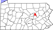 | |
| Townships | ||
| Unincorporated communities | ||