Montrose, Pennsylvania
| Montrose, Pennsylvania | |
|---|---|
| Borough | |
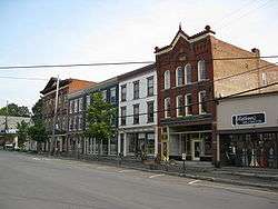 Downtown Montrose, Pennsylvania | |
| Nickname(s): Quarry Town | |
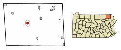 Location of Montrose in Susquehanna County, Pennsylvania. | |
 Montrose Location in Pennsylvania  Montrose Montrose (the US) | |
| Coordinates: 41°49′59″N 75°52′38″W / 41.83306°N 75.87722°WCoordinates: 41°49′59″N 75°52′38″W / 41.83306°N 75.87722°W | |
| Country | United States |
| State | Pennsylvania |
| County | Susquehanna |
| Settled | 1812 |
| Incorporated | 1824[1] |
| Government | |
| • Type | Borough Council |
| • Mayor | John Wilson |
| Area[2] | |
| • Total | 1.29 sq mi (3.33 km2) |
| • Land | 1.29 sq mi (3.33 km2) |
| • Water | 0.00 sq mi (0.00 km2) |
| Elevation | 1,400 ft (627 m) |
| Population (2010) | |
| • Total | 1,617 |
| • Estimate (2016)[3] | 1,491 |
| • Density | 1,158.51/sq mi (447.33/km2) |
| Time zone | UTC-5 (Eastern (EST)) |
| • Summer (DST) | UTC-4 (EDT) |
| ZIP code | 18801 |
| Area code(s) | 570 Exchange: 278 |
| FIPS code | 42-50736 |
Montrose (pronounced mon-TROSE) is a borough in Susquehanna County, Pennsylvania, United States, 37 miles (60 km) north by west of Scranton. The land is elevated about 1,400 feet (427 m) above sea level. It is the Susquehanna County seat.
History
Montrose was laid out in 1812. The first settlers were the descendants of Sir Peter Warren; Knight Vice Admiral on England's Royal Fleet. Upon retirement, he was given the land by grateful American soldiers. Mary Ann Warren, County Commissioner, is the great-great granddaughter once removed of Sir Peter Warren (1703 - 1752).
The first courthouse was built a year later, and Montrose was incorporated as a borough from part of Bridgewater Township on March 29, 1824.[1] Its name is a combination of "mont", the French word for “mountain” and Rose, for Dr. L R. Rose, a prominent citizen.
The traditional older industries included creameries and the manufacturing of cut glass, boxes, sawing machinery, lumber, etc. In 1900, 1,827 people lived here, and in 1910, 1,914 people lived here. The population was 1,664 at the 2000 census. The population was 1,617 at the 2010 census. It is the county seat of Susquehanna County.[4] The area of Montrose is notable for its many quarry sites. A type of rock that is indigenous to this area is called blue stone. The town, along with Susquehanna County, is best known as the location of significant Marcellus shale drilling, putting Montrose in the center of the bourgeoning natural gas industry of the 21st century.
Montrose was incorporated as a town and seat of Susquehanna County in 1824, but families began immigrating to the area in the mid-18th century, primarily from areas along the Connecticut River Valley (western Connecticut, Massachusetts, and Vermont). The American Revolution dramatically changed the political and built environments of New England. After the war, there was pent-up land hunger and many residents wanted some of the affordable land in Pennsylvania. When settlers arrived in what is now Susquehanna County they found rolling hills, clear lakes, and mountain streams with an abundance of natural resources such as timber and bluestone. In a very short period of time, the first families built Montrose in the style of their home New England towns: large colonial style houses surrounding churches, and both centered on a main street. A town “green” adjacent to the courthouse was the commons, or place for community events.
Several townsfolk and local historians claim that Montrose played a significant role in the Northern Trail of the Underground Railroad, and that several escaped slaves families were housed temporarily in town. Folklore has it that many of these families remained in Montrose or Susquehanna County after the War. Numerous local residents sought historical landmark status for their homes in the twentieth and twenty-first centuries based on local lore about the Railroad, but many were denied by the Pennsylvania Historical Commission due to lack of evidence that the rumored events took place. Several academic historians believe that, while the possibility of a family or two stopping in Montrose along the Northern Trail is plausible, the increase in African-American population in the county after the Civil War was more likely the result of people being attracted to jobs in the then-bourgeoning coal industry just south of the county. The Susquehanna County Historical Society and the Center for Anti-Slavery Studies (housed in one of the suspected former Railroad homes) remain dedicated to identifying and analyzing primary documents of the time. Historians have found little documentation to support the Underground Railroad claims.
Between the 1950s and 1990s, due to the declines in the coal industry and agriculture, residents emigrated from this area to other places for work. It was not until oil started to be heavily drilled for in the late 2000s that the economy began to pick up, in a dramatic way not seen since the late 19th century. Due to increased revenues in town, the Montrose hospital (the only major hospital in Susquehanna County) was moved from an old and small facility downtown to a large, advanced facility just outside town.
The town's Sylvanus Mulford House, Silver Lake Bank, and Susquehanna County Courthouse Complex are listed on the National Register of Historic Places.[5] The Montrose Historic District was added in 2011.
Geography
Montrose is located at 41°49′59″N 75°52′38″W / 41.83306°N 75.87722°W (41.833064, -75.877190).[6]
According to the United States Census Bureau, the borough has a total area of 1.3 square miles (3.4 km2), all land.
Demographics
| Historical population | |||
|---|---|---|---|
| Census | Pop. | %± | |
| 1830 | 415 | — | |
| 1840 | 632 | 52.3% | |
| 1850 | 917 | 45.1% | |
| 1860 | 1,168 | 27.4% | |
| 1870 | 1,463 | 25.3% | |
| 1880 | 1,722 | 17.7% | |
| 1890 | 1,735 | 0.8% | |
| 1900 | 1,827 | 5.3% | |
| 1910 | 1,914 | 4.8% | |
| 1920 | 1,661 | −13.2% | |
| 1930 | 1,909 | 14.9% | |
| 1940 | 1,977 | 3.6% | |
| 1950 | 2,075 | 5.0% | |
| 1960 | 2,363 | 13.9% | |
| 1970 | 2,058 | −12.9% | |
| 1980 | 1,980 | −3.8% | |
| 1990 | 1,982 | 0.1% | |
| 2000 | 1,664 | −16.0% | |
| 2010 | 1,617 | −2.8% | |
| Est. 2016 | 1,491 | [3] | −7.8% |
| Sources:[7][8][9] | |||
As of the census[10] of 2010, there were 1,617 people, 754 households, and 399 families residing in the borough. The population density was 1,243.8 people per square mile (485.9/km²). There were 857 housing units at an average density of 659.2 per square mile (257.5/km²). The racial makeup of the borough was 98.8% White, 0.2% African American, 0.05% American Indian and Alaska Native (U.S. Census)|American Indian, 0.05% Asian, 0.2% from other races, and 0.7% from two or more races. Hispanic or Latino of any race were 1.1% of the population.
There were 754 households out of which 23.1% had children under the age of 18 living with them, 39.3% were married couples living together, 10.2% had a female householder with no husband present, and 47.1% were non-families. 42.3% of all households were made up of individuals and 21.2% had someone living alone who was 65 years of age or older. The average household size was 2.14 and the average family size was 2.97.
In the borough the population was spread out with 21.5% under the age of 18, 56.8% from 18 to 64, and 21.7% who were 65 years of age or older. The median age was 44.4 years.
The median income for a household in the borough was $37,125, and the median income for a family was $48,867. Males had a median income of $33,077 versus $26,174 for females. The per capita income for the borough was $19,255. About 12.5% of families and 15.5% of the population were below the poverty line, including 20.2% of those under age 18 and 10.3% of those age 65 or over.
Transportation
Montrose is linked to the major highway in the area, Interstate 81, by only one winding road, Pennsylvania Route 706. Montrose is linked also by road to Friendsville, Little Meadows, and South Montrose. Although Husky Haven Airport is located minutes away, it is strictly recreational. All main flights must come in through Scranton or Binghamton airports.
Media
WPEL AM 800 and 96.5 FM have served the region for more than sixty years from studios at 251 High Street.
Notable people
- Charles Martin Crandall, toymaker
- William Jessup, judge and abolitionist
- Rich Thompson, outfielder for the Tampa Bay Rays
- Jonathan Jasper Wright, lived here as a youth and became the first African American to pass the Pennsylvania bar; went South with the American Missionary Association after the Civil War and served as head of the Freedmen's Bureau in Beaufort, South Carolina; and was elected associate justice of the South Carolina Supreme Court.
- Chris Snee, former offensive guard for New York Giants
- J. Brewster McCollum, Chief Justice of the Supreme Court of Pennsylvania, 1900 - 1903.
- Emily C. Blackman (1826-1907), historian and schoolteacher
- Lewis A Riley, 1847-1925, President of Lehigh Valley Coal & Navigation, Lehigh & Hudson River Railroad Company
- Joseph Welden (1925-), Award Winning Artist, Musician, World War II veteran, Citizen Of The Year award winner (2010).
References
- 1 2 "Bridgewater Township". Susquehanna County Historical Society. Archived from the original on 23 July 2014. Retrieved 10 March 2013.
- ↑ "2016 U.S. Gazetteer Files". United States Census Bureau. Retrieved Aug 14, 2017.
- 1 2 "Population and Housing Unit Estimates". Retrieved June 9, 2017.
- ↑ "Find a County". National Association of Counties. Retrieved 2011-06-07.
- ↑ National Park Service (2010-07-09). "National Register Information System". National Register of Historic Places. National Park Service.
- ↑ "US Gazetteer files: 2010, 2000, and 1990". United States Census Bureau. 2011-02-12. Retrieved 2011-04-23.
- ↑ "Census of Population and Housing". U.S. Census Bureau. Retrieved 11 December 2013.
- ↑ "American FactFinder". United States Census Bureau. Retrieved 2008-01-31.
- ↑ "Incorporated Places and Minor Civil Divisions Datasets: Subcounty Resident Population Estimates: April 1, 2010 to July 1, 2012". Population Estimates. U.S. Census Bureau. Archived from the original on 17 June 2013. Retrieved 11 December 2013.
- ↑ "American FactFinder". United States Census Bureau. Retrieved 2011-05-14.
External links
| Wikimedia Commons has media related to Montrose, Pennsylvania. |
Municipalities and communities of Susquehanna County, Pennsylvania, United States | ||
|---|---|---|
| Boroughs | 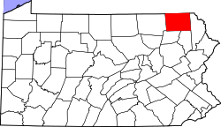 | |
| Townships | ||
| Unincorporated communities | ||