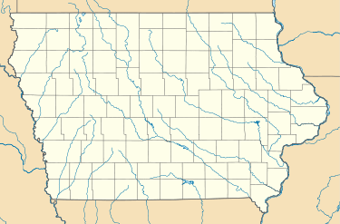
Voorhies, Iowa
| Voorhies, Iowa | |
|---|---|
| Unincorporated community | |
 Voorhies, Iowa Location within the state of Iowa | |
| Coordinates: 42°20′9″N 92°28′58″W / 42.33583°N 92.48278°WCoordinates: 42°20′9″N 92°28′58″W / 42.33583°N 92.48278°W | |
| Country | United States |
| State | Iowa |
| County | Black Hawk |
| Elevation | 1,001 ft (305 m) |
| Time zone | UTC-6 (Central (CST)) |
| • Summer (DST) | UTC-5 (CDT) |
| ZIP codes | 50643 |
| Area code(s) | 319 |
Voorhies, Iowa is an unincorporated community in Lincoln Township, Black Hawk County, Iowa, United States.
Voorhies is located in the most southwestern portion of Black Hawk County at 42°20′09″N 92°28′58″E / 42.3358204°N 92.4826908°E[1] approximately 6 miles southwest of Hudson and 7 miles east of Reinbeck.
Voorhies was platted on June 17, 1900, shortly after the Chicago and Northwestern Railway reached its location.[2]:238
There are two businesses currently in Voorhies - a grain elevator, the Voorhies Grain Company and Raincap Industries.[3] However, in 1904 in addition to the Northern Grain Company[2]:665 Voohries had a cooperative telephone association[2]:698 and creamery.[2]:678
References
- ↑ "United States Geological Survey". GNIS Database. Retrieved 2 September 2013.
- 1 2 3 4 Isaiah Van Metre, ed. (1904). History of Black Hawk County (PDF). Chicago, Illinois: Biographical Publishing Company. Retrieved 2 September 2013.
- ↑ "Voohries Grain Company Inc". Retrieved 2 September 2013.
External links
This article is issued from
Wikipedia.
The text is licensed under Creative Commons - Attribution - Sharealike.
Additional terms may apply for the media files.
