Volda
| Volda kommune | |||
|---|---|---|---|
| Municipality | |||
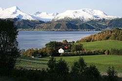
 View of Volda and the Voldsfjorden | |||
| |||
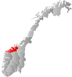
 Volda within Møre og Romsdal | |||
| Coordinates: 62°05′16″N 06°00′51″E / 62.08778°N 6.01417°ECoordinates: 62°05′16″N 06°00′51″E / 62.08778°N 6.01417°E | |||
| Country | Norway | ||
| County | Møre og Romsdal | ||
| District | Sunnmøre | ||
| Administrative centre | Volda | ||
| Government | |||
| • Mayor (2015) | Jørgen Amdam (Ap) | ||
| Area | |||
| • Total | 547.24 km2 (211.29 sq mi) | ||
| • Land | 524.58 km2 (202.54 sq mi) | ||
| • Water | 22.66 km2 (8.75 sq mi) | ||
| Area rank | #197 in Norway | ||
| Population (2017) | |||
| • Total | 9,102 | ||
| • Rank | #123 in Norway | ||
| • Density | 17.4/km2 (45/sq mi) | ||
| • Change (10 years) | 9.4% | ||
| Demonym(s) | Volding[1] | ||
| Time zone | UTC+01:00 (CET) | ||
| • Summer (DST) | UTC+02:00 (CEST) | ||
| ISO 3166 code | NO-1519 | ||
| Official language form | Nynorsk | ||
| Website |
www | ||

Volda is a municipality in Møre og Romsdal county, Norway. It is part of the Sunnmøre region. The administrative centre is the village of Volda. Other villages in the municipality include Dravlaus, Folkestad, Fyrde, Lauvstad, and Straumshamn. The municipality is located about 50 kilometres (31 mi) south of the city of Ålesund.
The 547-square-kilometre (211 sq mi) municipality is the 197th largest by area out of the 422 municipalities in Norway. Volda is the 123rd most populous municipality in Norway with a population of 9,102. The municipality's population density is 17.4 inhabitants per square kilometre (45/sq mi) and its population has increased by 9.4% over the last decade.[2]
General information

The municipality of Volden was established on 1 January 1838 (see formannskapsdistrikt). The original municipality was the same as the parish (prestegjeld) of Volden, including the sub-parishes of Ørsta and Dalsfjord. On 1 August 1883, the sub-parish of Ørsta was separated from Volden to form a new municipality of its own. This left Volden with 3,485 residents. On 1 January 1893, the Ytrestølen farm in Ørsta municipality (population: 13) was transferred to Volden municipality.
In 1918, the name was changed from Volden to Volda. On 1 July 1924, the sub-parish of Dalsfjord was separated from Volda to become a municipality of its own. This left Volda with 4,715 residents. During the 1960s, there were many municipal mergers across Norway due to the work of the Schei Committee. On 1 January 1964, the municipalities of Dalsfjord and Volda were merged back together. The new Volda municipality had 7,207 residents.[3]
On 1 January 2020, the neighboring municipality of Hornindal (in Sogn og Fjordane county) will merge with Volda and join Møre og Romsdal county.[4]
Name
The municipality is named after the Voldsfjorden (Old Norse: Vǫld). The name is probably derived from an old word meaning "wave". (Compare with the German: Welle which means "wave".) Before 1918, the name was written Volden.[5]
Coat-of-arms
The coat-of-arms is from modern times. They were granted on 19 June 1987. The arms show a silver-colored tip of a fountain pen on a blue background. This is a symbol for the long history of education in Volda.[6]
Churches
The Church of Norway has four parishes (sokn) within the municipality of Volda. It is part of the Søre Sunnmøre deanery in the Diocese of Møre.
| Parish (Sokn) | Church Name | Location of the Church | Year Built |
|---|---|---|---|
| Austefjord | Austefjord Church | Fyrde | 1773 |
| Dalsfjord | Dalsfjord Church | Dravlaus | 1910 |
| Kilsfjord | Kilsfjord Church | Straumshamn | 1974 |
| Volda | Volda Church | Volda | 1932 |
Geography
Volda's main geographical feature is the Voldsfjorden which branches off into the Austefjorden, Kilsfjorden, and Dalsfjorden. It is also mountainous, particularly southeast of the fjords, with the Sunnmørsalpene mountains surrounding the region. The 1,482-metre (4,862 ft) tall mountain Eidskyrkja is located in the southeastern part of the municipality.
Volda is bordered by Vanylven Municipality to the south-west/west, the municipalities of Herøy and Ulstein (only by sea) to the west, and Ørsta Municipality to the north and east. To the south it is adjacent to the municipalities of Hornindal and Eid in Sogn og Fjordane county.
The dominant centre, both in terms of population and administration, is the village of Volda, in the northernmost part of the municipality. Other population concentrations include Mork, Ekset, Folkestad, Fyrde, Steinsvika, Lauvstad, Bjørkedal, and Straumshamn.
Climate
| Climate data for Volda | |||||||||||||
|---|---|---|---|---|---|---|---|---|---|---|---|---|---|
| Month | Jan | Feb | Mar | Apr | May | Jun | Jul | Aug | Sep | Oct | Nov | Dec | Year |
| Average high °C (°F) | 0 (32) |
1 (34) |
3 (37) |
5 (41) |
10 (50) |
13 (55) |
14 (57) |
15 (59) |
11 (52) |
8 (46) |
3 (37) |
1 (34) |
7 (45) |
| Daily mean °C (°F) | −1.5 (29.3) |
−1 (30) |
0 (32) |
2 (36) |
7 (45) |
10 (50) |
11 (52) |
11.5 (52.7) |
8.5 (47.3) |
6 (43) |
1 (34) |
−1 (30) |
4.5 (40.1) |
| Average low °C (°F) | −3 (27) |
−3 (27) |
−3 (27) |
−1 (30) |
4 (39) |
7 (45) |
8 (46) |
8 (46) |
6 (43) |
4 (39) |
−1 (30) |
−3 (27) |
2 (36) |
| Average precipitation mm (inches) | 188 (7.4) |
146 (5.75) |
154 (6.06) |
100 (3.94) |
77 (3.03) |
95 (3.74) |
117 (4.61) |
136 (5.35) |
238 (9.37) |
237 (9.33) |
218 (8.58) |
237 (9.33) |
1,943 (76.49) |
| Average precipitation days | 25 | 22 | 22 | 19 | 16 | 17 | 21 | 22 | 26 | 25 | 25 | 27 | 267 |
| Mean monthly sunshine hours | 14 | 39 | 86 | 136 | 200 | 197 | 171 | 151 | 80 | 58 | 28 | 0 | 1,159 |
| Source: World Climate Guide[7] | |||||||||||||
Government
All municipalities in Norway, including Volda, are responsible for primary education (through 10th grade), outpatient health services, senior citizen services, unemployment and other social services, zoning, economic development, and municipal roads. The municipality is governed by a municipal council of elected representatives, which in turn elect a mayor.
Municipal council
The municipal council (Kommunestyre) of Volda is made up of 27 representatives that are elected to four year terms. Currently, the party breakdown is as follows:[8]
| Party Name | Name in Norwegian | Number of representatives | |
|---|---|---|---|
| Labour Party | Arbeiderpartiet | 6 | |
| Progress Party | Framstegspartiet | 4 | |
| Conservative Party | Høgre | 3 | |
| Christian Democratic Party | Kristelig Folkeparti | 6 | |
| Green Party | Miljøpartiet Dei Grøne | 1 | |
| Centre Party | Senterpartiet | 3 | |
| Socialist Left Party | Sosialistisk Venstreparti | 2 | |
| Liberal Party | Venstre | 2 | |
| Total number of members: | 27 | ||
Culture

Volda is primarily known for strong cultural heritage and academic traditions. A private library at Egset, the first rural of its kind in Norway, is said to have inspired the young Ivar Aasen in the 19th century. Martin Ulvestad, Norwegian–American author who published an English-Danish-Norwegian dictionary in 1895, (Engelsk-Dansk-Norsk Ordbog med fuldstændig Udtalebetegnelse) was born in Volda. The Norsk Landboeblad newspaper was based in Volda in the 1800s. Volda landsgymnas (established 1910) was the first Norwegian secondary school outside a major city. Among the most important institutions today is the Volda University College.
Volda University College is one of 25 university colleges in Norway. Volda University College enrolls about 3,000 students and specializes in education of teachers, animators, and journalists.
There is a thriving creative community in the town, with several animation companies, as well as the Norsk Animasjonsentrum/Norwegian Animation Centre and a yearly animation festival, run in cooperation with Volda University College.
Volda also hosts a national documentary film festival as well as an annual student festival. The festival, Den Norske Dokumentarfilmfestivalen is usually held in late April. The national ski festival X2 is also held in Volda during April every year. The Volda TI sports club includes a Third Division association football team that competes in Volda.
As a logical consequence of the huge influx of students, as well as a county hospital, public services are by far the most dominant sector, representing almost 50% of economic life in Volda. Industry and agriculture are also prevalent. Bjørkedalen is noted for its tradition in building wooden boats.
The Sivert Aarflot Museum is located at Ekset in Volda.[9] Volda and its environs are featured prominently in the film Troll Hunter (2010).
Transportation
The Ørsta-Volda Airport, Hovden is located in neighbouring Ørsta Municipality, just north of the village of Volda. The European route E39 highway passes north through the municipality on its way to the city of Ålesund. As noted, the municipality is criss-crossed by fjords; therefore, both Lauvstad and Folkestad are linked to the population centre Volda by ferry. In February 2008, the underwater Eiksund Tunnel connected the municipalities of Ulstein, Hareid, Herøy, and Sande to Ørsta and Volda. The tunnel is the deepest undersea tunnel in the world. The new Kviven Tunnel was completed in 2012, connecting Fyrde in eastern Volda to the village of Grodås in Hornindal Municipality to the south (in Sogn og Fjordane county).
Notable residents
- Ragnhild Aarflot Kalland, a local politician
- Olav Rune Ekeland Bastrup, writer
- Simone Larsen, artist and lead vocalist of D'Sound
- Beate S. Lech, jazz vocalist and lead singer of Beady Belle
- Eirik Sognnes, artist and notable singer of pop/folk music.
- Martin Ulvestad (1865-1942), Norwegian-American historian and philologist
References
- ↑ "Navn på steder og personer: Innbyggjarnamn" (in Norwegian). Språkrådet. Retrieved 2015-12-01.
- ↑ Statistisk sentralbyrå (2017). "Table: 06913: Population 1 January and population changes during the calendar year (M)" (in Norwegian). Retrieved 2017-10-20.
- ↑ Rygh, Oluf (1908). Norske gaardnavne: Romsdals amt (in Norwegian) (13 ed.). Kristiania, Norge: W. C. Fabritius & sønners bogtrikkeri.
- ↑ "Nye Volda" (in Norwegian). Retrieved 2017-10-20.
- ↑ Rygh, Oluf (1908). Norske gaardnavne: Romsdals amt (in Norwegian) (13 ed.). Kristiania, Norge: W. C. Fabritius & sønners bogtrikkeri. p. 67.
- ↑ Norske Kommunevåpen (1990). "Nye kommunevåbener i Norden". Retrieved 25 October 2008.
- ↑ "Volda Climate Guide, Norway". World Climate Guide. Retrieved March 18, 2012.
- ↑ "Table: 04813: Members of the local councils, by party/electoral list at the Municipal Council election (M)" (in Norwegian). Statistics Norway. 2015.
- ↑ "Sivert Aarflot Museum, Volda". Stiftinga Sunnmøre Museum. Retrieved February 1, 2018.
| Wikimedia Commons has media related to Volda. |
| Wikivoyage has a travel guide for Møre og Romsdal. |
External links
- Municipal fact sheet from Statistics Norway (in Norwegian)
- Official website (in Norwegian)
- Website about Volda (in Norwegian)
- Weather forecast for Volda
| Authority control |
|---|