Sande, Møre og Romsdal
| Sande kommune | |||
|---|---|---|---|
| Municipality | |||
 View of the Rovdefjorden (Sande is to the left) | |||
| |||
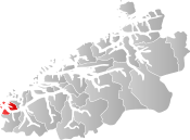 Sande within Møre og Romsdal | |||
| Coordinates: 62°15′30″N 05°25′53″E / 62.25833°N 5.43139°ECoordinates: 62°15′30″N 05°25′53″E / 62.25833°N 5.43139°E | |||
| Country | Norway | ||
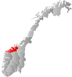
| County | Møre og Romsdal | ||
| District | Sunnmøre | ||
| Administrative centre | Larsnes | ||
| Government | |||
| • Mayor (2007) | Dag Vaagen (H) | ||
| Area | |||
| • Total | 93.21 km2 (35.99 sq mi) | ||
| • Land | 90.17 km2 (34.81 sq mi) | ||
| • Water | 3.04 km2 (1.17 sq mi) | ||
| Area rank | #385 in Norway | ||
| Population (2017) | |||
| • Total | 2,540 | ||
| • Rank | #291 in Norway | ||
| • Density | 28.2/km2 (73/sq mi) | ||
| • Change (10 years) | 0.6% | ||
| Demonym(s) | Sandeværing[1] | ||
| Time zone | UTC+01:00 (CET) | ||
| • Summer (DST) | UTC+02:00 (CEST) | ||
| ISO 3166 code | NO-1514 | ||
| Official language form | Nynorsk | ||
| Website |
www | ||

Sande is a municipality in Møre og Romsdal county, Norway. It is part of the Sunnmøre region. The administrative centre is the village of Larsnes on the island of Gurskøya. Other villages in Sande include Gursken, Sandshamn, Bringsinghaug, and Voksa.
The 93-square-kilometre (36 sq mi) municipality is the 385th largest by area out of the 422 municipalities in Norway. Sande is the 291st most populous municipality in Norway with a population of 2,540. The municipality's population density is 28.2 inhabitants per square kilometre (73/sq mi) and its population has increased by 0.6% over the last decade.[2]
General information
Sande was established as a municipality on 1 January 1867 when it was separated from the large Herøy Municipality. The initial population was 2,493. On 1 January 1873, a part of eastern Sande (with 362 residents) was transferred back to Herøy. On 1 January 1889, the Eksund area and the island of Ekø (population: 119) were transferred to Herøy Municipality.
On 1 January 1905, the eastern district of Sande was separated to form the separate municipality of Rovde. This left Sande with 2,221 residents. On 1 January 1964, the northern part of the municipality of Rovde (population: 562) plus three farms in the Gurskedalen valley (population: 25) were merged back with Sande (the southern part of Rovde was merged with Vanylven Municipality). The new Sande municipality had a population of 3,465. On 1 January 2002, the Åram area (population: 380) on the mainland was transferred from Sande to Vanylven Municipality.[3][4]
Name
The municipality (originally the parish) is named after the old Sande farm (Old Norse: Sandr), since the first church (Sande Church) was built there. The name is identical with the word sandr which means "sand" or "sandy beach". Before 1892, the name was written Sandø.[5]
Coat-of-arms
The coat-of-arms is from modern times. They were granted in 1987. The arms show a silver line buoy on a blue background. This symbol was chosen since it was historically used by fishermen in ocean and fjords around the island municipality.[6]
Churches
The Church of Norway has two parishes (sokn) within the municipality of Sande. It is part of the Søre Sunnmøre deanery in the Diocese of Møre.
| Parish (Sokn) | Church Name | Location of the Church | Year Built |
|---|---|---|---|
| Sande | Sande Church | Sande on Sandsøya | 1880 |
| Gursken | Gursken Church | Gursken | 1919 |
| Larsnes Chapel | Larsnes | 1989 |
Geography
Sande is composed of many islands including Sandsøya, Kvamsøya, Voksa, Riste, and part of Gurskøya (which is shared with neighboring Herøy). The island municipality sits north of the Rovdefjorden and east of the Vanylvsfjorden. The Haugsholmen Lighthouse sits in the southwest part of the municipality.
Government
All municipalities in Norway, including Sande, are responsible for primary education (through 10th grade), outpatient health services, senior citizen services, unemployment and other social services, zoning, economic development, and municipal roads. The municipality is governed by a municipal council of elected representatives, which in turn elect a mayor.
Municipal council
The municipal council (Kommunestyre) of Sande is made up of 21 representatives that are elected to four year terms. Currently, the party breakdown is as follows:[7]
| Party Name | Name in Norwegian | Number of representatives | |
|---|---|---|---|
| Labour Party | Arbeiderpartiet | 5 | |
| Progress Party | Framstegspartiet | 2 | |
| Conservative Party | Høgre | 7 | |
| Centre Party | Senterpartiet | 2 | |
| Liberal Party | Venstre | 1 | |
| Local Lists | Lokale lister | 4 | |
| Total number of members: | 21 | ||
Famous residents
- Jan Åge Fjørtoft, (born 1967)
- Bjartmar Gjerde, (born 1931)
- Tore Myklebust, (born 1990)
References
- ↑ "Navn på steder og personer: Innbyggjarnamn" (in Norwegian). Språkrådet. Retrieved 2015-12-01.
- ↑ Statistisk sentralbyrå (2017). "Table: 06913: Population 1 January and population changes during the calendar year (M)" (in Norwegian). Retrieved 2017-10-18.
- ↑ Jukvam, Dag (1999). "Historisk oversikt over endringer i kommune- og fylkesinndelingen" (PDF) (in Norwegian). Statistisk sentralbyrå.
- ↑ Statistisk sentralbyrå (2001). "1511 Vanylven. Population 1 January and population changes during the year. 1951-" (in Norwegian).
- ↑ Rygh, Oluf (1908). Norske gaardnavne: Romsdals amt (in Norwegian) (13 ed.). Kristiania, Norge: W. C. Fabritius & sønners bogtrikkeri. p. 18.
- ↑ "Møre og Romsdal fylke" (in Norwegian). Retrieved 2008-10-19.
- ↑ "Table: 04813: Members of the local councils, by party/electoral list at the Municipal Council election (M)" (in Norwegian). Statistics Norway. 2015.
External links
- Municipal fact sheet from Statistics Norway (in Norwegian)

