Aukra
| Aukra kommune | |||
|---|---|---|---|
| Municipality | |||
 View of the Ormen Lange facilities in Nyhamna | |||
| |||
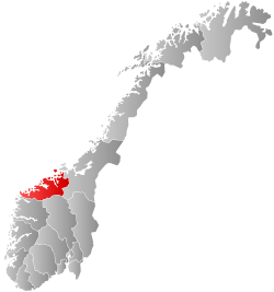
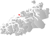 Aukra within Møre og Romsdal | |||
| Coordinates: 62°49′43″N 06°50′45″E / 62.82861°N 6.84583°ECoordinates: 62°49′43″N 06°50′45″E / 62.82861°N 6.84583°E | |||
| Country | Norway | ||
| County | Møre og Romsdal | ||
| District | Romsdal | ||
| Administrative centre | Aukra | ||
| Government | |||
| • Mayor (2007) | Bernhard Riksfjord (Ap) | ||
| Area | |||
| • Total | 59.08 km2 (22.81 sq mi) | ||
| • Land | 58.99 km2 (22.78 sq mi) | ||
| • Water | 0.09 km2 (0.03 sq mi) | ||
| Area rank | #408 in Norway | ||
| Population (2017) | |||
| • Total | 3,547 | ||
| • Rank | #245 in Norway | ||
| • Density | 60.1/km2 (156/sq mi) | ||
| • Change (10 years) | 12.9% | ||
| Demonym(s) |
Gossing Aukraværing[1] | ||
| Time zone | UTC+01:00 (CET) | ||
| • Summer (DST) | UTC+02:00 (CEST) | ||
| ISO 3166 code | NO-1547 | ||
| Official language form | Nynorsk | ||
| Website |
www | ||
Aukra is a village and municipality in Møre og Romsdal county, Norway. It is part of the region of Romsdalen. The administrative centre is the village of Falkhytta, which is part of the Aukrasanden urban area.
The municipality is made up of the island of Gossa as well as many small surrounding islands, plus a small area around Hollingen across the Julsundet strait on the Romsdal peninsula. Some of the main population centers include Hollingen, Aukrasanden, Varhaugvika, and Røssøyvågen. Nyhamna is a major industrial area in Aukra.
The 59-square-kilometre (23 sq mi) municipality is the 408th largest by area out of the 422 municipalities in Norway. Aukra is the 245th most populous municipality in Norway with a population of 3,547. The municipality's population density is 60.1 inhabitants per square kilometre (156/sq mi) and its population has increased by 12.9% over the last decade.[2]
General information
The municipality of Akerø was established on 1 January 1838 (see formannskapsdistrikt). In 1840, most of Akerø on the Romsdal peninsula was separated to form the municipality of Frænen. On 1 January 1867, the islands to the west of Gossa (population: 601) were separated to become the new Sandøy Municipality. On 1 January 1924, the southern part of the municipality (Otrøya and several other islands) were separated to form the new municipality of Sør-Aukra, and the remainder of the municipality was renamed Nord-Aukra. On 1 January 1964, the Mordal area of Nord-Aukra (population: 77) was transferred to Molde Municipality. On 1 January 1965, Nord- was dropped from the name of the municipality, so it was then just called Aukra.[3]
Name
The municipality (originally the parish) is named after the old Aukra farm (Old Norse: Aukrin), since the first church (Aukra Church) was built there. The first element is akr which means "field" or "acre" and the last element is vin which means "meadow" or "pasture". Before 1918, the name was written Akerø.[4]
Coat-of-arms
The coat-of-arms is from modern times. They were granted on 22 May 1987. The arms show two Bronze Age bracelets on a blue background. The bracelets are based on an archaeological finding in the area. The rings thus symbolize the long tradition of habitation in the area.[5]
Churches
The Church of Norway has one parish (sokn) within the municipality of Aukra. It is part of the Molde arch-deanery in the Diocese of Møre.
| Parish (Sokn) | Church Name | Location of the Church | Year Built |
|---|---|---|---|
| Aukra | Aukra Church | Aukrasanden | 1835 |
History
Aukra is the site of a shipwreck and rescue operation, when the cargo ship Rokta on 4 April 1938. The monument of Rokta is situated on Rindarøy island with a view of Galleskjæra where the Rokta sank.
Government
All municipalities in Norway, including Aukra, are responsible for primary education (through 10th grade), outpatient health services, senior citizen services, unemployment and other social services, zoning, economic development, and municipal roads. The municipality is governed by a municipal council of elected representatives, which in turn elect a mayor.
Municipal council
The municipal council (Kommunestyre) of Aukra is made up of 21 representatives that are elected to four year terms. Currently, the party breakdown is as follows:[6]
| Party Name | Name in Norwegian | Number of representatives | |
|---|---|---|---|
| Labour Party | Arbeiderpartiet | 7 | |
| Progress Party | Framstegspartiet | 1 | |
| Conservative Party | Høgre | 5 | |
| Christian Democratic Party | Kristelig Folkeparti | 3 | |
| Centre Party | Senterpartiet | 2 | |
| Liberal Party | Venstre | 2 | |
| Local Lists | Lokale lister | 1 | |
| Total number of members: | 21 | ||
Economy
The Nyhamna industrial area on the northeastern part of the island of Gossa in Aukra is the location from where the Langeled pipeline, transporting natural gas from the enormous Ormen Lange gas field to the United Kingdom, came onstream in 2007. Local politicians expect a lot from the land-based production facility. Especially the taxes, which in their opinion, far exceeds the externalities put on the inhabitants of Gossa.
Aukra Auto runs the bus service on the island of Gossa.
References
- ↑ "Navn på steder og personer: Innbyggjarnamn" (in Norwegian). Språkrådet. Retrieved 2015-12-01.
- ↑ Statistisk sentralbyrå (2017). "Table: 06913: Population 1 January and population changes during the calendar year (M)" (in Norwegian). Retrieved 2017-10-08.
- ↑ Jukvam, Dag (1999). "Historisk oversikt over endringer i kommune- og fylkesinndelingen" (PDF) (in Norwegian). Statistisk sentralbyrå.
- ↑ Rygh, Oluf (1908). Norske gaardnavne: Romsdals amt (in Norwegian) (13 ed.). Kristiania, Norge: W. C. Fabritius & sønners bogtrikkeri. p. 300.
- ↑ Norske Kommunevåpen (1990). "Nye kommunevåbener i Norden". Retrieved 18 October 2008.
- ↑ "Table: 04813: Members of the local councils, by party/electoral list at the Municipal Council election (M)" (in Norwegian). Statistics Norway. 2015.
| Wikimedia Commons has media related to Aukra. |
External links
- Municipal fact sheet from Statistics Norway (in Norwegian)
