Tingvoll
| Tingvoll kommune | |||
|---|---|---|---|
| Municipality | |||
 View of the Tingvollfjorden | |||
| |||
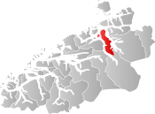 Tingvoll within Møre og Romsdal | |||
| Coordinates: 62°57′13″N 08°13′5″E / 62.95361°N 8.21806°ECoordinates: 62°57′13″N 08°13′5″E / 62.95361°N 8.21806°E | |||
| Country | Norway | ||
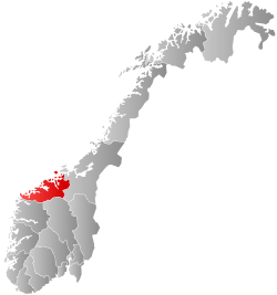
| County | Møre og Romsdal | ||
| District | Nordmøre | ||
| Administrative centre | Tingvollvågen | ||
| Government | |||
| • Mayor (2017) | Per Kåre (Ap) | ||
| Area | |||
| • Total | 336.76 km2 (130.02 sq mi) | ||
| • Land | 321.61 km2 (124.17 sq mi) | ||
| • Water | 15.15 km2 (5.85 sq mi) | ||
| Area rank | #262 in Norway | ||
| Population (2017) | |||
| • Total | 3,109 | ||
| • Rank | #260 in Norway | ||
| • Density | 9.7/km2 (25/sq mi) | ||
| • Change (10 years) | 0.8% | ||
| Demonym(s) | Tingvollgjelding[1] | ||
| Time zone | UTC+01:00 (CET) | ||
| • Summer (DST) | UTC+02:00 (CEST) | ||
| ISO 3166 code | NO-1560 | ||
| Official language form | Neutral | ||
| Website |
www | ||

Tingvoll is a municipality in Møre og Romsdal county, Norway. It is part of the Nordmøre region. The administrative centre is the village of Tingvollvågen. Other villages include Meisingset, Kvisvik, and Torjulvågen. The municipality covers a peninsula on the mainland as well as a few surrounding islands. Norwegian National Road 70 and European route E39 both run through the municipality.
The 337-square-kilometre (130 sq mi) municipality is the 262nd largest by area out of the 422 municipalities in Norway. Tingvoll is also the 260th most populous municipality in Norway with a population of 3,109. The municipality's population density is 9.7 inhabitants per square kilometre (25/sq mi) and its population has increased by 0.8% over the last decade.[2]
General information


The parish of Tingvoll was established as a municipality on 1 January 1838 (see formannskapsdistrikt). On 1 January 1866, the northern part of the municipality (population: 1,222) was separated to form the new municipality of Straumsnes. On 1 January 1874, a part of Stangvik municipality (population: 61) was transferred to Tingvoll. On 1 January 1877, the Tiltereidet and Meisalstranden part of Tingvoll (population: 212) on the west side of the Sunndalsfjorden was transferred to Nesset Municipality. On 1 January 1880, the Torjulvågen area of Halsa Municipality (population: 240) was transferred to Tingvoll. On 1 January 1890, the Rausand area of Tingvoll (population: 101) was transferred to Nesset Municipality.
During the 1960s, there were many municipal mergers across Norway due to the work of the Schei Committee. On 1 January 1964, the municipality of Straumsnes (population: 1,160) and the part of Frei Municipality on the island of Aspøya (population: 147) were merged into Tingvoll. On 1 January 1965, the part of Tingvoll located on the western side of the Tingvollfjorden (population: 778) was transferred to Gjemnes Municipality and the Åsprong-Sandnes area near Meisingset (population: 26) was transferred from Stangvik municipality to Tingvoll.[3]
Name
The municipality (originally the parish) is named after the old Tingvoll farm (Old Norse: Þingvǫllr), since the first church (Tingvoll Church) was built there. The first element is þing which means "thing" or "assembly" and the last element is vǫllr which means "meadow" (so Tingvoll means "meeting place"). Before 1918, the name was written Tingvold.[4]
Coat-of-arms
The coat-of-arms is from modern times. They were granted on 7 September 1984. The arms show five green oak leaves on a gray background. Each leaf represents one of the five main villages in the municipality: Tingvollvågen, Straumsnes, Gyl, Torjulvågen, and Meisingset. The oak leaves are chosen as a symbol for the municipality as Norway's northernmost oak forests can be found in the municipality.[5]
Churches
The Church of Norway has two parishes (sokn) within the municipality of Tingvoll. It is part of the Indre Nordmøre deanery in the Diocese of Møre.
| Parish (Sokn) | Church Name | Location of the Church | Year Built |
|---|---|---|---|
| Tingvoll | Tingvoll Church | Tingvollvågen | c. 1180 |
| Straumsnes | Straumsnes Church | Straumsnes | 1864 |
| Langøy Chapel | Langøya | 1935 |
History
Eight or nine centuries ago, Tingvoll was the site of the Nordmøre Ting. There was a flat field there, which in Norwegian is called voll. It was here that meetings were held, called ting, thus the name Tingvoll. The name has the same origin as the Scottish town of Dingwall, the parliament of the Isle of Man Tynwald, the English town of Thingwall (which Norwegian Vikings colonised[6]) Wirral Peninsula, and Þingvellir in Iceland.
Tingvoll Church, also known as the Nordmøre Cathedral (Nordmørsdomen), was built around 1180 at the village of Tingvollvågen.
Government
All municipalities in Norway, including Tingvoll, are responsible for primary education (through 10th grade), outpatient health services, senior citizen services, unemployment and other social services, zoning, economic development, and municipal roads. The municipality is governed by a municipal council of elected representatives, which in turn elect a mayor.
Municipal council
The municipal council (Kommunestyre) of Tingvoll is made up of 25 representatives that are elected to four year terms. Currently, the party breakdown is as follows:[7]
| Party Name | Name in Norwegian | Number of representatives | |
|---|---|---|---|
| Labour Party | Arbeiderpartiet | 7 | |
| Progress Party | Fremskrittspartiet | 3 | |
| Conservative Party | Høyre | 2 | |
| Christian Democratic Party | Kristelig Folkeparti | 5 | |
| Green Party | Miljøpartiet De Grønne | 1 | |
| Centre Party | Senterpartiet | 6 | |
| Liberal Party | Venstre | 1 | |
| Total number of members: | 25 | ||
Geography
Tingvoll Municipality is a peninsula surrounded by the Tingvollfjorden, Vinjefjorden, Freifjorden, Halsafjorden, and Trongfjorden. The municipality also includes some islands including Aspøya. The Bergsøysund Bridge (part of the European route E39 highway) connects Aspøya to the neighboring island of Bergsøya to the west.
Eco-municipality
Tingvoll has been a self declared Eco-municipality since 1990, when the municipal council (Kommunestyre) signed the declaration. The movement of eco-municipalities started among rural municipalities in Finland and later in Sweden in the 1980s. The idea was to inspire local economic and cultural development within a sustainable framework. In Tingvoll, the work started with a program for environmental education of the members of the council and the executive officers. The schools adapted national programs for environmental education.
A main part of the early years of eco-municipality, was the program for composting waste from the households. A new type of insulated bin was developed (Hagakompen) to assure composting could handle meat and fish waste, and work well in wintertime as well.
The Bioforsk Organic Food and Farming Division is located at Tingvoll.
Sister cities
Tingvoll has sister city agreements with the following places:
References
- ↑ "Navn på steder og personer: Innbyggjarnamn" (in Norwegian). Språkrådet. Retrieved 2015-12-01.
- ↑ Statistisk sentralbyrå (2017). "Table: 06913: Population 1 January and population changes during the calendar year (M)" (in Norwegian). Retrieved 2017-10-19.
- ↑ Jukvam, Dag (1999). "Historisk oversikt over endringer i kommune- og fylkesinndelingen" (PDF) (in Norwegian). Statistisk sentralbyrå.
- ↑ Rygh, Oluf (1908). Norske gaardnavne: Romsdals amt (in Norwegian) (13 ed.). Kristiania, Norge: W. C. Fabritius & sønners bogtrikkeri. p. 370.
- ↑ "Civic heraldry of Norway - Norske Kommunevåpen". Heraldry of the World. Retrieved 2017-10-19.
- ↑ Harding, Steve. "Wirral & West Lancashire Viking Research Page". Retrieved 2017-10-19.
- ↑ "Table: 04813: Members of the local councils, by party/electoral list at the Municipal Council election (M)" (in Norwegian). Statistics Norway. 2015.
| Wikimedia Commons has media related to Tingvoll. |
| Wikivoyage has a travel guide for Møre og Romsdal. |
External links
- Municipal fact sheet from Statistics Norway (in Norwegian)
- Regional tourist information