Vestal's Gap Road and Lanesville Historic District
|
Vestal's Gap Road and Lanesville Historic District | |
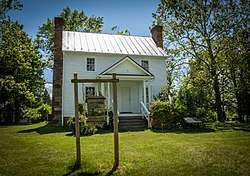 frame house in Lanesville Historic District | |
   | |
| Location | 21544 Cascades Pkwy., Sterling, Virginia |
|---|---|
| Coordinates | 39°1′3″N 77°24′11″W / 39.01750°N 77.40306°WCoordinates: 39°1′3″N 77°24′11″W / 39.01750°N 77.40306°W |
| Area | 7.5 acres (3.0 ha) |
| Built | c. 1807 |
| Architectural style | Early Republic |
| NRHP reference # | 99001722[1] |
| VLR # | 053-0007 |
| Significant dates | |
| Added to NRHP | February 3, 2000 |
| Designated VLR | September 15, 1999[2] |
Vestal's Gap Road and Lanesville Historic District is a national historic district located in Claude Moore Park at Sterling, Loudoun County, Virginia. It encompasses 1 contributing building and 1 contributing structure. They are "Lanesville," a two-story side-gabled frame house on a solid stone-rubble foundation built about 1807, and a section of the former Vestal's Gap Road, an 18th-century road.[3]
It was listed on the National Register of Historic Places in 2000.[1]
 Barn
Barn Road midpoint
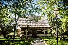 Log cabin
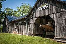 Workhorse museum
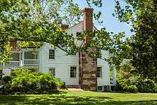 House
House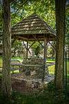 Well
Well
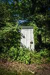 Outhouse
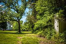 Road
Road
References
| Wikimedia Commons has media related to Vestal's Gap Road and Lanesville Historic District. |
- 1 2 National Park Service (2010-07-09). "National Register Information System". National Register of Historic Places. National Park Service.
- ↑ "Virginia Landmarks Register". Virginia Department of Historic Resources. Archived from the original on 21 September 2013. Retrieved 5 June 2013.
- ↑ Kerri Culhane (June 1999). "National Register of Historic Places Inventory/Nomination: Vestal's Gap Road and Lanesville Historic District" (PDF). Virginia Department of Historic Resources. and Accompanying photo and Accompanying map


This article is issued from
Wikipedia.
The text is licensed under Creative Commons - Attribution - Sharealike.
Additional terms may apply for the media files.