Utah County, Utah
| Utah County, Utah | |
|---|---|
_at_Historic_Utah_County_Courthouse%2C_Jul_15.jpg) Historic Utah County Courthouse | |
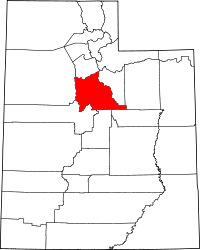 Location in the U.S. state of Utah | |
 Utah's location in the U.S. | |
| Founded | 1850 |
| Named for | Ute Tribe |
| Seat | Provo |
| Largest city | Provo |
| Area | |
| • Total | 2,144 sq mi (5,553 km2) |
| • Land | 2,003 sq mi (5,188 km2) |
| • Water | 141 sq mi (365 km2), 6.6% |
| Population (est.) | |
| • (2017) | 606,425[1] |
| • Density | 303/sq mi (117/km2) |
| Congressional districts | 3rd, 4th |
| Time zone | Mountain: UTC−7/−6 |
| Website |
www |
Utah County is a county in the U.S. state of Utah. As of the 2010 census, the population was 516,564,[2] thus making it Utah's second-most populous county. The county seat and largest city is Provo,[3] which is the state's third-largest city. The county was created in 1850[4] and named for the Spanish name (Yuta) for the Ute Indians.
Utah County is part of the Provo-Orem, UT Metropolitan Statistical Area as well as the Salt Lake City-Provo-Orem, UT Combined Statistical Area.
In 2010, the center of population of Utah was in Utah County, in the city of Saratoga Springs.[5]
Utah County is one of seven counties in the United States to have the same name as its state (the other six are Arkansas, Hawaii, Idaho, Iowa, New York, and Oklahoma Counties).[6]
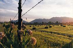
Geography
According to the U.S. Census Bureau, the county has an area of 2,144 square miles (5,550 km2), of which 2,003 square miles (5,190 km2) is land and 141 square miles (370 km2) (6.6%) is water.[7]
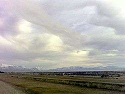
Utah Valley lies at the center of the county, lined by the mountains of the Wasatch Range on the east. Utah Lake occupies a large part of the valley. The elevation ranges from 4,487 feet (1,368 m) above sea level at the lake to 11,928 feet (3,636 m) at the peak of Mount Nebo.
Adjacent counties
- Salt Lake (north)
- Tooele (west)
- Wasatch (east)
- Juab (southwest)
- Sanpete (south)
- Carbon (southeast)
- Duchesne (east)
National protected areas
Demographics
| Historical population | |||
|---|---|---|---|
| Census | Pop. | %± | |
| 1850 | 2,026 | — | |
| 1860 | 8,248 | 307.1% | |
| 1870 | 12,203 | 48.0% | |
| 1880 | 17,973 | 47.3% | |
| 1890 | 23,768 | 32.2% | |
| 1900 | 32,456 | 36.6% | |
| 1910 | 37,942 | 16.9% | |
| 1920 | 40,792 | 7.5% | |
| 1930 | 49,021 | 20.2% | |
| 1940 | 57,382 | 17.1% | |
| 1950 | 81,912 | 42.7% | |
| 1960 | 106,991 | 30.6% | |
| 1970 | 137,776 | 28.8% | |
| 1980 | 218,106 | 58.3% | |
| 1990 | 263,590 | 20.9% | |
| 2000 | 368,540 | 39.8% | |
| 2010 | 516,564 | 40.2% | |
| Est. 2017 | 606,425 | [8] | 17.4% |
| U.S. Decennial Census[9] 1790–1960[10] 1900–1990[11] 1990–2000[12] 2010–2014[2] | |||
As of the census[13] of 2010, there were 516,564 people, 140,602 households, and 114,350 families residing in the county. The population density was 259 people per square mile (100/km²). There were 148,350 housing units, at an average density of 74 per square mile (29/km²). The county's racial makeup was 89.4% White, 0.5% Black or African American, 0.6% American Indian or Alaska Native, 1.4% Asian, 0.8% Native Hawaiian or other Pacific Islander, 4.6% some other race, and 2.7% from two or more races. 10.8% of the population were Hispanic or Latino of any race.
There were 140,602 households, out of which 47.7% had children under the age of 18 living with them, 69.9% were headed by married couples living together, 8.0% had a female householder with no husband present, and 18.7% were non-families. 11.6% of all households were made up of individuals, and 4.4% were someone living alone who was 65 years of age or older. The average household size was 3.57, and the average family size was 3.88.
The county's population was spread out with 35.2% under the age of 18, 15.8% from 18 to 24, 28% from 25 to 44, 14.5% from 45 to 64, and 6.5% who were 65 years of age or older. The median age was 24.6 years. For every 100 females, there were 100.3 males. For every 100 females age 18 and over, there were 97.7 males.
At the 2000 census, the median income for a household in the county was $45,833, and the median income for a family was $50,196. Males had a median income of $37,878 versus $22,656 for females. The per capita income for the county was $15,557. About 6.80% of families and 12.00% of the population were below the poverty line, including 8.40% of those under age 18 and 4.80% of those age 65 or over.
The five most reported ancestries in Utah County are:[14]
Religion
88.1% Church of Jesus Christ of Latter Day Saints
10.1% Non Religious
1.8% Other
[15]
Government
The government is an elected county commission made up of three commissioners. Utah County commissioners are elected at-large. Other elected officials include the county sheriff, the county clerk, and the county attorney.
Utah County's growth was recognized by the state legislature in 2011 by adding one new state Senate seat and two House district seats.[16]
Social issues
Utah County saw high rates of opioid and other prescription drug addiction from the mid-2000s onwards, foreshadowing the national opioid crisis. The 2008 documentary Happy Valley examined the problem.[17]
Giving USA, which researches and reports on charitable giving in the US, named Utah County as one of the three most generous counties in philanthropic donations, alongside San Juan County, Utah and Madison County, Idaho.[18]
Infrastructure
The I-15 CORE project added multiple lanes on Interstate 15 through most of Utah County. This expanded 24 miles (39 km) of freeway and was completed in 2012.[19]
Politics
Utah County has been referred to as "the most Republican county in the most Republican state in the United States."[20] It has only supported a Democrat for president nine times since statehood, and has not supported a Democrat for president since 1964.
In the 1992 presidential election, George H. W. Bush received the most votes and Bill Clinton was third in votes received. In the 2004 presidential election, 85.99% voted for George W. Bush.[21] In the 2008 U.S. presidential election, the county voted for John McCain by a 58.9% margin over Barack Obama, compared to McCain winning by 28.1% statewide.[22] Eight other Utah counties voted more strongly in favor of McCain.[23] In the 2012 election, Mitt Romney received 88.32% of the vote. In the 2016 election, it gave a slim majority of the vote to Donald Trump, and nearly 30% of the vote to independent candidate Evan McMullin, who outperformed Hillary Clinton in the county. This was McMullin's largest share of the vote in any county in Utah and his second best nationwide after Madison County, Idaho.
| Year | Republican | Democratic | Third parties |
|---|---|---|---|
| 2016 | 50.2% 102,182 | 14.0% 28,522 | 35.8% 72,938 |
| 2012 | 88.3% 156,950 | 9.7% 17,281 | 2.0% 3,482 |
| 2008 | 77.7% 122,224 | 18.8% 29,567 | 3.5% 5,488 |
| 2004 | 86.0% 128,269 | 11.6% 17,357 | 2.4% 3,547 |
| 2000 | 81.7% 98,255 | 13.7% 16,445 | 4.6% 5,556 |
| 1996 | 71.1% 69,653 | 18.7% 18,291 | 10.3% 10,087 |
| 1992 | 56.8% 61,398 | 13.0% 14,090 | 30.2% 32,690 |
| 1988 | 77.2% 68,134 | 21.0% 18,533 | 1.8% 1,560 |
| 1984 | 82.6% 72,284 | 16.9% 14,801 | 0.5% 419 |
| 1980 | 83.4% 71,859 | 14.1% 12,166 | 2.4% 2,096 |
| 1976 | 69.5% 49,328 | 25.8% 18,327 | 4.7% 3,338 |
| 1972 | 70.9% 42,179 | 18.2% 10,828 | 10.9% 6,453 |
| 1968 | 59.0% 29,226 | 33.6% 16,629 | 7.4% 3,673 |
| 1964 | 46.6% 20,912 | 53.4% 23,936 | |
| 1960 | 54.0% 23,057 | 46.0% 19,626 | 0.1% 25 |
| 1956 | 66.6% 25,371 | 33.4% 12,747 | |
| 1952 | 57.7% 20,913 | 42.3% 15,327 | |
| 1948 | 44.8% 13,395 | 54.2% 16,191 | 1.0% 300 |
| 1944 | 38.7% 9,946 | 61.1% 15,722 | 0.2% 45 |
| 1940 | 36.5% 8,740 | 63.3% 15,168 | 0.2% 48 |
| 1936 | 29.8% 6,173 | 69.5% 14,387 | 0.7% 135 |
| 1932 | 38.7% 7,953 | 59.1% 12,140 | 2.2% 443 |
| 1928 | 52.2% 8,771 | 47.3% 7,955 | 0.5% 81 |
| 1924 | 46.3% 6,946 | 34.8% 5,226 | 18.9% 2,838 |
| 1920 | 53.3% 7,752 | 43.9% 6,377 | 2.8% 403 |
| 1916 | 37.5% 5,201 | 59.3% 8,235 | 3.3% 451 |
| 1912 | 35.5% 4,185 | 39.3% 4,636 | 25.3% 2,986 |
| 1908 | 54.8% 6,373 | 42.9% 4,984 | 2.3% 269 |
| 1904 | 59.2% 6,490 | 38.7% 4,243 | 2.2% 239 |
| 1900 | 51.0% 5,698 | 48.2% 5,391 | 0.8% 90 |
| 1896 | 21.7% 2,039 | 78.3% 7,375 |
Utah County is split between two congressional districts. Most of the county is in the 3rd District, represented by Republican John Curtis. The northern portion is in the 4th District, represented by Republican Mia Love.
The county's Republican bent runs right through state and local politics. All six state senators representing the county, as well as all 12 state representatives, are Republicans.
Education
Utah County has three school districts. They are Alpine, Provo, and Nebo.[25]
It also has two universities: Brigham Young University and Utah Valley University. The county also has the Mountainland Technical College.
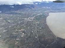
Communities
.jpg)
Cities
Towns
Census-designated places
Unincorporated communities
In popular culture
- The 2003 book Under the Banner of Heaven written by Jon Krakauer discusses locations throughout Utah County.
- The 1984 film Footloose was filmed at various locations in Utah County: American Fork, Lehi, Orem, Payson, and Provo.
See also
References
- ↑ Bureau, U.S. Census. "American FactFinder - Community Facts". factfinder.census.gov.
- 1 2 "State & County QuickFacts". United States Census Bureau. Retrieved December 30, 2013.
- ↑ "Find a County". National Association of Counties. Retrieved 2011-06-07.
- ↑ "Utah: Individual County Chronologies". Utah Atlas of Historical County Boundaries. The Newberry Library. 2008. Retrieved June 26, 2015.
- ↑ "Centers of Population by State: 2010". United States Census Bureau. Retrieved May 5, 2014.
- ↑ Joseph Nathan Kane; Charles Curry Aiken (2005). The American Counties: Origins of County Names, Dates of Creation, and Population Data, 1950-2000. Scarecrow Press. ISBN 978-0-8108-5036-1.
- ↑ "2010 Census Gazetteer Files". United States Census Bureau. August 22, 2012. Retrieved June 26, 2015.
- ↑ "Population and Housing Unit Estimates". Retrieved June 9, 2017.
- ↑ "U.S. Decennial Census". United States Census Bureau. Retrieved December 30, 2013.
- ↑ "Historical Census Browser". University of Virginia Library. Retrieved December 30, 2013.
- ↑ "Population of Counties by Decennial Census: 1900 to 1990". United States Census Bureau. Retrieved December 30, 2013.
- ↑ "Census 2000 PHC-T-4. Ranking Tables for Counties: 1990 and 2000" (PDF). United States Census Bureau. Retrieved December 30, 2013.
- ↑ "American FactFinder". United States Census Bureau. Retrieved 2011-05-14.
- ↑ "Utah County, Utah, Ancestry & Family History". ePodunk Inc. Retrieved 19 October 2012.
- ↑ "Utah County, Utah (UT) Religion Statistics Profile - Provo, Orem, Pleasant Grove, American Fork, Springville". City-data.com. Retrieved 19 October 2012.
- ↑ Hesterman, Billy. "Lawmakers say Utah County did well in redistricting process". Daily Herald. Retrieved October 19, 2011.
- ↑ "Happy Valley (2008)". Amazon.com.
- ↑ Giving USA 2003 (PDF) (Report). AAFRC Trust for Philanthropy (www.afpnet.org).
- ↑ "New changes on I-15 in Utah County". Retrieved October 28, 2011.
- ↑ Krakauer, Jon (2003). Under the Banner of Heaven. New York: Doubleday. p. 78.
- ↑ "Utah County General Election, Official Results". UtahCounty.Gov, the Official Website of Utah County Government (http://www.utahcounty.gov). 2 November 2004.
- ↑ "U.S. Election Atlas". United States Presidential Election Results. David Leip.
- ↑ "State of Utah County Election Results". NPR. 21 November 2008. Archived from the original on February 18, 2012.
- ↑ Leip, David. "Dave Leip's Atlas of U.S. Presidential Elections". uselectionatlas.org. Retrieved 2018-03-31.
- ↑ "UTAH SCHOOL DISTRICTS and CHARTER SCHOOLS" (PDF). Utah State Office of Education. 25 July 2012. Retrieved 19 October 2012.
External links
| Wikimedia Commons has media related to Utah County, Utah. |
- Utah County official website
- Utah County Sheriff's Office

Places adjacent to Utah County, Utah | |
|---|---|
Municipalities and communities of Utah County, Utah, United States | ||
|---|---|---|
| Cities | | |
| Towns | ||
| CDPs | ||
| Unincorporated communities | ||
| Indian reservation | ||
| Ghost towns | ||
| Footnotes | ‡This populated place also has portions in an adjacent county or counties | |