Sevier County, Utah
| Sevier County, Utah | |
|---|---|
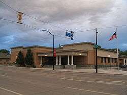 Sevier County Courthouse in Richfield | |
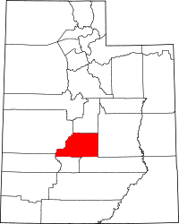 Location in the U.S. state of Utah | |
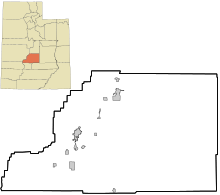
 Utah's location in the U.S. | |
| 38°45′N 111°48′W / 38.75°N 111.80°WCoordinates: 38°45′N 111°48′W / 38.75°N 111.80°W | |
| Founded | 1865 |
| Named for | The Sevier River |
| Seat | Richfield |
| Largest city | Richfield |
| Area | |
| • Total | 1,918 sq mi (4,968 km2) |
| • Land | 1,911 sq mi (4,949 km2) |
| • Water | 7.8 sq mi (20 km2), 0.4% |
| Population (est.) | |
| • (2017) | 21,316[1] |
| • Density | 11/sq mi (4/km2) |
| Congressional district | 2nd |
| Time zone | Mountain: UTC−7/−6 |
| Website |
www |
Sevier County (/sɛˈvɪər/ sə-VEER) is a county located in the central Utah, United States. As of the 2010 census, the population was 20,802.[2] Its county seat and largest city is Richfield.[3] The county was formed on January 16, 1865, as a split off from Sanpete County to the north. It was named for the Sevier River, which winding path forms its western boundary.[4]
History
Indigenous peoples migrated into this area by 10,000 years ago, developing different cultures. The Fremont culture of Native Americans occupied the area that is now Sevier County from about 2000 to 700 years before the present.[5] The Clear Creek site contains numerous native petroglyphs from that period.
In Utah, the Numic- (or Shoshonean) speaking peoples of the Uto-Aztecan language family evolved into four distinct groups in the historic period: the Northern Shoshone, Goshute or Western Shoshone, Southern Paiute, and Ute peoples. The central and eastern sections of this territory were occupied primarily by various bands of the Ute.[6] Historic tribes occupied the territory of Utah at the time of the first European contact by Spanish missionaries, and later settlement by European Americans in the 19th century.
The first non-Native Americans to see the Sevier River were most likely Catholic fathers Silvestre Vélez de Escalante and Francisco Atanasio Domínguez, missionaries who passed through on their expedition to California in 1776. The Old Spanish Trail (trade route) was the route they mapped. Over the course of the next hundred years the trail was used by fur trappers, hunters, government officials, and many more. This carried many people through what was later organized as Sevier County.
Permanent European-American colonization of this area is considered to have begun with the founding of Richfield within the present-day county boundaries. The area was colonized by the Mormon settlers on 15 June 1864. Much of the area was populated by new immigrants who were Mormon converts from Scandinavian countries. Because of the growth in this small community, the people officially created Sevier County in early 1865.[7]
According to Benjamin Edelman in "Red Light States: Who Buys Online Adult Entertainment?," published in 2009 in the Journal of Economic Perspectives, Sevier County has the highest rate of online pornography usage in the United States.[8]
Geography
According to the U.S. Census Bureau, the county has a total area of 1,918 square miles (4,970 km2), of which 1,911 square miles (4,950 km2) is land and 7.8 square miles (20 km2) (0.4%) is water.[9]
Adjacent counties
- Sanpete County (north)
- Emery County (east)
- Piute County (south)
- Wayne County (south)
- Millard County (west)
- Beaver County (west)
National protected areas
- Capitol Reef National Park (part)
- Fishlake National Forest (part)
- Manti-La Sal National Forest (part)
Major highways
Demographics
| Historical population | |||
|---|---|---|---|
| Census | Pop. | %± | |
| 1870 | 19 | — | |
| 1880 | 4,457 | 23,357.9% | |
| 1890 | 6,199 | 39.1% | |
| 1900 | 8,451 | 36.3% | |
| 1910 | 9,775 | 15.7% | |
| 1920 | 11,281 | 15.4% | |
| 1930 | 11,199 | −0.7% | |
| 1940 | 12,112 | 8.2% | |
| 1950 | 12,072 | −0.3% | |
| 1960 | 10,565 | −12.5% | |
| 1970 | 10,103 | −4.4% | |
| 1980 | 14,727 | 45.8% | |
| 1990 | 15,431 | 4.8% | |
| 2000 | 18,842 | 22.1% | |
| 2010 | 20,802 | 10.4% | |
| Est. 2017 | 21,316 | [10] | 2.5% |
| U.S. Decennial Census[11] 1790–1960[12] 1900–1990[13] 1990–2000[14] 2010–2014[2] | |||
As of the census[15] of 2000, there were 18,842 people, 6,081 households, and 4,907 families residing in the county. The population density was 10 people per square mile (4/km2). There were 7,016 housing units at an average density of 4 per square mile (1/km2). The racial makeup of the county was 95.61% White, 0.27% Black or African American, 2.00% Native American, 0.26% Asian, 0.09% Pacific Islander, 0.79% from other races, and 0.99% from two or more races. 2.55% of the population were Hispanic or Latino of any race.
There were 6,081 households out of which 43.00% had children under the age of 18 living with them, 70.10% were married couples living together, 7.80% had a female householder with no husband present, and 19.30% were non-families. Of the 6,081 households in Sevier County, 155 are unmarried partner households: 137 heterosexual, 11 same-sex male, and 7 same-sex female. 17.60% of all households were made up of individuals and 9.40% had someone living alone who was 65 years of age or older. The average household size was 3.03 and the average family size was 3.44.
In the county, the population was spread out with 34.50% under the age of 18, 10.10% from 18 to 24, 22.90% from 25 to 44, 19.70% from 45 to 64, and 12.90% who were 65 years of age or older. The median age was 30 years. For every 100 females there were 99.20 males. For every 100 females age 18 and over, there were 97.40 males.
The median income for a household in the county was $35,822, and the median income for a family was $40,110. Males had a median income of $32,632 versus $19,228 for females. The per capita income for the county was $14,180. About 8.30% of families and 10.80% of the population were below the poverty line, including 12.80% of those under age 18 and 8.50% of those age 65 or over.
Features
Interstate 70 runs through the county. As Richfield is about halfway between the major cities of Los Angeles, California and Denver, Colorado, it has built a hospitality industry, with motels, restaurants, etc. serving travelers on their way through the area.
Fremont Indian State Park is found in the Clear Creek Canyon, adjacent to I-70. It is noted for its archaeological remains from the ancient Native American Fremont culture. It has a museum displaying artifacts found at the site.
Politics
| Year | Republican | Democratic | Third parties |
|---|---|---|---|
| 2016 | 77.9% 6,740 | 8.0% 695 | 14.1% 1,219 |
| 2012 | 89.3% 7,207 | 9.2% 738 | 1.5% 124 |
| 2008 | 79.4% 6,394 | 16.9% 1,359 | 3.8% 305 |
| 2004 | 86.3% 6,597 | 12.0% 920 | 1.6% 124 |
| 2000 | 81.4% 5,763 | 14.8% 1,046 | 3.8% 268 |
| 1996 | 65.8% 4,031 | 21.7% 1,327 | 12.6% 769 |
| 1992 | 50.5% 3,160 | 16.6% 1,039 | 32.9% 2,059 |
| 1988 | 76.3% 4,747 | 22.6% 1,403 | 1.1% 71 |
| 1984 | 83.5% 5,736 | 15.6% 1,072 | 0.9% 62 |
| 1980 | 80.8% 5,614 | 16.0% 1,112 | 3.2% 223 |
| 1976 | 65.2% 3,686 | 27.7% 1,564 | 7.1% 400 |
| 1972 | 73.0% 3,700 | 16.2% 820 | 10.9% 551 |
| 1968 | 67.2% 3,190 | 24.6% 1,167 | 8.2% 387 |
| 1964 | 57.3% 2,617 | 42.7% 1,948 | |
| 1960 | 65.2% 3,166 | 34.8% 1,690 | 0.0% 1 |
| 1956 | 74.7% 3,646 | 25.3% 1,232 | |
| 1952 | 73.4% 3,996 | 26.6% 1,445 | |
| 1948 | 58.8% 2,791 | 40.9% 1,943 | 0.3% 16 |
| 1944 | 52.8% 2,345 | 47.1% 2,095 | 0.1% 5 |
| 1940 | 51.7% 2,703 | 48.2% 2,521 | 0.1% 4 |
| 1936 | 39.8% 1,899 | 59.1% 2,816 | 1.1% 52 |
| 1932 | 48.4% 2,225 | 50.1% 2,303 | 1.4% 65 |
| 1928 | 63.1% 2,424 | 36.4% 1,399 | 0.4% 17 |
| 1924 | 56.4% 2,111 | 32.1% 1,201 | 11.4% 428 |
| 1920 | 62.8% 2,506 | 35.7% 1,425 | 1.4% 57 |
| 1916 | 44.8% 1,720 | 53.4% 2,052 | 1.8% 68 |
| 1912 | 41.9% 1,452 | 26.4% 915 | 31.7% 1,098 |
| 1908 | 54.9% 1,780 | 39.3% 1,272 | 5.8% 188 |
| 1904 | 59.1% 1,725 | 31.9% 930 | 9.0% 264 |
| 1900 | 54.8% 1,581 | 43.7% 1,261 | 1.5% 42 |
| 1896 | 21.1% 497 | 78.9% 1,858 |
Communities
See also
References
- ↑ https://factfinder.census.gov/faces/nav/jsf/pages/community_facts.xhtml?src=bkmk
- 1 2 "State & County QuickFacts". United States Census Bureau. Retrieved December 29, 2013.
- ↑ "Find a County". National Association of Counties. Retrieved June 7, 2011.
- ↑ Van Cott, J. W., 1990, Utah Place Names, ISBN 0-87480-345-4
- ↑ Snow, Dean R. (2009). Archaeology of Native North America. Prentice Hall ISBN 0-13-615686-X.
- ↑ David Rich Lewis, "Native Americans in Utah", Utah History Encyclopedia; accessed 6 December 2016
- ↑ Bishop, M. Guy. A History of Sevier County. Salt Lake City: Utah State Historical Society, 1997.
- ↑ Benjamin Edelman, "Red Light States: Who Buys Online Adult Entertainment?," Journal of Economic Perspectives, Volume 23, Number 1— Winter 2009; accessed 6 December 2016
- ↑ "2010 Census Gazetteer Files". United States Census Bureau. August 22, 2012. Retrieved June 25, 2015.
- ↑ "Population and Housing Unit Estimates". Retrieved June 9, 2017.
- ↑ "U.S. Decennial Census". United States Census Bureau. Retrieved June 25, 2015.
- ↑ "Historical Census Browser". University of Virginia Library. Retrieved June 25, 2015.
- ↑ Forstall, Richard L., ed. (June 25, 1995). "Population of Counties by Decennial Census: 1900 to 1990". United States Census Bureau. Retrieved March 27, 2015.
- ↑ "Census 2000 PHC-T-4. Ranking Tables for Counties: 1990 and 2000" (PDF). United States Census Bureau. April 2, 2001. Retrieved June 25, 2015.
- ↑ "American FactFinder". United States Census Bureau. Retrieved May 14, 2011.
- ↑ Leip, David. "Dave Leip's Atlas of U.S. Presidential Elections". uselectionatlas.org. Retrieved 2018-03-31.
External links

- Official website
Places adjacent to Sevier County, Utah | |
|---|---|
Municipalities and communities of Sevier County, Utah, United States | ||
|---|---|---|
| Cities | | |
| Towns | ||
| Unincorporated communities | ||
| Ghost town | ||
| Indian reservation | ||
| Footnotes | ‡This populated place also has portions in an adjacent county or counties | |