Cache County, Utah
| Cache County, Utah | |
|---|---|
 Cache County Courthouse, July 2009 | |
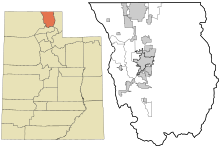
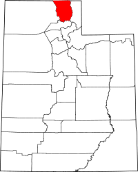 Location in the U.S. state of Utah | |
 Utah's location in the U.S. | |
| 41°41′N 111°45′W / 41.69°N 111.75°WCoordinates: 41°41′N 111°45′W / 41.69°N 111.75°W | |
| Founded | 1857 |
| Named for | Caches of furs found in the area by early fur trappers |
| Seat | Logan |
| Largest city | Logan |
| Area | |
| • Total | 1,173 sq mi (3,038 km2) |
| • Land | 1,165 sq mi (3,017 km2) |
| • Water | 8.2 sq mi (21 km2), 0.7% |
| Population (est.) | |
| • (2017) | 124,438[1] |
| • Density | 107/sq mi (41/km2) |
| Congressional district | 1st |
| Time zone | Mountain: UTC−7/−6 |
| Website |
www |
Cache County (/kæʃ/ KASH) is a county located on the northern edge of Utah, United States. As of the 2010 Census the population was 112,656.[2] Its county seat and largest city is Logan.[3] The county was created in 1856 and organized the next year.[4] It was named for the fur stashes, known in French as Caches, made by many of the Rocky Mountain Fur Company trappers.
The Cache Valley and surrounding mountains are located in the county, which reaches up to the Idaho border. The Bear River Mountains, the northernmost extension of the Wasatch Range, which reach as high as 10,000 feet (3,000 m), cover the eastern half of the county. The Bear River flows through Cache Valley. Wellsville was the first European settlement in the county, settled by Peter Maughan in 1853.
Cache County is included in the Logan, UT-ID Metropolitan Statistical Area.
Geography
According to the U.S. Census Bureau, the county has a total area of 1,173 square miles (3,040 km2), of which 1,165 square miles (3,020 km2) is land and 8.2 square miles (21 km2) (0.7%) is water.[5]
On the western edge of the county lies the Wellsville Mountains and on the eastern edge lie the Bear River Mountains, both northern branches of the Wasatch Range. A canyon carves its way through the Wellsville Mountains. Up this canyon climb U.S. Routes 89 and 91 together. In downtown Logan the highways split, with US-91 heading north into Idaho and US-89 heading east and northeast into Logan Canyon. Taking up the land between the Wellsville and Bear River Mountains is Cache Valley, a relatively flat valley traversed by the Bear River and dotted with small farm towns in the west and the larger, more urban, and faster-growing areas in the east, along the benches of the Bear River Mountains. The county climbs to an elevation of 9,980 feet (3,040 m) at Naomi Peak in the Bear River Mountains.
Adjacent counties
- Box Elder County (west)
- Weber County (south)
- Rich County (east)
- Franklin County, Idaho (north)
- Oneida County, Idaho (northwest)
National protected areas
- Cache National Forest (part)
- Caribou National Forest (part)
Government and politics
Cache County is governed by a seven-member county council and also elects eight officials at large. At the end of 2013, all county elected officials were members of the Republican Party.
| Year | Republican | Democratic | Third parties |
|---|---|---|---|
| 2016 | 45.3% 21,139 | 18.3% 8,563 | 36.4% 17,016 |
| 2012 | 82.9% 35,039 | 14.8% 6,244 | 2.4% 1,010 |
| 2008 | 69.5% 29,127 | 24.6% 10,294 | 6.0% 2,501 |
| 2004 | 81.8% 32,486 | 16.1% 6,375 | 2.2% 870 |
| 2000 | 78.2% 25,920 | 15.6% 5,170 | 6.2% 2,052 |
| 1996 | 63.8% 16,832 | 25.0% 6,595 | 11.2% 2,967 |
| 1992 | 52.0% 15,971 | 16.2% 4,973 | 31.8% 9,781 |
| 1988 | 77.8% 21,766 | 21.0% 5,871 | 1.2% 326 |
| 1984 | 83.7% 22,127 | 15.6% 4,123 | 0.7% 192 |
| 1980 | 78.7% 20,251 | 14.1% 3,639 | 7.2% 1,845 |
| 1976 | 71.7% 16,636 | 23.4% 5,430 | 4.9% 1,128 |
| 1972 | 76.8% 16,538 | 18.7% 4,018 | 4.5% 969 |
| 1968 | 68.8% 11,906 | 25.0% 4,327 | 6.2% 1,070 |
| 1964 | 58.5% 9,326 | 41.5% 6,627 | |
| 1960 | 67.7% 10,281 | 32.4% 4,917 | |
| 1956 | 73.8% 10,349 | 26.2% 3,671 | |
| 1952 | 70.6% 10,167 | 29.4% 4,242 | |
| 1948 | 50.3% 6,514 | 49.3% 6,383 | 0.4% 49 |
| 1944 | 41.3% 4,938 | 58.6% 6,998 | 0.1% 12 |
| 1940 | 39.7% 5,184 | 60.3% 7,867 | 0.1% 7 |
| 1936 | 27.3% 3,258 | 72.0% 8,606 | 0.8% 93 |
| 1932 | 42.2% 4,829 | 57.0% 6,522 | 0.8% 93 |
| 1928 | 52.6% 5,297 | 47.2% 4,748 | 0.3% 26 |
| 1924 | 52.0% 4,973 | 40.9% 3,915 | 7.1% 674 |
| 1920 | 53.9% 5,063 | 45.1% 4,239 | 1.0% 95 |
| 1916 | 41.1% 3,756 | 58.0% 5,305 | 0.9% 81 |
| 1912 | 37.9% 2,825 | 44.3% 3,296 | 17.8% 1,328 |
| 1908 | 52.8% 3,787 | 46.3% 3,317 | 0.9% 67 |
| 1904 | 56.9% 4,008 | 41.9% 2,948 | 1.3% 89 |
| 1900 | 47.6% 2,820 | 52.0% 3,082 | 0.4% 23 |
| 1896 | 16.0% 839 | 84.0% 4,395 |
Demographics
| Historical population | |||
|---|---|---|---|
| Census | Pop. | %± | |
| 1890 | 15,509 | — | |
| 1900 | 18,139 | 17.0% | |
| 1910 | 23,062 | 27.1% | |
| 1920 | 26,992 | 17.0% | |
| 1930 | 27,424 | 1.6% | |
| 1940 | 29,797 | 8.7% | |
| 1950 | 33,536 | 12.5% | |
| 1960 | 35,788 | 6.7% | |
| 1970 | 42,331 | 18.3% | |
| 1980 | 57,176 | 35.1% | |
| 1990 | 70,183 | 22.7% | |
| 2000 | 91,391 | 30.2% | |
| 2010 | 112,656 | 23.3% | |
| Est. 2017 | 124,438 | [7] | 10.5% |
| U.S. Decennial Census[8] 1790–1960[9] 1900–1990[10] 1990–2000[11] 2010–2014[2] | |||
As of the census[12] of 2011, there were 112,655 people, 34,722 households, and 26,464 families residing in the county. The population density was 96.7 people per square mile (37.35/km²). There were 37,024 housing units at an average density of 31.78 per square mile (12.28/km²). The racial makeup of the county was 89.12% White, 0.62% Black or African American, 0.61% Native American, 1.88% Asian, 0.39% Pacific Islander, 5.48% from other races, and 1.90% from two or more races. 9.96% of the population was Hispanic or Latino of any race.
There were 34,722 households out of which 41.34% had children under the age of 18 living with them, 76.22% were married couples living together, 7.73% had a female householder with no husband present, and 23.78% were non-families. 16.30% of all households were made up of individuals and 5.54% had someone living alone who was 65 years of age or older. The average household size was 3.14 and the average family size was 3.55.
In the county, the population was spread out with 36.3% under the age of 20, 12.59% from 20 to 24, 26.97% from 25 to 44, 16.41% from 45 to 64, and 7.72% who were 65 years of age or older. The median age was 25.5 years. For every 100 females there were 98.84 males. For every 100 females age 18 and over, there were 99.53 males.
2015
As of 2015, the largest self reported ancestry groups in Cache County were:
- 27.9% were of English ancestry
- 12.1% were of German ancestry
- 7.3% were of Danish ancestry.
- 6.1% were of American ancestry
- 5.2% were of Swedish ancestry
- 5.0% were of Scottish ancestry
- 4.5% were of Irish ancestry
- 3.0% were of Norwegian ancestry
- 2.6% were of Welsh ancestry
- 2.1% were of Italian ancestry
- 2.0% were of Swiss ancestry
- 2.0% were of Dutch ancestry
- 1.5% were of French ancestry
- 0.7% were of Polish ancestry[13]
2016
As of 2016, the largest self reported ancestry groups in Cache County were:
- 28.3% were of English ancestry
- 11.6% were of German ancestry
- 7.4% were of Danish ancestry.
- 5.9% were of American ancestry
- 5.3% were of Swedish ancestry
- 5.1% were of Scottish ancestry
- 4.6% were of Irish ancestry
- 2.9% were of Norwegian ancestry
- 2.7% were of Welsh ancestry
- 2.2% were of Italian ancestry
- 2.2% were of Swiss ancestry
- 1.8% were of French ancestry
- 1.7% were of Dutch ancestry
- 0.8% were of Polish ancestry[14]
Communities
Cities
Towns
Census-designated places
Gallery
 View of the valley looking south from North Logan
.jpg) Logan Tabernacle in downtown Logan
Logan Tabernacle in downtown Logan
See also
References
- ↑ https://factfinder.census.gov/faces/nav/jsf/pages/community_facts.xhtml?src=bkmk
- 1 2 "State & County QuickFacts". United States Census Bureau. Retrieved December 29, 2013.
- ↑ "Find a County". National Association of Counties. Archived from the original on 2011-05-31. Retrieved 2011-06-07.
- ↑ "Utah: Individual County Chronologies". Utah Atlas of Historical County Boundaries. The Newberry Library. 2008. Retrieved June 26, 2015.
- ↑ "2010 Census Gazetteer Files". United States Census Bureau. August 22, 2012. Retrieved March 27, 2015.
- ↑ Leip, David. "Dave Leip's Atlas of U.S. Presidential Elections". uselectionatlas.org. Retrieved 2018-03-30.
- ↑ "Population and Housing Unit Estimates". Retrieved June 9, 2017.
- ↑ "U.S. Decennial Census". United States Census Bureau. Archived from the original on May 12, 2015. Retrieved March 27, 2015.
- ↑ "Historical Census Browser". University of Virginia Library. Retrieved March 27, 2015.
- ↑ Forstall, Richard L., ed. (March 27, 1995). "Population of Counties by Decennial Census: 1900 to 1990". United States Census Bureau. Retrieved March 27, 2015.
- ↑ "Census 2000 PHC-T-4. Ranking Tables for Counties: 1990 and 2000" (PDF). United States Census Bureau. April 2, 2001. Retrieved March 27, 2015.
- ↑ "American FactFinder". United States Census Bureau. Archived from the original on 2013-09-11. Retrieved 2011-05-14.
- ↑ Bureau, U.S. Census. "American FactFinder - Results". factfinder.census.gov. Retrieved 2018-03-30.
- ↑ Bureau, U.S. Census. "American FactFinder - Results". factfinder.census.gov. Retrieved 2018-03-30.
External links
| Wikimedia Commons has media related to Cache County, Utah. |
Places adjacent to Cache County, Utah | ||||||||||
|---|---|---|---|---|---|---|---|---|---|---|
| ||||||||||
Municipalities and communities of Cache County, Utah, United States | ||
|---|---|---|
| Cities | | |
| Towns | ||
| CDPs | ||
| Unincorporated community | ||
| Ghost town | ||