Carbon County, Utah
| Carbon County, Utah | |
|---|---|
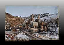 Carbon power plant at Castle Gate, Utah | |
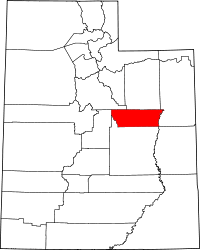 Location in the U.S. state of Utah | |
 Utah's location in the U.S. | |
| 39°38′N 110°35′W / 39.64°N 110.58°WCoordinates: 39°38′N 110°35′W / 39.64°N 110.58°W | |
| Founded | 1894 |
| Named for | Abundant coal deposits |
| Seat | Price |
| Largest city | Price |
| Area | |
| • Total | 1,485 sq mi (3,846 km2) |
| • Land | 1,478 sq mi (3,828 km2) |
| • Water | 6.1 sq mi (16 km2), 0.4% |
| Population (est.) | |
| • (2017) | 20,295[1] |
| • Density | 14/sq mi (5/km2) |
| Congressional district | 3rd |
| Time zone | Mountain: UTC−7/−6 |
| Website |
www |
Carbon County is a county located in the U.S. state of Utah. As of the 2010 census, the population was 21,403.[2] Its county seat and largest city is Price.[3] The county is named for the major coal deposits in the area. The Price, UT Micropolitan Statistical Area includes all of Carbon County.
Carbon County is the second largest natural gas producer in Utah (after Uintah County), with 94 billion cubic feet produced in 2008.[4]
History
Carbon County was part of Emery County which was founded in 1880. The demographics along the Price River changed with the construction of the Denver and Rio Grande Western Railroad in 1883 and the development of coal mines to fuel the railroad. The Utah Territorial Legislature established Carbon County in 1894[5] naming it after the element Carbon to emphasize the industrial nature of the area.
Geography
According to the U.S. Census Bureau, the county has a total area of 1,485 square miles (3,850 km2), of which 1,478 square miles (3,830 km2) is land and 6.1 square miles (16 km2) (0.4%) is water.[6]
Adjacent counties
- Utah County (northwest)
- Duchesne County (north)
- Emery County (south)
- Uintah County (east)
- Sanpete County (west)
- Grand County (southeast)
National protected area
- Manti National Forest (part)
Demographics
| Historical population | |||
|---|---|---|---|
| Census | Pop. | %± | |
| 1900 | 5,004 | — | |
| 1910 | 8,624 | 72.3% | |
| 1920 | 15,489 | 79.6% | |
| 1930 | 17,798 | 14.9% | |
| 1940 | 18,459 | 3.7% | |
| 1950 | 24,901 | 34.9% | |
| 1960 | 21,135 | −15.1% | |
| 1970 | 15,647 | −26.0% | |
| 1980 | 22,179 | 41.7% | |
| 1990 | 20,228 | −8.8% | |
| 2000 | 20,422 | 1.0% | |
| 2010 | 21,403 | 4.8% | |
| Est. 2017 | 20,295 | [7] | −5.2% |
| U.S. Decennial Census[8] 1790–1960[9] 1900–1990[10] 1990–2000[11] 2010–2014[2] | |||
As of the 2010 census,[12] there were 21,403 people, 7,978 households, and 5,587 families residing in the county. The population density was 14.48 people per square mile (5.59/km²). There were 9,551 housing units with an average density of 6.46 per square mile (2.49/km²). The racial makeup of the county was 92.31% White, 0.43% Black or African American, 1.18% Native American, 0.58% Asian, 0.01% Pacific Islander, 3.03% from other races, and 2.36% from two or more races. 12.42% of the population were Hispanic or Latino of any race.
There were 7,978 households, of which 30.16% had children under the age of 18 living with them. 54.50% were married couples living together, 10.65% had a female householder with no husband present, and 29.97% were non-families. 25.50% of all households were made up of individuals (one person), and 11.07% had someone living alone who was 65 years of age or older. The average household size was 2.61 and the average family size was 3.14.
The population was spread out, with 30.41% under the age of 20, 6.82% aged 20 to 24, 23.73% aged 25 to 44, 25.48% aged 45 to 64, and 13.56% who were 65 years of age or older. The median age was 34.4. For every 100 females, there were 98.40 males. For every 100 females age 18 and over, there were 96.88 males.
2015
As of 2015 the largest self-reported ancestry groups in Carbon County, Utah are:[13]
| Largest ancestries (2015) | Percent |
|---|---|
| English | 22.7% |
| German | 11.9% |
| Italian | 11.1% |
| Irish | 6.6% |
| Danish | 5.9% |
| Scottish | 4.1% |
| Swedish | 3.3% |
| Welsh | 1.9% |
| Dutch | 1.9% |
| Polish | 1.4% |
| Norwegian | 1.4% |
Politics
Carbon County historically has been the base of Democratic Party support in strongly Republican Utah with its sizable blue-collar population. It voted for Bill Clinton in 1992 and 1996 by wide margins. In 1964 Lyndon Johnson carried 72.7% of votes in the county. At the state level it was no less Democratic; in the 1992 gubernatorial election it was one of two counties (the other being Summit County) that voted for Democratic candidate Stewart Hanson over Republican Michael Leavitt.
After the turn of the millennium, however, Carbon County has trended Republican. It voted for George W. Bush in 2000 and 2004, while voting for the Democratic gubernatorial candidates. In 2008, John McCain won Carbon County with 52.60% of the vote, versus 44.59% for Barack Obama. In 2012, the county's Democratic vote fell further as Mitt Romney carried 67.3% to 30.1% for Obama. In 2016, despite Utah's strong Democratic swing, Carbon County was the only county in the state to swing more Republican, as Donald Trump won 66% to Hillary Clinton's 21.5% percent.
| Year | Republican | Democratic | Third parties |
|---|---|---|---|
| 2016 | 66.0% 5,275 | 21.5% 1,717 | 12.6% 1,007 |
| 2012 | 67.3% 5,090 | 30.1% 2,275 | 2.7% 202 |
| 2008 | 52.3% 4,091 | 44.3% 3,468 | 3.4% 263 |
| 2004 | 58.2% 4,950 | 40.1% 3,415 | 1.7% 143 |
| 2000 | 50.9% 3,758 | 44.7% 3,298 | 4.4% 328 |
| 1996 | 30.9% 2,343 | 55.0% 4,172 | 14.1% 1,067 |
| 1992 | 23.1% 2,038 | 50.8% 4,480 | 26.1% 2,299 |
| 1988 | 35.1% 3,019 | 64.2% 5,521 | 0.7% 63 |
| 1984 | 49.8% 4,393 | 49.4% 4,357 | 0.8% 68 |
| 1980 | 47.7% 4,320 | 47.6% 4,317 | 4.7% 426 |
| 1976 | 38.7% 3,360 | 59.4% 5,157 | 1.9% 166 |
| 1972 | 53.2% 3,956 | 44.8% 3,335 | 2.0% 147 |
| 1968 | 36.2% 2,618 | 60.0% 4,344 | 3.8% 277 |
| 1964 | 27.3% 2,130 | 72.7% 5,672 | |
| 1960 | 32.8% 2,953 | 67.1% 6,039 | 0.2% 14 |
| 1956 | 50.3% 4,507 | 49.7% 4,460 | |
| 1952 | 39.4% 3,770 | 60.6% 5,790 | |
| 1948 | 28.9% 2,704 | 68.3% 6,397 | 2.8% 259 |
| 1944 | 30.1% 2,318 | 69.7% 5,364 | 0.2% 14 |
| 1940 | 30.1% 2,242 | 69.5% 5,180 | 0.5% 34 |
| 1936 | 20.7% 1,348 | 77.4% 5,040 | 1.9% 122 |
| 1932 | 27.0% 1,655 | 69.3% 4,239 | 3.7% 226 |
| 1928 | 42.1% 2,184 | 56.9% 2,954 | 1.0% 50 |
| 1924 | 37.6% 1,878 | 30.6% 1,528 | 31.8% 1,590 |
| 1920 | 47.1% 1,675 | 43.8% 1,559 | 9.2% 326 |
| 1916 | 44.4% 1,301 | 50.4% 1,478 | 5.2% 152 |
| 1912 | 35.4% 771 | 23.6% 514 | 41.0% 892[15] |
| 1908 | 59.8% 1,023 | 34.0% 581 | 6.2% 106 |
| 1904 | 65.4% 1,224 | 27.1% 508 | 7.5% 140 |
| 1900 | 54.0% 748 | 44.8% 621 | 1.2% 16 |
| 1896 | 11.4% 85 | 88.6% 663 |

Cities
- East Carbon-Sunnyside
- Helper
- Price (county seat)
- Wellington
Town
Census-designated places
Ghost towns
Notable people
Carbon County has produced one governor of Utah, J. Bracken Lee (1899-1996; governor, 1949-1957). Lee also served as mayor of Price from 1935 to 1947, and later as mayor of Salt Lake City, from 1959 to 1971.
See also
References
- ↑ https://www.census.gov/quickfacts/fact/table/carboncountyutah/IPE120216
- 1 2 "State & County QuickFacts". United States Census Bureau. Retrieved December 29, 2013.
- ↑ "Find a County". National Association of Counties. Archived from the original on 2011-05-31. Retrieved 2011-06-07.
- ↑ "Annual natural gas production in MCF by the top 7 producing counties in Utah" (PDF). Archived from the original (PDF) on 2010-11-07. Retrieved 2010-09-12.
- ↑ "Carbon County". I Love Utah History. Utah.gov. Retrieved 10 February 2017.
- ↑ "2010 Census Gazetteer Files". United States Census Bureau. August 22, 2012. Retrieved March 27, 2015.
- ↑ "Population and Housing Unit Estimates". Retrieved June 9, 2017.
- ↑ "U.S. Decennial Census". United States Census Bureau. Archived from the original on May 12, 2015. Retrieved March 27, 2015.
- ↑ "Historical Census Browser". University of Virginia Library. Retrieved March 27, 2015.
- ↑ Forstall, Richard L., ed. (March 27, 1995). "Population of Counties by Decennial Census: 1900 to 1990". United States Census Bureau. Retrieved March 27, 2015.
- ↑ "Census 2000 PHC-T-4. Ranking Tables for Counties: 1990 and 2000" (PDF). United States Census Bureau. April 2, 2001. Retrieved March 27, 2015.
- ↑ "American FactFinder". United States Census Bureau. Archived from the original on 2013-09-11. Retrieved 2011-05-14.
- ↑ Bureau, U.S. Census. "American FactFinder - Results". factfinder.census.gov. Retrieved 2018-03-30.
- ↑ Leip, David. "Dave Leip's Atlas of U.S. Presidential Elections". uselectionatlas.org. Retrieved 2018-03-30.
- ↑ The leading "other" candidate, Progressive Theodore Roosevelt, received 541 votes, while Socialist candidate Eugene Debs received 344 votes, Socialist Labor candidate Arthur Reimer received 7 votes.
External links
| Wikimedia Commons has media related to Carbon County, Utah. |
Places adjacent to Carbon County, Utah | |
|---|---|
Municipalities and communities of Carbon County, Utah, United States | ||
|---|---|---|
| Cities | | |
| Town | ||
| CDPs | ||
| Indian reservation | ||
| Ghost towns | ||
| Footnotes | ‡This populated place also has portions in an adjacent county or counties | |