Saint-Maurice-la-Souterraine
| Saint-Maurice-la-Souterraine | |
|---|---|
| Commune | |
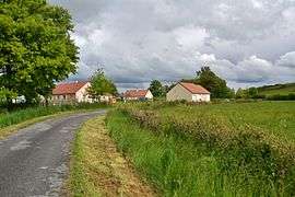 Buildings in Saint-Maurice-la-Souterraine | |
 Saint-Maurice-la-Souterraine Location within Nouvelle-Aquitaine region  Saint-Maurice-la-Souterraine | |
| Coordinates: 46°12′54″N 1°25′55″E / 46.215°N 1.4319°ECoordinates: 46°12′54″N 1°25′55″E / 46.215°N 1.4319°E | |
| Country | France |
| Region | Nouvelle-Aquitaine |
| Department | Creuse |
| Arrondissement | Guéret |
| Canton | La Souterraine |
| Intercommunality | CC Monts et Vallées Ouest Creuse |
| Government | |
| • Mayor (2008–2014) | Gilbert Tixier |
| Area1 | 39.72 km2 (15.34 sq mi) |
| Population (2008)2 | 1,201 |
| • Density | 30/km2 (78/sq mi) |
| Time zone | UTC+1 (CET) |
| • Summer (DST) | UTC+2 (CEST) |
| INSEE/Postal code | 23219 /23300 |
| Elevation |
300–422 m (984–1,385 ft) (avg. 359 m or 1,178 ft) |
|
1 French Land Register data, which excludes lakes, ponds, glaciers > 1 km2 (0.386 sq mi or 247 acres) and river estuaries. 2 Population without double counting: residents of multiple communes (e.g., students and military personnel) only counted once. | |
Saint-Maurice-la-Souterraine is a commune in the Creuse department in central France.
Geography
The river Semme flows west through the commune's southern part.
The river Brame flows west through the commune's northern part.
Population
| Historical population | ||
|---|---|---|
| Year | Pop. | ±% |
| 1962 | 1,183 | — |
| 1968 | 1,246 | +5.3% |
| 1975 | 1,117 | −10.4% |
| 1982 | 1,082 | −3.1% |
| 1990 | 1,089 | +0.6% |
| 1999 | 1,048 | −3.8% |
| 2008 | 1,201 | +14.6% |
See also
References
| Wikimedia Commons has media related to Saint-Maurice-la-Souterraine. |
This article is issued from
Wikipedia.
The text is licensed under Creative Commons - Attribution - Sharealike.
Additional terms may apply for the media files.