Saint-Avit-le-Pauvre
| Saint-Avit-le-Pauvre | |
|---|---|
| Commune | |
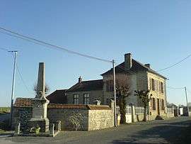 The town hall in Saint-Avit-le-Pauvre | |
 Saint-Avit-le-Pauvre Location within Nouvelle-Aquitaine region  Saint-Avit-le-Pauvre | |
| Coordinates: 45°59′48″N 2°02′42″E / 45.9967°N 2.045°ECoordinates: 45°59′48″N 2°02′42″E / 45.9967°N 2.045°E | |
| Country | France |
| Region | Nouvelle-Aquitaine |
| Department | Creuse |
| Arrondissement | Aubusson |
| Canton | Ahun |
| Intercommunality | CC Creuse Sud Ouest |
| Government | |
| • Mayor (2008–2014) | Gilles Depatureaux |
| Area1 | 4.99 km2 (1.93 sq mi) |
| Population (2008)2 | 75 |
| • Density | 15/km2 (39/sq mi) |
| Time zone | UTC+1 (CET) |
| • Summer (DST) | UTC+2 (CEST) |
| INSEE/Postal code | 23183 /23480 |
| Elevation |
529–618 m (1,736–2,028 ft) (avg. 570 m or 1,870 ft) |
|
1 French Land Register data, which excludes lakes, ponds, glaciers > 1 km2 (0.386 sq mi or 247 acres) and river estuaries. 2 Population without double counting: residents of multiple communes (e.g., students and military personnel) only counted once. | |
Saint-Avit-le-Pauvre is a commune in the Creuse department in central France.
Population
| Historical population | ||
|---|---|---|
| Year | Pop. | ±% |
| 1962 | 99 | — |
| 1968 | 104 | +5.1% |
| 1975 | 91 | −12.5% |
| 1982 | 76 | −16.5% |
| 1990 | 69 | −9.2% |
| 1999 | 80 | +15.9% |
| 2008 | 75 | −6.2% |
See also
References
| Wikimedia Commons has media related to Saint-Avit-le-Pauvre. |
This article is issued from
Wikipedia.
The text is licensed under Creative Commons - Attribution - Sharealike.
Additional terms may apply for the media files.