Boussac-Bourg
| Boussac-Bourg | |
|---|---|
| Commune | |
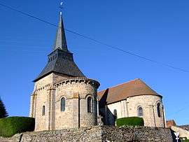 The church in Boussac-Bourg | |
 Boussac-Bourg Location within Nouvelle-Aquitaine region  Boussac-Bourg | |
| Coordinates: 46°21′43″N 2°14′07″E / 46.3619°N 2.2353°ECoordinates: 46°21′43″N 2°14′07″E / 46.3619°N 2.2353°E | |
| Country | France |
| Region | Nouvelle-Aquitaine |
| Department | Creuse |
| Arrondissement | Guéret |
| Canton | Boussac |
| Intercommunality | CC Creuse Confluence |
| Government | |
| • Mayor (2008–2014) | Maurice Santinon |
| Area1 | 38.69 km2 (14.94 sq mi) |
| Population (2008)2 | 789 |
| • Density | 20/km2 (53/sq mi) |
| Time zone | UTC+1 (CET) |
| • Summer (DST) | UTC+2 (CEST) |
| INSEE/Postal code | 23032 /23600 |
| Elevation |
310–499 m (1,017–1,637 ft) (avg. 425 m or 1,394 ft) |
|
1 French Land Register data, which excludes lakes, ponds, glaciers > 1 km2 (0.386 sq mi or 247 acres) and river estuaries. 2 Population without double counting: residents of multiple communes (e.g., students and military personnel) only counted once. | |
Boussac-Bourg is a commune in the Creuse department in the Nouvelle-Aquitaine region in central France.
Geography
A farming area comprising the village and several hamlets situated in the valley of the small river Béroux, some 23 miles (37 km) northwest of Guéret, at the junction of the D916 and the D997. The Petite Creuse river forms much of the southern border of the commune.
Population
| Historical population | ||
|---|---|---|
| Year | Pop. | ±% |
| 1962 | 844 | — |
| 1968 | 887 | +5.1% |
| 1975 | 882 | −0.6% |
| 1982 | 892 | +1.1% |
| 1990 | 899 | +0.8% |
| 1999 | 788 | −12.3% |
| 2008 | 789 | +0.1% |
Sights
- The two churches, built alongside each other: Notre-Dame and St. Martin, both dating from the eleventh century.
- A rural museum, housed in an old factory.
See also
References
External links
- Boussac-Bourg on the Quid website (in French)
| Wikimedia Commons has media related to Boussac-Bourg. |
This article is issued from
Wikipedia.
The text is licensed under Creative Commons - Attribution - Sharealike.
Additional terms may apply for the media files.