Faux-la-Montagne
| Faux-la-Montagne | |
|---|---|
| Commune | |
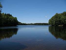 Faux Lake | |
 Faux-la-Montagne Location within Nouvelle-Aquitaine region  Faux-la-Montagne | |
| Coordinates: 45°45′06″N 1°56′08″E / 45.7517°N 1.9356°ECoordinates: 45°45′06″N 1°56′08″E / 45.7517°N 1.9356°E | |
| Country | France |
| Region | Nouvelle-Aquitaine |
| Department | Creuse |
| Arrondissement | Aubusson |
| Canton | Felletin |
| Intercommunality | CC Creuse Grand Sud |
| Government | |
| • Mayor (2008–2014) | Catherine Moulin |
| Area1 | 47.89 km2 (18.49 sq mi) |
| Population (2008)2 | 364 |
| • Density | 7.6/km2 (20/sq mi) |
| Time zone | UTC+1 (CET) |
| • Summer (DST) | UTC+2 (CEST) |
| INSEE/Postal code | 23077 /23340 |
| Elevation | 525–826 m (1,722–2,710 ft) |
|
1 French Land Register data, which excludes lakes, ponds, glaciers > 1 km2 (0.386 sq mi or 247 acres) and river estuaries. 2 Population without double counting: residents of multiple communes (e.g., students and military personnel) only counted once. | |
Faux-la-Montagne is a commune in the Creuse department in the Nouvelle-Aquitaine region in central France.
Geography
An area of lakes and streams, forestry and farming comprising the village and several hamlets some 19 miles (31 km) southwest of Aubusson at the junction of the D3, D85 and the D992 roads. On its southern and eastern sides, the commune borders the department of Corrèze and is within the national park of the Millevaches (not 1000 cows, but lakes).
Population
| Historical population | ||
|---|---|---|
| Year | Pop. | ±% |
| 1962 | 435 | — |
| 1968 | 565 | +29.9% |
| 1975 | 417 | −26.2% |
| 1982 | 396 | −5.0% |
| 1990 | 391 | −1.3% |
| 1999 | 394 | +0.8% |
| 2008 | 364 | −7.6% |
Sights
See also
References
External links
- Faux-la-Montagne on the Quid website (in French)
| Wikimedia Commons has media related to Faux-la-Montagne. |
This article is issued from
Wikipedia.
The text is licensed under Creative Commons - Attribution - Sharealike.
Additional terms may apply for the media files.