Saint-Michel-de-Veisse
| Saint-Michel-de-Veisse | |
|---|---|
| Commune | |
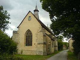 The chapel in Saint-Michel-de-Veisse | |
 Saint-Michel-de-Veisse Location within Nouvelle-Aquitaine region  Saint-Michel-de-Veisse | |
| Coordinates: 45°57′09″N 2°03′17″E / 45.9525°N 2.0547°ECoordinates: 45°57′09″N 2°03′17″E / 45.9525°N 2.0547°E | |
| Country | France |
| Region | Nouvelle-Aquitaine |
| Department | Creuse |
| Arrondissement | Aubusson |
| Canton | Ahun |
| Intercommunality | CC Creuse Sud Ouest |
| Government | |
| • Mayor (2008–2014) | Michel Bounaud |
| Area1 | 15.57 km2 (6.01 sq mi) |
| Population (2008)2 | 158 |
| • Density | 10/km2 (26/sq mi) |
| Time zone | UTC+1 (CET) |
| • Summer (DST) | UTC+2 (CEST) |
| INSEE/Postal code | 23222 /23480 |
| Elevation |
539–681 m (1,768–2,234 ft) (avg. 650 m or 2,130 ft) |
|
1 French Land Register data, which excludes lakes, ponds, glaciers > 1 km2 (0.386 sq mi or 247 acres) and river estuaries. 2 Population without double counting: residents of multiple communes (e.g., students and military personnel) only counted once. | |
Saint-Michel-de-Veisse is a commune in the Creuse department in central France.
Population
| Historical population | ||
|---|---|---|
| Year | Pop. | ±% |
| 1962 | 242 | — |
| 1968 | 268 | +10.7% |
| 1975 | 200 | −25.4% |
| 1982 | 204 | +2.0% |
| 1990 | 177 | −13.2% |
| 1999 | 177 | +0.0% |
| 2008 | 158 | −10.7% |
See also
References
| Wikimedia Commons has media related to Saint-Michel-de-Veisse. |
| Authority control |
|---|
This article is issued from
Wikipedia.
The text is licensed under Creative Commons - Attribution - Sharealike.
Additional terms may apply for the media files.