Lussat, Creuse
| Lussat | |
|---|---|
| Commune | |
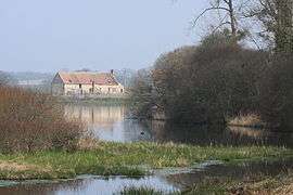 Nature reserve pond of Landes | |
 Lussat Location within Nouvelle-Aquitaine region  Lussat | |
| Coordinates: 46°11′01″N 2°20′33″E / 46.1836°N 2.3425°ECoordinates: 46°11′01″N 2°20′33″E / 46.1836°N 2.3425°E | |
| Country | France |
| Region | Nouvelle-Aquitaine |
| Department | Creuse |
| Arrondissement | Aubusson |
| Canton | Évaux-les-Bains |
| Intercommunality | CC Creuse Confluence |
| Government | |
| • Mayor (2008–2014) | Rémy Bodeau |
| Area1 | 46.86 km2 (18.09 sq mi) |
| Population (2008)2 | 449 |
| • Density | 9.6/km2 (25/sq mi) |
| Time zone | UTC+1 (CET) |
| • Summer (DST) | UTC+2 (CEST) |
| INSEE/Postal code | 23114 /23170 |
| Elevation |
351–453 m (1,152–1,486 ft) (avg. 443 m or 1,453 ft) |
|
1 French Land Register data, which excludes lakes, ponds, glaciers > 1 km2 (0.386 sq mi or 247 acres) and river estuaries. 2 Population without double counting: residents of multiple communes (e.g., students and military personnel) only counted once. | |
Lussat is a commune in the Creuse department in the Nouvelle-Aquitaine region in central France.
Geography
A large area of farming, lakes and streams, comprising the village and several hamlets situated some 20 miles (32 km) northeast of Aubusson, at the junction of the D55 and the D915 roads and also on the D993.
The river Voueize, a tributary of the Tardes, flows eastward through the northern part of the commune. The Tardes forms most of the commune's eastern border.
Population
| Historical population | ||
|---|---|---|
| Year | Pop. | ±% |
| 1962 | 523 | — |
| 1968 | 631 | +20.7% |
| 1975 | 525 | −16.8% |
| 1982 | 520 | −1.0% |
| 1990 | 486 | −6.5% |
| 1999 | 528 | +8.6% |
| 2008 | 449 | −15.0% |
Sights
- The church, dating from the nineteenth century.
- The remains of a feudal castle, now a house.
- The Landes lake nature reserve.
See also
References
External links
| Wikimedia Commons has media related to Lussat (Creuse). |
- Lussat on the Quid website (in French)
This article is issued from
Wikipedia.
The text is licensed under Creative Commons - Attribution - Sharealike.
Additional terms may apply for the media files.