Saint-Agnant-près-Crocq
| Saint-Agnant-près-Crocq | |
|---|---|
| Commune | |
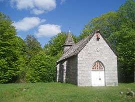 The chapel of Saint-Michel in Saint-Agnant-près-Crocq | |
 Saint-Agnant-près-Crocq Location within Nouvelle-Aquitaine region  Saint-Agnant-près-Crocq | |
| Coordinates: 45°48′14″N 2°21′02″E / 45.8039°N 2.3506°ECoordinates: 45°48′14″N 2°21′02″E / 45.8039°N 2.3506°E | |
| Country | France |
| Region | Nouvelle-Aquitaine |
| Department | Creuse |
| Arrondissement | Aubusson |
| Canton | Auzances |
| Intercommunality | CC Chénérailles, Auzances/Bellegarde et Haut Pays Marchois |
| Government | |
| • Mayor (2008–2014) | Robert Chaussat |
| Area1 | 25.51 km2 (9.85 sq mi) |
| Population (2008)2 | 203 |
| • Density | 8.0/km2 (21/sq mi) |
| Time zone | UTC+1 (CET) |
| • Summer (DST) | UTC+2 (CEST) |
| INSEE/Postal code | 23178 /23260 |
| Elevation |
650–824 m (2,133–2,703 ft) (avg. 730 m or 2,400 ft) |
|
1 French Land Register data, which excludes lakes, ponds, glaciers > 1 km2 (0.386 sq mi or 247 acres) and river estuaries. 2 Population without double counting: residents of multiple communes (e.g., students and military personnel) only counted once. | |
Saint-Agnant-près-Crocq is a commune in the Creuse department in central France.
Population
| Historical population | ||
|---|---|---|
| Year | Pop. | ±% |
| 1962 | 343 | — |
| 1968 | 373 | +8.7% |
| 1975 | 294 | −21.2% |
| 1982 | 247 | −16.0% |
| 1990 | 209 | −15.4% |
| 1999 | 199 | −4.8% |
See also
References
| Wikimedia Commons has media related to Saint-Agnant-près-Crocq. |
| Authority control |
|---|
This article is issued from
Wikipedia.
The text is licensed under Creative Commons - Attribution - Sharealike.
Additional terms may apply for the media files.