Saint-Sulpice-les-Champs
| Saint-Sulpice-les-Champs | ||
|---|---|---|
| Commune | ||
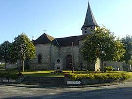 The church in Saint-Sulpice-les-Champs | ||
| ||
 Saint-Sulpice-les-Champs Location within Nouvelle-Aquitaine region  Saint-Sulpice-les-Champs | ||
| Coordinates: 45°59′47″N 2°01′21″E / 45.9964°N 2.0225°ECoordinates: 45°59′47″N 2°01′21″E / 45.9964°N 2.0225°E | ||
| Country | France | |
| Region | Nouvelle-Aquitaine | |
| Department | Creuse | |
| Arrondissement | Aubusson | |
| Canton | Aubusson | |
| Intercommunality | CC Creuse Grand Sud | |
| Government | ||
| • Mayor (2008–2014) | Jacqueline Larpin | |
| Area1 | 21.7 km2 (8.4 sq mi) | |
| Population (2008)2 | 384 | |
| • Density | 18/km2 (46/sq mi) | |
| Time zone | UTC+1 (CET) | |
| • Summer (DST) | UTC+2 (CEST) | |
| INSEE/Postal code | 23246 /23480 | |
| Elevation |
515–651 m (1,690–2,136 ft) (avg. 612 m or 2,008 ft) | |
|
1 French Land Register data, which excludes lakes, ponds, glaciers > 1 km2 (0.386 sq mi or 247 acres) and river estuaries. 2 Population without double counting: residents of multiple communes (e.g., students and military personnel) only counted once. | ||

Saint-Sulpice-les-Champs is a commune in the Creuse department in central France.
Population
| Historical population | ||
|---|---|---|
| Year | Pop. | ±% |
| 1962 | 477 | — |
| 1968 | 469 | −1.7% |
| 1975 | 446 | −4.9% |
| 1982 | 406 | −9.0% |
| 1990 | 395 | −2.7% |
| 1999 | 366 | −7.3% |
| 2008 | 384 | +4.9% |
See also
References
| Wikimedia Commons has media related to Saint-Sulpice-les-Champs. |
This article is issued from
Wikipedia.
The text is licensed under Creative Commons - Attribution - Sharealike.
Additional terms may apply for the media files.