Mourioux-Vieilleville
| Mourioux-Vieilleville | |
|---|---|
| Commune | |
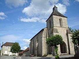 The church and the town hall in Mourioux-Vieilleville | |
 Mourioux-Vieilleville Location within Nouvelle-Aquitaine region  Mourioux-Vieilleville | |
| Coordinates: 46°04′41″N 1°38′46″E / 46.0781°N 1.6461°ECoordinates: 46°04′41″N 1°38′46″E / 46.0781°N 1.6461°E | |
| Country | France |
| Region | Nouvelle-Aquitaine |
| Department | Creuse |
| Arrondissement | Guéret |
| Canton | Le Grand-Bourg |
| Intercommunality | CC Monts et Vallées Ouest Creuse |
| Government | |
| • Mayor (2008–2014) | Alain Delattre |
| Area1 | 25.2 km2 (9.7 sq mi) |
| Population (2008)2 | 588 |
| • Density | 23/km2 (60/sq mi) |
| Time zone | UTC+1 (CET) |
| • Summer (DST) | UTC+2 (CEST) |
| INSEE/Postal code | 23137 /23210 |
| Elevation |
379–516 m (1,243–1,693 ft) (avg. 456 m or 1,496 ft) |
|
1 French Land Register data, which excludes lakes, ponds, glaciers > 1 km2 (0.386 sq mi or 247 acres) and river estuaries. 2 Population without double counting: residents of multiple communes (e.g., students and military personnel) only counted once. | |
Mourioux-Vieilleville is a commune in the Creuse department in the Nouvelle-Aquitaine region in central France.
Geography
An area of lakes and streams, forestry and farming, comprising the village and a few hamlets situated some 14 miles (23 km) north of Guéret at the junction of the D5, D50, D42 and the D912a1 roads. The commune is served by a TER railway.
Population
| Historical population | ||
|---|---|---|
| Year | Pop. | ±% |
| 1962 | 864 | — |
| 1968 | 941 | +8.9% |
| 1975 | 851 | −9.6% |
| 1982 | 719 | −15.5% |
| 1990 | 629 | −12.5% |
| 1999 | 569 | −9.5% |
| 2008 | 588 | +3.3% |
Sights
- The church, dating from the thirteenth century.
- A group of dolmen called "le Four des Fades".
- A fifteenth-century house known as "le Monastère".
See also
References
External links
- Mourioux-Vieilleville on the Quid website (in French)
| Wikimedia Commons has media related to Mourioux-Vieilleville. |
This article is issued from
Wikipedia.
The text is licensed under Creative Commons - Attribution - Sharealike.
Additional terms may apply for the media files.