Saint-Christol, Vaucluse
| Saint-Christol | ||
|---|---|---|
| Commune | ||
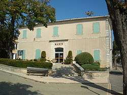 Mairie | ||
| ||
 Saint-Christol Location within Provence-A.-C.d'A. region  Saint-Christol | ||
| Coordinates: 44°01′46″N 5°29′34″E / 44.0294°N 5.4928°ECoordinates: 44°01′46″N 5°29′34″E / 44.0294°N 5.4928°E | ||
| Country | France | |
| Region | Provence-Alpes-Côte d'Azur | |
| Department | Vaucluse | |
| Arrondissement | Carpentras | |
| Canton | Pernes-les-Fontaines | |
| Intercommunality | Pays de Sault | |
| Government | ||
| • Mayor (2008–2014) | Henri Bonnefoy | |
| Area1 | 46.08 km2 (17.79 sq mi) | |
| Population (2008)2 | 1,104 | |
| • Density | 24/km2 (62/sq mi) | |
| Time zone | UTC+1 (CET (UTC +1)) | |
| • Summer (DST) | UTC+2 (CEST) | |
| INSEE/Postal code | 84107 /84390 | |
| Website | saintchristol.free.fr | |
|
1 French Land Register data, which excludes lakes, ponds, glaciers > 1 km2 (0.386 sq mi or 247 acres) and river estuaries. 2 Population without double counting: residents of multiple communes (e.g., students and military personnel) only counted once. | ||
.svg.png)
Saint-Christol is a commune in the Vaucluse department in the Provence-Alpes-Côte d'Azur region in southeastern France.
See also
References
| Wikimedia Commons has media related to Saint-Christol, Vaucluse. |
This article is issued from
Wikipedia.
The text is licensed under Creative Commons - Attribution - Sharealike.
Additional terms may apply for the media files.