Gignac, Vaucluse
| Gignac | ||
|---|---|---|
| Commune | ||
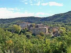 The village of Gignac | ||
| ||
 Gignac Location within Provence-A.-C.d'A. region  Gignac | ||
| Coordinates: 43°55′12″N 5°31′39″E / 43.92°N 5.5275°ECoordinates: 43°55′12″N 5°31′39″E / 43.92°N 5.5275°E | ||
| Country | France | |
| Region | Provence-Alpes-Côte d'Azur | |
| Department | Vaucluse | |
| Arrondissement | Apt | |
| Canton | Apt | |
| Government | ||
| • Mayor (2001–2008) | Fernand Borel | |
| Area1 | 8.15 km2 (3.15 sq mi) | |
| Population (2006)2 | 69 | |
| • Density | 8.5/km2 (22/sq mi) | |
| Time zone | UTC+1 (CET) | |
| • Summer (DST) | UTC+2 (CEST) | |
| INSEE/Postal code | 84048 /84400 | |
| Elevation |
366–834 m (1,201–2,736 ft) (avg. 450 m or 1,480 ft) | |
|
1 French Land Register data, which excludes lakes, ponds, glaciers > 1 km2 (0.386 sq mi or 247 acres) and river estuaries. 2 Population without double counting: residents of multiple communes (e.g., students and military personnel) only counted once. | ||
.svg.png)
Gignac is a commune in the Vaucluse department in the Provence-Alpes-Côte d'Azur region in southeastern France. Chateau d'Autet lies to the northeast of the village.
See also
References
| Wikimedia Commons has media related to Gignac, Vaucluse. |
This article is issued from
Wikipedia.
The text is licensed under Creative Commons - Attribution - Sharealike.
Additional terms may apply for the media files.