Octonia Stone
|
Octonia Stone | |
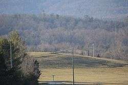 Hilltop on which the stone sits | |
  | |
| Location | Off VA 637 north of Stanardsville, Virginia |
|---|---|
| Coordinates | 38°19′59″N 78°27′14″W / 38.33306°N 78.45389°WCoordinates: 38°19′59″N 78°27′14″W / 38.33306°N 78.45389°W |
| Area | 9.9 acres (4.0 ha) |
| Built | 1721 |
| NRHP reference # | 70000800[1] |
| VLR # | 039-0003 |
| Significant dates | |
| Added to NRHP | September 15, 1970 |
| Designated VLR | June 2, 1970[2] |
The Octonia Stone, also known as Octoney, Octeny, Octona, and Octuna Stone, is a historic boundary marker located near Stanardsville, Greene County, Virginia. The stone marks the terminus of the westernmost boundary line of the 24,000-acre Octonia Grant. It is a granite-type rock which is part of a natural outcropping in a hayfield. The stone is engraved with a figure 8, composed of two, nearly perfect circles, with a cross touching the top of the 8.[3]
It was listed on the National Register of Historic Places in 1970.[1]
References
- 1 2 National Park Service (2010-07-09). "National Register Information System". National Register of Historic Places. National Park Service.
- ↑ "Virginia Landmarks Register". Virginia Department of Historic Resources. Retrieved 5 June 2013.
- ↑ Virginia Historic Landmarks Commission Staff (March 1970). "National Register of Historic Places Inventory/Nomination: Octonia Stone" (PDF). Virginia Department of Historic Resources. and Accompanying photo


This article is issued from
Wikipedia.
The text is licensed under Creative Commons - Attribution - Sharealike.
Additional terms may apply for the media files.