Claremont Historic District
|
Claremont Historic District | |
 | |
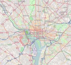   | |
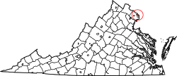
| Location | Bounded by S. Greenbrier St., S. Chesterfield Rd., S. Buchanan St., 25th St. S, 24th St. S, 23rd St. S and 22nd St. S, Arlington, Virginia |
|---|---|
| Coordinates | 38°50′47″N 77°6′20″W / 38.84639°N 77.10556°WCoordinates: 38°50′47″N 77°6′20″W / 38.84639°N 77.10556°W |
| Area | 58.9 acres (23.8 ha) |
| Built | 1946 |
| Architect | Banks and Lee; Freed, Gerald and Claremont et al. |
| Architectural style | Colonial Revival, Modern Movement |
| MPS | Historic Residential Suburbs in the United States, 1830-1960 MPS |
| NRHP reference # | 06000751[1] |
| VLR # | 000-9700 |
| Significant dates | |
| Added to NRHP | August 31, 2006 |
| Designated VLR | June 8, 2006, December 13, 2006[2] |
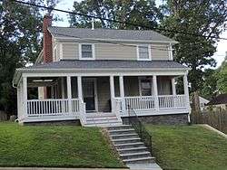
The Claremont Historic District is a national historic district located at Arlington County, Virginia. It contains 253 contributing buildings in a residential neighborhood in southwestern Arlington. The area was developed initially between 1946 and 1949, of two-story Colonial Revival style houses and 1 1/2-story Cape Cod style houses. In 1954, thirty-six Ranch-style houses were added.[3]
It was listed on the National Register of Historic Places in 2006.[1]
References
- 1 2 National Park Service (2010-07-09). "National Register Information System". National Register of Historic Places. National Park Service.
- ↑ "Virginia Landmarks Register". Virginia Department of Historic Resources. Retrieved 2013-05-12.
- ↑ Laura V. Trieschmann; Patti Kuhn; Ellen Jenkins; Elizabeth Breiseth (February 2006). "National Register of Historic Places Inventory/Nomination: Claremont Historic District" (PDF). and Accompanying four photos and Accompanying map Archived September 26, 2012, at the Wayback Machine.


This article is issued from
Wikipedia.
The text is licensed under Creative Commons - Attribution - Sharealike.
Additional terms may apply for the media files.