Moraga, California
| Town of Moraga | |
|---|---|
| Town in California | |
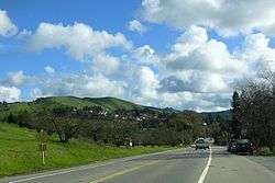 Moraga Way view toward Moraga Road | |
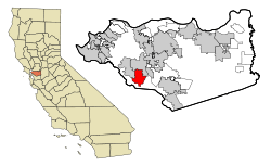 Location in Contra Costa County and the state of California | |
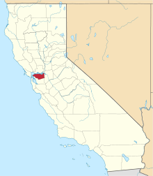
 Town of Moraga Location in the United States | |
| Coordinates: 37°50′06″N 122°07′47″W / 37.83500°N 122.12972°WCoordinates: 37°50′06″N 122°07′47″W / 37.83500°N 122.12972°W | |
| Country | USA |
| State |
|
| County | Contra Costa |
| Incorporated | November 13, 1974[1] |
| Government | |
| • Mayor | Teresa Onoda[2] |
| • State Senator | Steve Glazer (D)[3] |
| • State Assembly | Catharine Baker (R)[4] |
| • U. S. Congress | Mark DeSaulnier (D)[5] |
| Area[6] | |
| • Total | 9.47 sq mi (24.54 km2) |
| • Land | 9.46 sq mi (24.51 km2) |
| • Water | 0.01 sq mi (0.02 km2) 0.09% |
| Elevation | 499 ft (152 m) |
| Population (2010) | |
| • Total | 16,016 |
| • Estimate (2016)[7] | 17,416 |
| • Density | 1,840.04/sq mi (710.46/km2) |
| Time zone | UTC-8 (PST) |
| • Summer (DST) | UTC-7 (PDT) |
| ZIP codes | 94556, 94570, 94575 |
| Area code(s) | 925 |
| FIPS code | 06-49187 (formerly 06-49194) |
| GNIS feature IDs | 1659171, 2413013 |
| Website |
www |
Moraga (incorporating the former communities of Moraga Town, Rheem, and Rheem Valley)[8] is a suburban incorporated town located in Contra Costa County, California, United States, in the San Francisco Bay Area. It is named in honor of Joaquin Moraga, whose grandfather was José Joaquin Moraga, second in command to Juan Bautista de Anza. As of 2010, Moraga had a total population of 16,016 people.
Geography
Moraga is located at 37°50'06" North, 122°07'47" West, at an elevation of 499 feet (152 m).[8] It is located adjacent to the cities of Lafayette and Orinda, as well as the unincorporated community of Canyon. Other nearby cities include Walnut Creek, Oakland, San Francisco, Concord and Berkeley.
According to the United States Census Bureau, the town has a total area of 9.4 square miles (24 km2), of which, 9.4 square miles (24 km2) is land and 0.09% is water. Originally Moraga was abundant with pears, but, over the years more houses have been built and it is losing its pear trees. The old orchards are now reduced to but a few acres. Rimer Ranch has begun planting new fruit trees on the south edge of town. The new trees are bearing first-fruit this year. [9]
Moraga is in a valley, surrounded by rolling hills (green in the winter, brown in the summer) and grazing cows. Residents enjoy walking or biking many trails in the Lamorinda area. Large sections of the Lafayette-Moraga Regional Trail pass through the town.
Moraga is well known for its school district, which attracts many people from surrounding cities, such as Berkeley, California, Walnut Creek, and even as far away as Antioch, California.
History
The land now called Moraga was first inhabited by the Saklan Indians, who belonged to the Bay Miwok language group.[10]
Joaquin Moraga was the grandson of José Joaquín Moraga, builder of the Presidio of San Francisco and founder of the pueblo that grew into the city of San Jose. Joaquin's father Gabriel Moraga was also a soldier, and an early explorer who named many of the state's rivers, including the Sacramento and San Joaquin.
Moraga is located on the 1835 Mexican Land Grant Rancho Laguna de los Palos Colorados given to Joaquin Moraga and his cousin, Juan Bernal. Part of that grant was the property today known as Moraga Ranch. The Moraga Adobe has been preserved, and is located in neighboring Orinda. Joaquin Moraga Intermediate School, a middle school in Moraga, bears his name.
In the first half of the 20th century (January 1, 1900 – December 31, 1950), the line of the Sacramento Northern Railroad ran through Moraga; much of the old right-of-way is now part of the popular Lafayette-Moraga Regional Trail.
Moraga's first post office opened in 1886, and was closed in 1887; it reopened in 1915.[11] In 1955, Moraga built a new post office.
Saint Mary's College of California moved to Moraga in 1928.
Township
In June 2017, Moraga declared a fiscal emergency, because a sinkhole in the downtown area and a failed bridge on Canyon Road were expected to cost $5 million to repair.[12]
Climate
Moraga has a Mediterranean climate, with warm, dry summers and cool, wet winters. In the summer, morning fog is a common occurrence, but it usually burns off by the late morning or early afternoon, giving way to clear skies the rest of the day. Most of the annual rainfall comes during the winter; snow is very rare, but occasional light dustings have been seen. Over the course of a year, the town averages 26 days of 90 °F (32 °C) or higher, 40 nights of 32 °F (0 °C) or lower, and 59 days with rain. In 2014, the southwestern US was plagued by a serious drought. Moraga was badly burdened, with high fire warnings.[13]
| Moraga | ||||||||||||||||||||||||||||||||||||||||||||||||||||||||||||
|---|---|---|---|---|---|---|---|---|---|---|---|---|---|---|---|---|---|---|---|---|---|---|---|---|---|---|---|---|---|---|---|---|---|---|---|---|---|---|---|---|---|---|---|---|---|---|---|---|---|---|---|---|---|---|---|---|---|---|---|---|
| Climate chart (explanation) | ||||||||||||||||||||||||||||||||||||||||||||||||||||||||||||
| ||||||||||||||||||||||||||||||||||||||||||||||||||||||||||||
| ||||||||||||||||||||||||||||||||||||||||||||||||||||||||||||
Demographics
| Historical population | |||
|---|---|---|---|
| Census | Pop. | %± | |
| 1970 | 14,205 | — | |
| 1980 | 15,014 | 5.7% | |
| 1990 | 15,852 | 5.6% | |
| 2000 | 16,290 | 2.8% | |
| 2010 | 16,016 | −1.7% | |
| Est. 2016 | 17,416 | [7] | 8.7% |
| U.S. Decennial Census[14] | |||
As of the 2000 census, Moraga was the 79th-wealthiest place in the US with a population above 10,000.
2010
The 2010 United States Census[15] reported that Moraga had a population of 16,016. The population density was 1,696.3 people per square mile (654.9/km²). The racial makeup of Moraga was 12,201 (76.2%) White, 277 (1.7%) African American, 31 (0.2%) Native American, 2,393 (14.9%) Asian, 25 (0.2%) Pacific Islander, 281 (1.8%) from other races, and 808 (5.0%) from two or more races. Hispanic or Latino people of any race were 1,123 persons (7.0%).
The Census reported that 14,293 people (89.2% of the population) lived in households, 1,545 (9.6%) lived in non-institutionalized group quarters, and 178 (1.1%) were institutionalized.
There were 5,570 households, out of which 1,945 (34.9%) had children under the age of 18 living in them, 3,685 (66.2%) were opposite-sex married couples living together, 418 (7.5%) had a female householder with no husband present, 165 (3.0%) had a male householder with no wife present. There were 121 (2.2%) unmarried opposite-sex partnerships, and 24 (0.4%) same-sex married couples or partnerships. 1,073 households (19.3%) were made up of individuals and 564 (10.1%) had someone living alone who was 65 years of age or older. The average household size was 2.57. There were 4,268 families (76.6% of all households); the average family size was 2.95.
The population was spread out with 3,474 people (21.7%) under the age of 18, 2,342 people (14.6%) aged 18 to 24, 2,193 people (13.7%) aged 25 to 44, 4,947 people (30.9%) aged 45 to 64, and 3,060 people (19.1%) who were 65 years of age or older. The median age was 45.0 years. For every 100 females, there were 89.2 males. For every 100 females age 18 and over, there were 84.6 males.
There were 5,754 housing units at an average density of 609.4 per square mile (235.3/km²), of which 4,673 (83.9%) were owner-occupied, and 897 (16.1%) were occupied by renters. The homeowner vacancy rate was 0.7%; the rental vacancy rate was 4.1%. 12,073 people (75.4% of the population) lived in owner-occupied housing units and 2,220 people (13.9%) lived in rental housing units.
2000
As of the census[16] of 2000, there are 16,290 people, 5,662 households, and 4,325 families permanently residing in the town. The population density is 1,756.9 people per square mile (678.5 people/km²). There are 5,760 housing units at an average density of 621.2 people/sq mi (239.9 people/km²). The racial makeup is 81.10% White, 1.01% Black or African American, 0.15% Native American, 12.44% Asian, 0.09% Pacific Islander, 1.45% from other races, and 3.75% from two or more races. 4.76% of the population are Hispanic or Latino of any race.
There are 5,662 households out of which 35.1% have children under age 18 living with them, 67.7% are married couples living together, 6.5% have a female householder with no husband present, and 23.6% are non-families. 19.2% of all households are made up of individuals and 8.5% have someone living alone who is 65 years of age or older. The average household size is 2.59 and the average family size is 2.99. In 2009 there were 3,570 licensed dogs in 67% of the households.
In the town the population is spread out with 22.7% under age 18, 13.9% from 18–24, 18.6% from 25–44, 29.1% from 45–64, and 15.8% who are 65 years of age or older. The median age is 42 years. For every 100 females there are 89.2 males. For every 100 females aged 18 and over, there are 84.5 males.
The median income for a household in the town is $98,080, and the median income for a family is $116,113. Males have a median income of $92,815 versus $51,296 for females. The per capita income for the town is $45,437. 2.9% of the population and 1.9% of families are below the poverty line. Out of the total population, 3.5% of those under the age of 18 and 1.0% of those 65 and older are living below the poverty line.
Politics
In 2017, there were 4,671 registered Democrats, 3,154 registered Republicans and 2,695 independent voters.[17]
From its incorporation until 2004, Moraga was a Republican stronghold in presidential elections. However, John Kerry broke the streak in 2004, becoming the first Democrat to win Moraga. It has since trended Democratic.
| Year | Democratic | Republican |
|---|---|---|
| 2016 | 69.5% 6,071 | 23.7% 2,071 |
| 2012 | 58.7% 5,244 | 39.0% 3,487 |
| 2008 | 62.9% 5,932 | 35.3% 3,324 |
| 2004 | 56.3% 5,062 | 42.6% 3,835 |
| 2000 | 47.5% 4,129 | 48.1% 4,184 |
| 1996 | 44.8% 3,831 | 48.2% 4,126 |
| 1992 | 40.4% 3,839 | 41.3% 3,926 |
| 1988 | 34.9% 3,226 | 64.3% 5,953 |
| 1984 | 27.0% 2,253 | 72.2% 6,021 |
| 1980 | 20.1% 1,490 | 67.0% 4,972 |
| 1976 | 26.4% 1,877 | 72.7% 5,177 |
Education
Moraga is home to the grade schools of Los Perales Elementary, Donald L. Rheem School, Camino Pablo School, and Joaquin Moraga Intermediate School; Campolindo High School, and Saint Mary's College of California, a private college. In 2011 Moraga was named a top city to live and learn in.[18]
Primary and secondary schools
The Moraga School District includes:
- Camino Pablo Elementary School, grades K–5[19]
- Los Perales Elementary School, grades K–5[20]
- Donald L. Rheem Elementary School, grades K–5[21]
- Joaquin Moraga Intermediate School, grades 6–8[22]
The Acalanes Union High School District includes:
- Campolindo High School, grades 9–12
The Saklan School (formerly known as Saklan Valley School and The Carden School of Moraga), a private elementary school founded in 1954, is also located in Moraga.[23] It is a co-educational school with around 155 students from preschool to 8th grade. The school is accredited by the California Association of Independent Schools (a member of the National Association of Independent Schools), and the Western Association of Schools and Colleges. It has a maximum class size of 16.
Moraga's only public high school is Campolindo High School, although some Moraga students choose to attend Miramonte High School, located just across the town border in Orinda. Both schools are part of the Acalanes Union High School District, which encompasses Moraga, Lafayette, Orinda, and parts of Walnut Creek.
Orion Academy is a private secondary school for students with conditions such as Asperger syndrome, attention deficit-hyperactivity disorder (ADHD), and nonverbal learning disorder.
Colleges and universities
Saint Mary's College of California is located just northeast of downtown Moraga;[11] it is a Catholic university with 3,962 undergraduate and postgraduate students in the 2007–2008 school year. The college was originally located in San Francisco and then Oakland, but moved to Moraga in 1928.
Public libraries
The Moraga Library of the Contra Costa County Library is located along Saint Marys Road in Moraga.[24]
Notable people
- Conrad Bassett-Bouchard, North American Scrabble champion
- Matt Biondi, Olympic gold medalist (swimming)
- Hans Florine, speed climber
- Will Forte, actor, comedian, and writer; former cast member of Saturday Night Live
- George Harrison, 1960 Olympic gold medalist and world record holder (swimming)
- Daniel Levitin, best-selling author, cognitive neuroscientist, and musician
- Patty Mills, professional NBA player, San Antonio Spurs
- Aaron Poreda, Major League Baseball pitcher
- Stephen Robinson, astronaut and professor
- Kim Vandenberg, Olympic silver medalist (swimming)
- Peter Varellas, Olympic silver medalist (water polo)
- Matt Vasgersian, sportscaster for MLB Network; was raised in Moraga
References
- ↑ "California Cities by Incorporation Date". California Association of Local Agency Formation Commissions. Archived from the original (Word) on October 17, 2013. Retrieved March 27, 2013.
- ↑ "Town Council Members". Town of Moraga. Retrieved July 4, 2017.
- ↑ "Senators". State of California. Retrieved March 21, 2013.
- ↑ "Members Assembly". State of California. Retrieved March 21, 2013.
- ↑ "California's 11th Congressional District - Representatives & District Map". Civic Impulse, LLC. Retrieved March 9, 2013.
- ↑ "2016 U.S. Gazetteer Files". United States Census Bureau. Retrieved Jun 28, 2017.
- 1 2 "Population and Housing Unit Estimates". Retrieved June 9, 2017.
- 1 2 U.S. Geological Survey Geographic Names Information System: Moraga, California
- ↑ https://dkdavis-cm.wixsite.com/rimer-ranch
- ↑ Archived April 1, 2012, at the Wayback Machine.
- 1 2 Durham, David L. (1998). California's Geographic Names: A Gazetteer of Historic and Modern Names of the State. Clovis, Calif.: Word Dancer Press. p. 666. ISBN 1-884995-14-4.
- ↑ Allison Graham (August 1, 2017). "Moraga sinks into fiscal straits". San Francisco Chronicle.
- ↑ "SAINT MARYS COLLEGE, CALIFORNIA – Climate Summary". Western Regional Climate Center. Retrieved August 30, 2012.
- ↑ "Census of Population and Housing". Census.gov. Archived from the original on May 12, 2015. Retrieved June 4, 2015.
- ↑ "2010 Census Interactive Population Search: CA – Moraga town". U.S. Census Bureau. Retrieved July 12, 2014.
- ↑ "American FactFinder". United States Census Bureau. Archived from the original on September 11, 2013. Retrieved 2008-01-31.
- ↑ "Election results" (PDF). elections.cdn.sos.ca.gov. 2017.
- ↑ "Find a school skills articles, book lists, videos, and milestones - GreatSchools". Parenting.
- ↑ "Archived copy". Archived from the original on February 18, 2007. Retrieved October 24, 2008.
- ↑ "Los Perales Elementary School: Home Page". lp.moraga.k12.ca.us.
- ↑ "Donald Rheem Elementary School: Home Page". rh.moraga.k12.ca.us.
- ↑ "Archived copy". Archived from the original on October 6, 2011. Retrieved January 2, 2011.
- ↑ "The Saklan School". www.saklan.org.
- ↑ "Moraga Library." Contra Costa County Library. Retrieved on April 1, 2010.
External links
| Wikimedia Commons has media related to Moraga, California. |
- Official website

- ShopMoragaFirst.com
- Moraga Chamber of Commerce
- Moraga history
- Moraga Historical Society
- Contra Costa Historical Society – Judge Bray radio essays
- St. Mary's College of California
- Lamorinda Weekly newspaper
- Local resources guide for new and current residents
- http://www.moragahistory.com/
| Bodies of water |
|  |
|---|---|---|
| Counties | ||
| Major cities | ||
| Cities and towns 100k–250k | ||
| Cities and towns 50k–99k | ||
| Cities and towns 25k-50k | ||
| Cities and towns 10k–25k |
| |
| Sub-regions | ||
